Published on : 25 Feb 2026
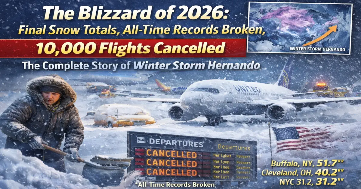
📖 DEFINITIVE RECAP | Published: February 25, 2026 | Storm Dates: February 22–24, 2026
Official Name: Winter Storm Hernando (The Weather Channel) / The Blizzard of 2026 (FOX Weather / popular usage) Storm Type: Nor’easter Bomb Cyclone — pressure dropped 41 millibars in 24 hours Peak Central Pressure: Equivalent to a Category 2 hurricane (cold-core system) Duration: February 22 (onset) — February 24 (exit) — 72 hours States Impacted: 11 eastern states — West Virginia to Maine — plus Atlantic Canada States With 30+ Inches: New Jersey, New York, Connecticut, Rhode Island, Massachusetts — 5 states All-Time Record Broken: Providence, Rhode Island — 37.9 inches — greatest snowstorm in city history (beat 1978 record) Historic First: Boston Globe stopped printing for the first time in its 153-year history Fatalities: At least 2 confirmed Power Outages: 650,000+ customers at peak — 381,649 still without power Feb 25 morning Flights Cancelled: 10,000+ across Feb 22–24 — worst aviation event since the pandemic Travel Bans: Rhode Island (full state), Massachusetts (South Coast), New York City, New Jersey, Pennsylvania emergency declarations Wind Gusts: 98 mph in Wellfleet, Massachusetts — hurricane-force Peak Snowfall Rate: 3 inches per hour on Long Island
The last time New York City issued a blizzard warning was nine years ago. The last time Providence, Rhode Island saw a storm like this was never — because a storm like this had never happened there before, in 121 years of weather records. The last time The Boston Globe stopped the presses was before most of today’s travelers were born.
Winter Storm Hernando — also known simply as the Blizzard of 2026 — was not just the most disruptive winter storm in years. For several cities and towns along the Northeast corridor, it was the most disruptive winter storm in recorded history. Period.
This is the complete story: every record broken, every snow total confirmed, the human moments that defined 72 hours of chaos, the full aviation collapse and recovery, and what it all means for the Northeast travel season still unfolding right now.
Understanding how Winter Storm Hernando became so catastrophic requires a brief look at the meteorology — because this storm did something that even veteran forecasters called extraordinary.
Originating out of a shortwave trough that moved ashore on the West Coast of the United States on February 20, the system swiftly moved eastwards across the country before beginning to consolidate late the following day. A new surface low developed off the southeastern United States early on February 22 and began moving north, before rapidly strengthening overnight, bringing blizzard conditions and very heavy snowfall to the Northeast corridor on February 23.
The critical development was the bomb cyclone intensification. A storm is classified as a bomb cyclone when its central pressure drops at least 24 millibars in 24 hours. Hernando’s central pressure plunged 41 millibars in 24 hours ending at 7 AM EST on February 23, according to analyses from NOAA’s Weather Prediction Center — nearly double the threshold. While its central pressure was similar to that of a Category 2 hurricane, the storm was cold-core rather than warm-core. There was no eye wall, no warm ocean feeding it. There was only Arctic air, atmospheric dynamics, and a coastal moisture supply that turned into snowfall at rates of up to 3 inches per hour on Long Island.
The blizzard warnings issued for New York City, New Jersey, and Connecticut were the first for those regions in years — for New York City, the first in nine years; for New Jersey’s 21 counties, the first time all 21 counties were under a blizzard warning simultaneously since January 1996. For the record books: as early as mid-February 2026, the Weather Prediction Center had begun highlighting a potential coastal storm to develop off the Northeastern US within the February 20–23 timeframe.
These are the verified, final confirmed snowfall totals from the National Weather Service and cooperative weather observers across the affected region:
| Location | Total | Record? |
|---|---|---|
| T.F. Green Airport (Providence) | 37.9 inches | ✅ All-time state record |
| Providence (city centre) | 32.8–37.9 inches | ✅ All-time city record (beat 1978 Blizzard) |
| North Stonington, CT border | 30.8 inches | — |
Providence broke one of the largest records during Winter Storm Hernando, which blasted the Northeast in the form of a nor’easter bomb cyclone. Before the historic storm, the biggest snowstorm on record for Providence was the Blizzard of 1978, which occurred February 2–3. That record had stood for 48 years. Providence saw both its snowiest two-day period and snowiest single day on record — the snowfall that dropped on Monday alone almost equalled Providence’s entire annual average of 36.6 inches.
| Location | Total | Record? |
|---|---|---|
| Whitman | 33.7 inches | — |
| Dighton | 27.1 inches | — |
| Boston Logan Airport | 17.1 inches | First above-average winter season in 4 years |
| Cape Cod (Wellfleet) | 25+ inches + 98 mph gusts | — |
The snow fell so quickly that for the first time in its 153-year-old history, The Boston Globe called off the printing of its daily newspaper. The paper had faced labour strikes in the 1950s and 1960s and even had a limited run during another historic blizzard in 1978 — but it had never stopped the presses entirely for weather. February 24, 2026 was that day. Over 250,000 people in Massachusetts were without power as of Tuesday morning, with Eversource alone reporting more than 200,000 customers in the dark and warning that some restorations on Cape Cod could take up to six days.
| Location | Total | Record? |
|---|---|---|
| Babylon (Long Island) | 29+ inches | — |
| Central Islip (Long Island) | 31 inches | — |
| Brooklyn / Queens | ~20 inches | — |
| Central Park (Manhattan) | 19.7 inches | Heaviest since Winter Storm Jonas (2016) |
| Newark, New Jersey | 27.2 inches | 0.6 inches short of all-time record (Jan 1996) |
The storm is now the ninth biggest in New York City history, dating back in the record books to 1869. Central Park’s 19.7 inches was the heaviest snowfall in nearly a decade — since Winter Storm Jonas in late January 2016, which recorded 27.5 inches and remains NYC’s all-time record. Snowfall rates of up to 3 inches per hour were observed on Long Island, where the totals were the most extreme in the metropolitan area.
The famous midnight skiers became an instant symbol of the storm: a photographer captured two late-night skiers traversing the sidewalks outside Bergdorf Goodman on Fifth Avenue near Central Park. Patsy Cline had a hit with a song called “Walkin’ After Midnight” — but how about skiing after midnight? It happened.
| Location | Total | Record? |
|---|---|---|
| Multiple coastal counties | 30+ inches | ✅ Several towns all-time records |
| Atlantic City | 16.9 inches | Heaviest in 15+ years |
| Trenton | 16.4 inches | — |
| Newark | 27.2 inches | Near all-time record (1996) |
Atlantic City’s 16.9 inches was both the heaviest snowstorm in over 15 years and almost exactly equal to the city’s average snowfall for an entire season of 17.4 inches — delivered in a single 48-hour event. Officials in Atlantic City urged residents and casino visitors to stay off streets during the storm, especially in low-lying neighbourhoods prone to flooding. NJ Transit suspended buses and light rails beginning at 6:00 PM EST on February 22.
| Location | Total | Record? |
|---|---|---|
| North Stonington | 30.8 inches | — |
| Hartford (Bradley Airport) | 14+ inches | 140+ flights cancelled |
| Multiple southeastern towns | 24–30 inches | — |
| Location | Total | Record? |
|---|---|---|
| Philadelphia | 14 inches | 17th largest snowfall on record |
| King of Prussia | Significant tree damage | — |
In Philadelphia, Mayor Cherelle Parker and Governor Josh Shapiro both issued emergency declarations. Shapiro’s administration deployed approximately 60,000 tons of salt across five counties and more than 170 trucks pretreating roadways. Philadelphia’s 14 inches placed it as the 17th largest snowfall in recorded city history — significant, but not record-breaking for a city that has seen more extreme events.
The most extraordinary non-snow statistic from Hernando: peak wind gusts of 98 mph were recorded in Wellfleet, Massachusetts — just 2 mph short of the 74 mph threshold that defines hurricane-force winds at their minimum Category 1 level. For context: gusts of this magnitude were causing structural damage, toppling trees, and downing power lines across Cape Cod and southeastern Massachusetts. Blizzard conditions were confirmed by the National Weather Service in multiple locations, including the full verification standard requiring sustained winds of 35 mph or greater with less than quarter-mile visibility for three consecutive hours.
Between Sunday and Tuesday, carriers scrubbed more than 10,000 flights according to FlightAware — virtually all of them in the path of the storm — making Hernando one of the most disruptive aviation events of the winter season. Monday alone produced roughly 5,600 to 5,700 cancellations, close to 20 percent of scheduled departures nationwide. It was the worst single aviation disruption since the COVID-19 pandemic groundings of 2020.
Boston Logan (BOS): 958 flights cancelled by the morning of February 23 alone. Operations suspended through Tuesday. Remained heavily impacted into Wednesday.
Rhode Island T.F. Green (PVD): Suspended all operations entirely for February 23 — a complete 24-hour shutdown.
JFK, LaGuardia (LGA), Newark (EWR): Nearly 90% of outgoing flights grounded at peak. Major hubs saw near-total disruption for 48 hours.
Philadelphia (PHL): 74% cancellation rate at peak. Partial recovery Tuesday.
Hartford Bradley (BDL): Over 140 flights cancelled.
Atlantic City, Islip: Shut down completely during the height of the storm.
Cincinnati/Northern Kentucky (CVG): 58 cancellations — the storm’s reach even extended into the Ohio Valley.
Halifax Stanfield (YHZ): Multiple cancellations as the storm tracked into Atlantic Canada, causing 4,450 Nova Scotia Power customers to lose power and waist-deep snow drifts in some locations.
The storm’s impact extended far beyond the Northeast. Air India suspended all flights to and from JFK and Newark on February 24. Lufthansa cancelled flights to New York and Boston departing February 23. Transatlantic services from the UK and Ireland experienced widespread cancellations. Nearly a quarter of inbound international flights to the US were affected at peak disruption, as aircraft and crews positioned for Northeast arrivals were grounded in Europe, unable to complete their scheduled westbound transatlantic legs.
American Airlines resumed Northeast operations and added more than 4,000 seats — including flights operated by some of American’s largest aircraft — for Feb 24, publishing a full schedule recovery plan by 2 PM ET. American’s Chief Operating Officer David Seymour said: “American is known for its swift recoveries, and Winter Storm Hernando is a great example of how our team comes together to deliver for our customers.”
Delta Air Lines’ operations remained suspended at Boston Logan, JFK, LaGuardia, and Newark into Tuesday, February 24. United Airlines began partial restoration at Newark on February 24, while Washington Dulles and Reagan National resumed operations. The final full recovery — all Northeast airports operating at normal capacity — was projected for Thursday, February 26.
The total ripple effect spread to DFW (119 cancellations, American worst hit), Toronto Pearson (311 disruptions), Denver, Charlotte, and Atlanta as displaced aircraft and crew struggled to reposition across the global network.
No collection of statistics captures what the Blizzard of 2026 actually felt like for the people who lived through it. These are the moments that defined the storm.
As two to three inches of snow fell per hour on Manhattan, two late-night skiers were photographed gliding down Fifth Avenue beside Central Park — past the closed storefronts of Bergdorf Goodman, past the empty yellow cabs buried at the curb, through what had become a silent white corridor through one of the world’s most frenetic streets. The image became the storm’s defining visual.
In Boston, an MBTA city bus slid off Beacon Street during the height of the storm — photographed by Scott Eisen for Getty Images, the image showed the bus tilted against a snow bank, its emergency lights blinking, passengers evacuating onto a sidewalk that had itself become impassable. Boston public schools remained closed. Government offices shut. The city went quiet in a way it almost never does.
At Dallas-Fort Worth, stranded traveler after stranded traveler shared their stories as the blizzard’s ripple effects cascaded into Texas. One traveler said his family had been cancelled for four consecutive days: “This is the fourth day in a row we have been cancelled after being delayed, delayed, delayed. It’s not obvious to me American is in total meltdown.” Patrick and Karen McCain, trying to reach Seattle, couldn’t leave until Thursday. “We’re like, we are here. Where’s the crew?” Karen said.
For the first time in 153 years of continuous publication — through two World Wars, the Great Depression, the blizzard of 1978, the September 11 attacks, and COVID-19 — The Boston Globe determined the risk was too great for staff and drivers to deliver Tuesday’s paper edition. Print subscribers received Tuesday’s paper delivered on Wednesday. The announcement was less operationally significant in today’s digital world, but symbolically profound: this storm had done something that nothing in a century and a half of history had done.
Before the midnight Fifth Avenue skiers, workers in Times Square were photographed in the early morning hours of February 23 — not commuters, not tourists, but maintenance crews with shovels, standing in snowdrifts that had buried the crosswalks of the world’s most photographed intersection. The marquees still blazed. The snow fell harder. Times Square, empty, buried, and lit up like a fever dream.
One by one, as the storm intensified, governors across the Northeast issued the most serious administrative tools available to them:
The National Guard was activated in multiple states — rescuing stranded motorists, transporting medical personnel, delivering fuel and food to isolated communities, and using helicopters to reach stranded drivers on buried highway segments.
At the height of the storm, over 650,000 customers across the Northeast were without power — a number that includes both residential and commercial accounts. As of Tuesday morning, February 25, an estimated 381,649 US power customers remained without power.
The breakdown by utility and expected restoration:
| Utility | Customers Affected | Restoration Timeline |
|---|---|---|
| Eversource (Massachusetts) | 232,000+ | Most by Thu–Sat; Cape Cod up to 6 days |
| National Grid (Massachusetts) | Significant | 72 hours from Tuesday morning |
| JCP&L (New Jersey) | Under review | Through Wednesday night into Thursday |
| PSE&G (New Jersey) | Localized outages | Late Tuesday or Wednesday AM |
| Delmarva Power (Delaware/Maryland) | 35% still out as of Tuesday | Several more days — “second-worst storm in history” |
The good news for affected residents: Massachusetts residents will automatically receive a 25 percent reduction on February and March electric bills under a $180-million statewide relief plan. In Maryland, more than 247,000 Potomac Edison customers are getting automatic credits of $45–$60 on February bills. New Jersey lawmakers are also considering a bill that would require utility companies to compensate residents for losses after long outages.
Every major city affected by Hernando has now been placed in its proper historical context. Here is where this storm ranks against the all-time record books:
| City | Hernando Total | Historical Rank |
|---|---|---|
| Providence, RI | 37.9 inches | #1 All-time — beat 1978 Blizzard |
| Babylon, NY (Long Island) | 29+ inches | Top 5 all-time for Long Island |
| Central Islip, NY | 31 inches | Top 5 all-time for Long Island |
| New York City (Central Park) | 19.7 inches | #9 all-time (records to 1869) |
| Newark, NJ | 27.2 inches | 2nd all-time (0.6″ from 1996 record) |
| Atlantic City, NJ | 16.9 inches | Heaviest in 15+ years |
| Philadelphia, PA | 14 inches | #17 all-time |
| Boston, MA | 17.1 inches | First above-average winter in 4 years |
The most significant comparison: this was the heaviest snowstorm since Winter Storm Jonas just over 10 years ago at New York’s Central Park (19.7 inches), Philadelphia (14 inches) and Trenton, New Jersey (16.4 inches). Jonas (January 2016) remains the benchmark for Northeastern US blizzards in the modern era. Hernando did not surpass Jonas for most cities — but for Providence and Rhode Island, it surpassed every storm that has ever come before.
As of today, Wednesday February 25 — Day 3 after the storm’s peak:
New York metro (JFK, LGA, EWR): Airports recovering. American Airlines resumed operations with extra flights added. Delta restored at JFK. United partially restored at EWR. Ripple effects continuing — see Day 2 article for details.
Boston Logan (BOS): Still heavily impacted Tuesday. Partial operations Wednesday. Full recovery expected Thursday.
Ground transport: LIRR and Metro-North resumed limited service on modified schedules Tuesday. NJ Transit restoring services progressively.
Power: 381,649 customers still without power as of Tuesday morning. Cape Cod and Rhode Island’s hardest-hit areas face the longest restoration timelines — up to 6 days for some Eversource customers on Cape Cod.
Roads: Highway travel bans fully lifted. Plowing and salting operations continuing on secondary roads. Allow extra travel time on all Northeast routes through Thursday.
The secondary storm warning: Weather forecasters are tracking another clipper system expected to bring 1–3 inches of additional snow to parts of New England and the mid-Atlantic by Thursday. This will slow road clearing and add marginal delay risk to Thursday departures at recovering Northeast airports.
The Blizzard of 2026 will be studied by meteorologists, emergency managers, airline operations teams, and urban resilience planners for years. But for everyday travelers, the practical takeaways are more immediate:
1. The Northeast is still in a winter weather pattern. This storm was historically large — but it was not an anomaly. The Northeast had already experienced Winter Storm Fern in January 2026, which caused American Airlines to cancel more than 10,000 flights. Two major blizzards in five weeks is an unusual but not unprecedented pattern. Anyone flying through Northeast hubs before mid-March should book refundable fares, monitor forecasts starting 7 days before travel, and have a rebooking plan ready.
2. Airline waivers are still active — but expiring. American Airlines’ waiver expires today, February 25. Delta’s waiver covers travel through February 25 with rebooking by February 28. United’s waivers covered travel through February 24 with rebooking by February 27. If you have unused waiver flexibility, act today.
3. Power restoration timelines matter for hotel guests. If you are staying in Massachusetts, particularly on Cape Cod or the South Shore, power may not be restored until this weekend at some properties. Call ahead before arrival and confirm your hotel has power and full amenities.
4. The next storm is already being watched. A secondary clipper system is expected to produce 1–3 inches of snow across parts of New England and the mid-Atlantic by Thursday, February 27. This is not a Hernando sequel — but it will slow road clearing and extend the disruption window for an already stressed system.
5. The airports that held up best tell you where to connect. During Hernando’s peak, Washington Dulles (IAD), Reagan National (DCA), and Charlotte Douglas (CLT) maintained the strongest operational capacity of any Northeast-adjacent major hub airports. If you are booking future Northeast-bound itineraries with connections, these airports represent greater weather resilience than JFK, LGA, BOS, or EWR during major Northeast storms.
| Metric | Figure |
|---|---|
| Storm dates | February 22–24, 2026 |
| States with 1+ foot of snow | 11 |
| States with 2+ feet of snow | 5 |
| All-time records broken | Providence RI, multiple NJ/RI towns |
| Peak snowfall rate | 3 inches/hour (Long Island) |
| Maximum wind gust | 98 mph (Wellfleet, MA) |
| Flights cancelled (total) | 10,000+ |
| Flights cancelled (Monday peak) | ~5,600–5,700 (20% of US schedule) |
| Passengers affected (aviation) | Estimated 1.2–1.5 million |
| Power outages (peak) | 650,000+ customers |
| Power outages (Feb 25 morning) | 381,649 customers |
| State emergency declarations | 7 states |
| Travel bans issued | Rhode Island, Massachusetts, New York, New Jersey |
| Fatalities | At least 2 confirmed |
| American Airlines cancellations | 10,000+ (all-time company record) |
| Boston Globe printing pauses | 1 — first in 153-year history |
| NYC historical ranking | #9 all-time (records to 1869) |
| Providence historical ranking | #1 all-time — beat 1978 Blizzard |
Published: February 25, 2026. Information sourced from the National Weather Service, NOAA Weather Prediction Center, FlightAware, Wikipedia February 2026 North American Blizzard article (updated February 25), The Weather Channel / weather.com (meteorologist Jonathan Erdman), CBS News, CBS News New York, CBS News Boston, The Boston Globe, Daily Caller, Newsweek, Business Traveller, American Airlines Newsroom, Delta News Hub, AOL News, Yahoo News, Indian Eagle, Travel and Tour World, USNN World News, Poweroutage.com, and official statements from Governors Hochul, Healey, Shapiro, and Sherrill. All figures accurate as of 8:00 AM EST February 25, 2026.
For More Resources:
Related Articles:
Posted By : Vinay
This article is provided for general informational purposes only and is based on information available at the time of publication. Travel advisories, airline schedules, airport operations, visa requirements, government regulations, and other travel-related information are subject to change without prior notice. While Travel Tourister makes reasonable efforts to verify information using official announcements, government publications, airline and airport communications, and other reliable sources, we cannot guarantee that all information remains complete, accurate, or up to date at all times. Readers should independently verify any information that may affect their travel plans with the relevant airline, airport authority, government agency, embassy, or other official source before making travel, financial, or other decisions. Travel Tourister shall not be liable for any direct or indirect loss, inconvenience, or damages arising from the use of or reliance on the information contained in this article. Nothing in this publication constitutes legal, immigration, financial, or professional travel advice. If you believe any information in this article is inaccurate or outdated, please contact our editorial team. We review all credible correction requests promptly and update our content whenever appropriate.
Lastest News
2nd Floor, 39, Above Kirti Club, DLF Industrial Area, Kirti Nagar, New Delhi, Delhi 110015



Travel Tourister is a leading Travel portal where we introduce travellers to trusted travel agents to make their journey hasselfree, memorable And happy. Travel Tourister is a platform where travellers get Tour packages ,Hotel packages deals through trusted travel companies And hoteliers who are working with us across the world. We always try to find new and more travel agents and hoteliers from every nook and corners across the world so that you could compare the deals with different travel agents and hoteliers and book your tour or hotel with the one you have chosen according to your taste and budget.
Copyright © Travel Tourister, India. All Rights Reserved

 Call
Call Enquiry