Published on : 23 Oct 2026
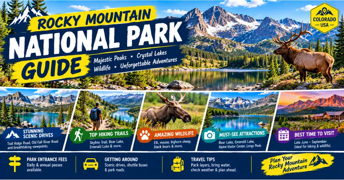
Rocky Mountain National Park is one of the great mountain parks of North America — 415 square miles of the central Rocky Mountains in northern Colorado, preserving a landscape that encompasses subalpine forest, glacially carved valleys, and more than 60 miles of open alpine tundra above the treeline at 11,500 feet. The park protects 14 peaks above 13,000 feet (including Longs Peak at 14,259 feet, the park’s only Fourteener), more than 350 miles of hiking trails, 150 lakes, 450 miles of streams, and one of the most extraordinary wildlife assemblages in the American West — Rocky Mountain elk, bighorn sheep, moose, black bear, mountain lion, marmot, pika, and the golden eagle all inhabit the park in viable populations. Approximately 4.5 million people visit each year, making it one of the ten most-visited national parks in the United States.
What sets Rocky Mountain apart from other national parks is the combination of accessibility and altitude. Trail Ridge Road — the highest paved continuous highway in the United States, reaching 12,183 feet at its crest — crosses the park from east to west, placing any visitor in genuine alpine tundra without hiking. The open tundra at Trail Ridge Road’s summit is not a park viewpoint with a parking lot and a vista; it is a functioning high-altitude ecosystem where the wind-sculpted krummholz (stunted, flag-shaped spruce and fir at the treeline), the boulder fields of pika and marmot colonies, and the wildflower meadows of mid-summer are all accessible by short walks from roadside pullouts. Elk and bighorn sheep are visible from the road with great frequency, and the 360-degree mountain panoramas from any tundra highpoint in the park are among the finest in Colorado.
The park also has a strong claim to being the finest wildlife-watching destination in the Rockies. The fall elk rut — when bull elk gather harems in the meadows of Horseshoe Park and Moraine Park and bugle across the valley to competitors — is one of the most dramatic wildlife spectacles in the continental United States. The bugling of bull elk echoing off the valley walls, the displays of 700-pound bulls gathering cows, and the availability of this spectacle from a paved road at dawn make the September–October rut one of the most compelling reasons to visit any national park in the country.
| Factor | Details |
|---|---|
| Location | Northern Colorado, 70 miles northwest of Denver |
| Size | 415 square miles (265,769 acres) |
| Established | January 26, 1915 |
| Elevation Range | 7,860 feet (Fall River entrance) to 14,259 feet (Longs Peak) |
| Main Entrances | Fall River (US-34) and Beaver Meadows (US-36) — both near Estes Park; Grand Lake (west side, US-34) |
| Gateway Town (East) | Estes Park |
| Gateway Town (West) | Grand Lake |
| Annual Visitors | ~4.5 million |
| Entry Fee | $35/vehicle (valid 7 days); $30/motorcycle; $20/individual (on foot/bike) |
| Annual Pass | America the Beautiful Interagency Pass, $80 — covers all US national parks for one year |
| Timed Entry Required | May 24 – October 14, 2026 (Bear Lake Road Corridor and park-wide entry) |
| Best Season | June–September (trail access); September–October (elk rut); December–March (snowshoeing/skiing) |
| Website | nps.gov/romo |
The most common approach: US-36 northwest from Boulder to Lyons, then CO-7 or US-36 to Estes Park (east entrance). Alternatively: I-25 north to Loveland, US-34 west through Big Thompson Canyon to Estes Park. The CO-7 route through Lyons is more scenic; the US-34 Big Thompson Canyon route is faster in normal conditions but has a history of flash flood closures.
From Denver International Airport (DEN): Allow 2–2.5 hours to Estes Park. Take I-25 or CO-470 to US-36 west toward Boulder, then continue through Boulder (or bypass via CO-119 to Lyons) to Estes Park.
US-34 west from Loveland through the Big Thompson Canyon to Estes Park.
I-70 east to Granby, then US-40 east to US-34 north to the Grand Lake (west) entrance.
Estes Park Shuttle: Several private shuttle companies serve the Denver–Estes Park corridor, particularly from Denver International Airport. Rocky Mountain Gateway (rockymtngateway.com) and Estes Park Shuttle (estesparkshuttle.com) operate direct service from DEN to Estes Park. Fares $40–55/person one-way; reservation required.
Personal vehicle: The most flexible option, but Bear Lake Road and the park’s primary trailheads have mandatory timed-entry windows from late May through mid-October (see Timed Entry, below). Have a reservation or plan to arrive very early (before 6 AM) or late (after 3 PM, when demand drops).
Park Shuttle (free, seasonal): Free shuttle buses operate within the park during peak season (late May–mid-October):
Using the free shuttles eliminates the timed-entry and parking complications for the Bear Lake corridor; this is the recommended approach for peak-season visitors.
Rocky Mountain National Park requires timed-entry reservations for two periods in 2026:
Bear Lake Road Corridor: 5 AM – 6 PM daily, May 24 – October 14, 2026. Required to drive Bear Lake Road (the most popular section of the park). Without a reservation, use the free shuttle from the Estes Park Visitor Center or the Park & Ride lot (which does not require a separate reservation).
Park-Wide Entry: Required for entering the park at all primary entrances (Beaver Meadows, Fall River) during peak hours; check nps.gov/romo for 2026 specific dates and times.
How to reserve: recreation.gov — reservations open 2 days in advance (the rolling 2-day window opens at 8 AM Mountain Time) and 1–3 months in advance for specific high-demand dates. The 2-day window is the most reliable approach for flexible travelers; the advance window books out quickly in peak summer.
Timed entry not required: The Grand Lake (west) entrance does not require timed entry in most periods. Trail Ridge Road and the Alpine Visitor Center are accessible from the west side without Bear Lake Road access. Arriving before 5 AM or after 6 PM also bypasses the timed-entry requirement.
Cost: Timed-entry reservation is free; the park entry fee ($35/vehicle) is separate.
Trail Ridge Road is the defining feature of Rocky Mountain National Park for most visitors — the highest paved continuous highway in the United States, running 48 miles across the park from the Fall River entrance near Estes Park to the Grand Lake entrance on the west side. The road reaches its crest at 12,183 feet above sea level in the open tundra above the treeline, where it remains for approximately 11 miles before beginning its descent toward the Never Summer Mountains and Grand Lake.
What to see along Trail Ridge Road (east to west):
Trail Ridge Road season: Opens late May (weather-dependent, typically Memorial Day weekend); closes for winter in mid-October (weather-dependent). Snow can close the road temporarily in any month. Check current road status at nps.gov/romo or cotrip.org before departure.
Rocky Mountain National Park’s 350+ miles of trails range from flat valley walks accessible to any visitor to the demanding Class 3+ summit route on Longs Peak. The following are the finest trails by difficulty level.
Bear Lake Loop
Sprague Lake Loop
Tundra Communities Trail (Rock Cut)
Alberta Falls
Dream Lake via Nymph and Bear Lakes
Mills Lake
Sky Pond via Glacier Gorge
Ute Trail (from Trail Ridge Road)
Ouzel Falls via Calypso Cascades
Flattop Mountain and Hallett Peak
Longs Peak — Keyhole Route
North Inlet / Tonahutu Trail (Grand Lake side)
Rocky Mountain National Park is one of the finest wildlife destinations in the continental United States. The combination of diverse habitats (montane meadow, subalpine forest, riparian corridor, alpine tundra) and the park’s role as a protected refuge since 1915 has produced habituated, visible populations of large mammals.
The park’s elk herd numbers approximately 3,000 animals — one of the largest in the Rocky Mountain region. Elk are visible year-round but are most reliably seen in two periods:
Fall rut (mid-September – mid-October): The most spectacular wildlife event in the park — bull elk gather harems of cows in the open meadows of Horseshoe Park (US-34, 3 miles from Fall River entrance) and Moraine Park (Bear Lake Road, 2 miles from Beaver Meadows entrance). Dominant bulls bugle — a multi-note vocalization beginning with a high whistle and descending into a guttural growl — to challenge competitors and maintain their harems. The bugling echoes across the valley at dawn and dusk; hundreds of visitors gather in the meadow pullouts to observe.
Best viewing protocol: Arrive at Horseshoe Park or Moraine Park 30 minutes before sunrise. Stay at least 75 feet from elk (legal requirement; bull elk during rut are aggressive toward humans who approach too closely — multiple visitors are charged or injured each year). Bring binoculars. The rut peaks in the last two weeks of September; it continues through mid-October at decreasing intensity.
Summer: Elk are in the high meadows and tundra; good viewing along Trail Ridge Road and in Horseshoe Park at dawn and dusk.
The park’s bighorn herd (approximately 200 animals) is most reliably seen at two locations:
Moose were reintroduced to Colorado in 1978 and the park’s moose population is now estimated at 50–100 animals. Primary viewing locations:
The park has five campgrounds accessible by car, all reservable through recreation.gov. Peak-season reservations (June–August) open 6 months in advance and fill within minutes of opening. Book as early as possible.
| Campground | Location | Sites | Fee | Season | Notes |
|---|---|---|---|---|---|
| Moraine Park | Bear Lake Road, 2.5 mi from Beaver Meadows | 244 | $35/night | Year-round | Largest campground; group sites available; near elk meadow |
| Aspenglen | Fall River entrance, 5 mi from Estes Park | 53 | $35/night | Late May–Sept | Smallest east-side campground; nicely wooded; quiet |
| Glacier Basin | Bear Lake Road, 5 mi from Beaver Meadows | 150 | $35/night | Late May–Sept | Central location for Bear Lake trails; group sites |
| Timber Creek | Trail Ridge Road, west side (Kawuneeche Valley) | 98 | $30/night | Late May–Oct | Only campground on the west side; good for Grand Lake access; moose habitat adjacent |
| Longs Peak | South section, 11 mi south of Estes Park | 26 | $30/night | Year-round | Walk-in tent only; for Longs Peak climbers (14-day max); first-come, first-served |
Backcountry camping: 267 backcountry campsites require a backcountry permit ($30/permit, spring–fall; free in winter). Permits for peak dates open in March at recreation.gov. All backcountry campers must carry a bear canister. See nps.gov/romo/planyourvisit/backcountry.htm.
Beaver Meadows Visitor Center (US-36, east entrance): The primary visitor center — largest, year-round open, full ranger staff, trip planning resources, bookstore. The 20-minute park film (free) is worth watching to orient to the park’s geology and ecology.
Alpine Visitor Center (Trail Ridge Road, 11,796 feet): Open late May–mid-October. The highest visitor center in the National Park Service; exhibits on tundra ecology, café, excellent bookstore. Worth a 45-minute stop.
Fall River Visitor Center (US-34, Fall River entrance): Eastern entrance visitor center; staffed for trip planning, bighorn sheep shuttle coordination.
Kawuneeche Visitor Center (US-34, Grand Lake entrance): Western side visitor center; staffed year-round.
Moraine Park Discovery Center (Bear Lake Road, 1 mile from Beaver Meadows): Excellent exhibits on the park’s glacial geology and ecology; ranger-led programs in summer.
Estes Park (population 6,500; elevation 7,522 feet) is the primary gateway to Rocky Mountain National Park — the town sits 3 miles east of the Beaver Meadows entrance, compressed into the Thompson River valley at the foot of the park. The downtown is a walkable tourist commercial strip (Elkhorn Avenue) with souvenir shops, ice cream, outdoor gear, and restaurants. Accommodation ranges from budget motels on the highway to full-service lodges.
The Stanley Hotel (333 Wonderland Lane): The finest hotel in Estes Park and the most famous building — the 1909 Georgian Revival resort where Stephen King stayed in 1974 and conceived The Shining. Room 217 (King’s original room) books months in advance. The hotel’s ghost tours are a major local attraction. Rooms $200–450/night.
Estes Park Brewery (470 Prospect Village Dr): Colorado’s highest-elevation craft brewery (7,522 feet). Après-hike pint with mountain views.
YMCA of the Rockies (2515 Tunnel Rd): A sprawling family lodge and cabin complex immediately adjacent to the park boundary — not a typical YMCA but a full-service mountain resort with hiking, horseback riding, and organized activities. Good value for families. Cabins $150–250/night.
Grand Lake (population 450; elevation 8,369 feet) is the western gateway town — smaller, quieter, and more genuinely mountain-town than Estes Park. The historic boardwalk downtown (a single block of 1880s commercial buildings) overlooks the largest natural body of water in Colorado (Grand Lake) and the adjacent Shadow Mountain Reservoir. Far fewer visitors than Estes Park.
Grand Lake Lodge (15500 US-34): A 1920s log lodge complex above Grand Lake with a deck overlooking the lake — the finest setting for a casual lunch in the western Rocky Mountain area. $150–300/night for cabins.
Trail Ridge Road typically opens for the season on Memorial Day weekend (weather-dependent). Spring wildflowers (pasqueflowers, spring beauties, marsh marigolds) peak in the subalpine zone in late May and early June. Snowfields on north-facing slopes persist through June at higher elevations; microspikes or traction devices helpful for trails above 11,000 feet through mid-June. Mosquitoes emerge in the valley meadows in early June with snowmelt.
Peak season: maximum trail access, all facilities open, maximum crowds. Wildflowers in the alpine tundra peak in mid-July (the Alpine Visitor Center area is excellent). Afternoon thunderstorms develop almost daily above treeline — be below 12,000 feet by noon, descend at the first sign of lightning. Bears are active, feeding on berries before fall hibernation (August peak).
The finest season in Rocky Mountain National Park. The elk rut (peak mid-to-late September) is the most compelling wildlife event. Aspen groves on the montane slopes turn gold in the last two weeks of September — the Big Thompson Canyon approach, the Horseshoe Park periphery, and the Glacier Basin area are the best aspen viewing locations in the park. Trail Ridge Road typically closes for winter in mid-October. Crowds drop sharply after Labor Day.
Trail Ridge Road is closed (November–May); the east side of the park remains accessible to the Bear Lake Road corridor (plowed year-round). Winter snowshoeing and cross-country skiing on the Bear Lake Road trails and in the Moraine Park area are excellent. The Colorado Mountain Club and park-organized snowshoe walks (free, ranger-led, on weekends) make the winter park accessible to beginners. Wildlife viewing in the valley meadows (elk, coyote, bald eagle on the river) is excellent in winter when snow drives animals to lower elevations.
| Budget Level | Daily Cost Per Person | What’s Included |
|---|---|---|
| Budget (camping) | $40–70/day | Campground site ($35/night shared); self-prepared meals from Estes Park grocery; free shuttle; trails |
| Mid-Range | $120–200/day | Estes Park motel or lodge; restaurant meals; one guided activity |
| Luxury | $300–500+/day | Stanley Hotel; fine dining; guided horseback or private hiking guide |
Money-saving tips:
5:30 AM: Arrive at Moraine Park (no timed entry required before 5 AM). Watch for elk in the meadow at first light. 7 AM: Drive Bear Lake Road to Bear Lake. Walk the Bear Lake Loop (0.8 miles, 30 min), continue to Dream Lake and Emerald Lake (2.2 miles each way, 2.5–3 hrs total). 12 PM: Return to Beaver Meadows; drive Trail Ridge Road west to the Alpine Visitor Center. Stop at Forest Canyon Overlook and Rock Cut (Tundra Communities Trail, 1.6 miles, 1.5 hrs). 3 PM: Alpine Visitor Center — café, bighorn sheep ridge walk. 5 PM: Return east on Trail Ridge Road; stop at Rainbow Curve for sunset over the Never Summer Mountains. Evening: Dinner in Estes Park.
Day 1: Bear Lake corridor — Dream Lake and Emerald Lake in the morning; Mills Lake in the afternoon; sunset at Sprague Lake.
Day 2: Trail Ridge Road full traverse west to Grand Lake; Kawuneeche Valley walk for moose (dawn); Alpine Visitor Center; return east by mid-afternoon; Horseshoe Park for elk (dusk).
Day 1: Bear Lake corridor hikes (Dream Lake, Emerald Lake, Sky Pond for ambitious hikers). Day 2: Trail Ridge Road traverse; lunch at Grand Lake Lodge; return via Trail Ridge Road. Day 3: Longs Peak attempt (depart 3 AM, Keyhole Route — for experienced hikers) OR Wild Basin (Calypso Cascades and Ouzel Falls — quieter alternative) OR Estes Park with horseback riding at one of several park-adjacent stables.
Rocky Mountain National Park spans 7,860 feet (park valley floor) to 14,259 feet (Longs Peak). Most trailheads begin at 8,000–9,500 feet. Visitors from sea level frequently experience mild altitude sickness — headache, fatigue, nausea, reduced sleep quality. Protocols: spend one night at Denver altitude (5,280 feet) before entering the park; hydrate aggressively (3–4 liters/day at altitude); avoid alcohol on the first day; ascend slowly, descend at the first sign of serious symptoms. Children are as susceptible as adults; watch for unusual irritability or headache.
Mountain weather in Rocky Mountain National Park is highly variable. Summer temperatures at valley elevation (8,000–9,000 feet) range from 45–75°F; at tundra elevation (12,000+ feet), temperatures can drop below freezing at any time of year. Afternoon thunderstorms develop almost daily in July and August above treeline; all hikers bound for summits or the tundra should begin descent by noon. Lightning strikes are the leading cause of weather-related fatalities in the park.
Carry: rain jacket, warm mid-layer, sunscreen (UV intensity increases 5–7% per 1,000 feet of altitude), sun hat, and 2–3 liters of water on any hike above 10,000 feet regardless of distance.
Black bears are present throughout the park. All food, scented items, and toiletries must be stored in bear boxes (provided at campgrounds) or bear canisters (required for backcountry). Do not leave food in vehicles — bears regularly break into cars with visible food items. If you encounter a bear on trail: do not run; speak calmly, make yourself appear large, and back away slowly. Bear spray is recommended for backcountry travel; it is legal in the park.
The tundra ecosystem along Trail Ridge Road is exceptionally fragile — tundra plants grow 1 inch per year, and footprints on the tundra mat can take decades to recover. Stay on designated trails at all times on the tundra. The park’s visitor density makes cumulative trail damage a major management concern; impacting the alpine zone for a shortcut or “better photo angle” has measurable effects.
Posted By : Vinay
Latest Article
2nd Floor, 39, Above Kirti Club, DLF Industrial Area, Kirti Nagar, New Delhi, Delhi 110015



Travel Tourister is a leading Travel portal where we introduce travellers to trusted travel agents to make their journey hasselfree, memorable And happy. Travel Tourister is a platform where travellers get Tour packages ,Hotel packages deals through trusted travel companies And hoteliers who are working with us across the world. We always try to find new and more travel agents and hoteliers from every nook and corners across the world so that you could compare the deals with different travel agents and hoteliers and book your tour or hotel with the one you have chosen according to your taste and budget.
Copyright © Travel Tourister, India. All Rights Reserved

 Call
 Enquiry