Published on : 25 Sep 2026
By Travel Tourister | Updated Sep 2026
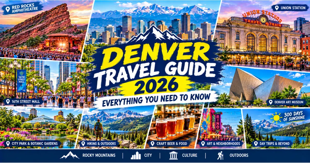
Denver is the American city whose specific geographic position most completely defines the visitor experience — the 5,280-foot altitude that gives it the Mile High City nickname creates the specific physical experience of arrival (the slight breathlessness climbing the airport’s escalators, the faster-acting alcohol at the breweries, and the dramatically intensified sunburn risk from the high-altitude UV that first-time visitors most consistently report as the unexpected Denver discovery), the Rocky Mountains rising visibly from downtown’s western edge create the specific daily experience of living with a 14,000-foot wall of granite as the western backdrop to every city view, and the 300 days of annual sunshine create the outdoor-lifestyle culture (the Washington Park morning runners, the bicycle commuters on the 16th Street Mall, and the Friday-afternoon I-70 westbound ski traffic) that most specifically characterizes Denver’s daily social character.
Planning a Denver visit in 2026 requires understanding several things that the standard travel resources frequently underemphasize: the altitude (the 5,280-foot base elevation affecting every visitor differently but affecting every visitor measurably — the specific altitude management strategies that make the difference between a Denver visit defined by headache and fatigue and one defined by the energy and enthusiasm that the city’s outdoor culture expects), the neighborhood geography (the 20+ Denver neighborhoods whose individual characters — from the RiNo Art District’s converted warehouses to the Washington Park residential character to the Capitol Hill Victorian diversity to the Cherry Creek upscale shopping — require more navigation than a compact pedestrian city but reward the visitor who explores beyond downtown), and the mountain access reality (the I-70 corridor that connects Denver to Breckenridge, Vail, Aspen, and Rocky Mountain National Park is simultaneously the city’s greatest asset and its most specifically traffic-constrained element — the Friday-afternoon ski traffic extending what should be a 1.5-hour drive to 2.5–3.5 hours in peak season).
This complete Denver Travel Guide for 2026 covers everything from getting there and managing the altitude through neighborhood orientation, budget planning, the best seasons, transport within the city, and the specific insider knowledge that transforms a Denver visit from a list-checking exercise into a genuinely rewarding Rocky Mountain city experience.
For specific activity, dining, and day-trip guidance, see our Things to Do in Denver 2026, Best Restaurants in Denver 2026, Day Trips from Denver 2026, and Best Time to Visit Denver 2026.
| Category | Details |
|---|---|
| Nickname | The Mile High City |
| Elevation | 5,280 feet (1,609 meters) above sea level |
| Population | 720,000 (city); 2.9 million (metro) |
| Founded | 1858 (gold rush settlement) |
| State | Colorado |
| Airport | Denver International Airport (DEN) — 25 miles northeast of downtown |
| Climate | Semi-arid continental — 300 days of sunshine; cold winters; warm summers |
| Time zone | Mountain Time (MT) — UTC-7 standard; UTC-6 daylight saving |
| Currency | US Dollar (USD) |
| Language | English (primary); Spanish widely spoken |
| Best neighborhoods | LoDo, RiNo, Capitol Hill, Cherry Creek, Highland (LoHi), Washington Park |
| Best season | May–June and September–October |
| Avoid | I-70 Friday afternoons (ski season); July–August (thunderstorm afternoons) |
| Mid-range hotel | $140–$220/night |
| Cannabis | Legal for adults 21+ at licensed dispensaries throughout Denver |
| Altitude note | Arrive hydrated; limit alcohol on Day 1; expect fatigue the first 24–48 hours |
Airport code: DEN | Distance from downtown: 25 miles northeast | Drive time: 35–45 minutes (traffic-dependent) | Website: flydenver.com
Denver International Airport (DEN) is the 5th busiest airport in the United States — the massive Jeppesen Terminal (the white fabric-tensile roof structure whose specific mountain-peak silhouette profile was designed to echo the Rocky Mountain range visible to the west, the specific architectural reference that makes DEN the most specifically Colorado-identity single airport terminal in the US) serves as the primary gateway for the entire Rocky Mountain region.
Airlines serving DEN: United (the primary hub carrier — the most extensive domestic route network from DEN), Southwest (the second-largest DEN carrier by flight count, the most significant budget-carrier presence), Frontier (the Denver-headquartered ultra-low-cost carrier with the most extensive Colorado route network), and all major US carriers alongside various international airlines (Lufthansa, British Airways, Air Canada, and the various other international carriers providing direct European and Canadian connections).
Getting from DEN to downtown Denver:
RTD University of Colorado A Line (train): The most specifically recommended airport-to-downtown transfer — the light rail service from DEN’s underground rail station (accessible directly from the terminal through the underground concourse) to Denver Union Station (the LoDo/downtown hub) in 37 minutes, running every 15 minutes during peak hours. Cost: $10.50 one-way. The A Line provides the most specifically pleasant single airport transfer experience in Denver: the route passes through the Denver Tech Center and the Cherry Creek corridor before arriving at the architecturally magnificent Union Station, the specific journey providing the most comprehensive single introduction to Denver’s metro geography available in a 37-minute transfer.
Rideshare (Uber/Lyft): $35–$55 one-way to downtown in normal conditions; $55–$80 during surge pricing (particularly Sunday evening returns from mountain destinations when both airport-bound and city-bound demand concentrates). The rideshare pickup area at DEN (the specific Level 5 pickup area, accessed by elevator from the terminal) is clearly marked and well-organized — the wait time typically 5–10 minutes in standard conditions.
Taxi: $55–$70 fixed-rate estimate to downtown — the taxi stand on the Level 5 ground transportation level provides the most consistent non-surge-susceptible transfer option.
Rental car: The DEN rental car facility (the separate Peña Station rental car campus, connected by shuttle from the terminal) houses all major rental companies. The specific Denver rental car consideration: a car is strongly recommended for Red Rocks, Rocky Mountain National Park, and all mountain day trips (the RTD rail and bus network serves downtown Denver well but doesn’t extend to the mountain destinations that are Denver’s primary attraction draw). For city-only visits staying in LoDo, RiNo, or Capitol Hill, a car may not be necessary for the city portion — but the mountain day trip motivation that brings most visitors to Denver specifically requires either a rental car or a guided tour.
Station: Denver Union Station, 1701 Wynkoop St | Routes: California Zephyr (Chicago to San Francisco via Denver — the most specifically scenic US train route, the Rocky Mountain passage through the Moffat Tunnel and the Colorado River canyon providing the most dramatically beautiful single American train journey segment)
The California Zephyr (the Amtrak route connecting Chicago with San Francisco through Denver — the 51-hour Chicago-to-San-Francisco journey whose Denver stop [approximately 18 hours from Chicago, 33 hours from San Francisco] makes Denver the most specifically train-accessible major Rocky Mountain city) provides rail access from both the Midwest and the Pacific Coast, the specific Rocky Mountain scenery between Denver and Salt Lake City being the most specifically beautiful single segment of any Amtrak route in the continental United States.
From Colorado Springs: I-25 North; 1 hour (70 miles) From Albuquerque, NM: I-25 North; 6.5 hours (450 miles) From Salt Lake City, UT: I-70 East through the Rockies; 7.5 hours (525 miles) — the most specifically scenic of all drives to Denver, the Wasatch Range, the Colorado Rockies, and the Vail/Beaver Creek ski corridor all traversed From Kansas City, MO: I-70 West; 8.5 hours (600 miles) From Dallas, TX: I-25 North through Pueblo; 12 hours (920 miles) From Chicago, IL: I-80 West to I-76 West; 14 hours (1,000 miles)
Interstate note: I-25 (the north-south interstate through Colorado, the primary Denver urban spine connecting Fort Collins to the north through downtown through Colorado Springs and Pueblo to the south), I-70 (the east-west interstate connecting Kansas City to Denver to the Rockies and beyond — the Denver-to-Vail stretch being among the most scenically dramatic interstate highway segments in the US), and I-76 (the northeastern connection to Nebraska and the I-80 cross-country route) together form Denver’s primary interstate network.
The I-70 mountain corridor caution: The I-70 westbound Friday afternoon traffic (the specific weekly rush when Denver’s ski population departs simultaneously for the mountain resorts — Loveland, Arapahoe Basin, Keystone, Breckenridge, Vail, Beaver Creek, Copper Mountain all accessible via I-70 west) creates the most specifically congested single highway condition in Colorado. The specific traffic pattern: normal 1.5-hour Denver-to-Breckenridge drive extending to 2.5–4 hours on Friday afternoons between 2–7 PM during ski season (November–March). The Saturday morning departure (6–7 AM) and the Sunday afternoon return (after 3 PM) provide the most traffic-optimized I-70 mountain trip timing.
The 5,280-foot Denver altitude is the single most practically important planning element for first-time visitors from sea-level cities — the specific physiological effects of altitude (reduced oxygen partial pressure, lower air humidity, and increased UV radiation compared to sea-level conditions) affecting every visitor to some degree regardless of fitness level or prior high-altitude experience.
Day 1–2 (most significant adjustment period):
Days 3–7 (acclimatization period): Most visitors at Denver’s moderate altitude (5,280 feet is genuinely mild compared to the ski resorts at 8,000–11,000+ feet) feel substantially acclimatized within 48–72 hours — the body producing additional red blood cells to compensate for the reduced oxygen partial pressure, the specific breathlessness during physical activity diminishing, and the headache typically resolving.
Hydration: The single most effective altitude management strategy — consuming 50–100% more water than normal (the specific guideline of drinking water before thirst develops, the body’s thirst response being delayed at altitude relative to sea level). The specific Denver practice: a 32-oz water bottle consumed on the flight to Denver before arrival provides the most effective single pre-arrival altitude preparation.
Day 1 activity moderation: Limiting strenuous physical activity on the first day (the altitude’s effect on athletic performance most significant in the first 24 hours) — walking the 16th Street Mall, exploring Union Station, and visiting indoor attractions is appropriate Day 1 programming while saving the Washington Park running loop and the Red Rocks hiking for Day 2 or 3.
Alcohol moderation on Day 1: The single most frequently ignored Denver altitude advice — limiting alcohol consumption on the first evening (the Denver craft brewery taproom culture creating a specific social invitation that the altitude specifically argues against on Day 1) prevents the specific Day 2 altitude-amplified hangover that most Denver first-timers specifically report as their most regrettable single altitude mistake.
Aspirin or ibuprofen: The most specifically recommended over-the-counter altitude headache management — ibuprofen (200–400mg) taken at the first sign of altitude headache provides the most consistently effective symptom relief without requiring prescription altitude medications.
Sunscreen (non-negotiable): The UV radiation at Denver’s 5,280-foot elevation is approximately 25% more intense than at sea level — the specific Colorado sunburn (faster and more severe than sea-level UV exposure) being the most consistently underestimated single Denver visitor physical hazard. SPF 50+ sunscreen applied at the beginning of any outdoor Denver activity is the most specific altitude UV management requirement.
Character: Historic brick warehouses, Union Station, Coors Field, restaurant-and-bar concentration | Best for: First-time visitors, baseball fans, walkable dining | Access: RTD A Line to Union Station; walking within neighborhood
LoDo (the Lower Downtown neighborhood centered on Union Station — the 1880s–1890s brick warehouse district bounded by the South Platte River to the west, Larimer Street to the east, 20th Street to the north, and Market Street to the south) is the most specifically walkable single Denver neighborhood and the most appropriate base for first-time visitors who want the maximum density of restaurant, bar, and cultural options within a single neighborhood’s walking range. The Larimer Square Victorian commercial block (the most specifically historic single Denver commercial streetscape), the Coors Field exterior (the 1995 Colorado Rockies stadium whose specific brick and ironwork exterior is the most thoughtfully designed single new MLB stadium of the 1990s), and the restaurant concentration on Larimer Street and Blake Street together create Denver’s most active single pedestrian neighborhood environment.
Character: Murals, craft breweries, galleries, the most creative current Denver neighborhood | Best for: Art enthusiasts, craft beer explorers, the most Instagram-worthy Denver neighborhood | Access: RTD 48 bus; Uber/Lyft from downtown (5 min); bikeshare from Union Station
RiNo (the River North neighborhood north of downtown — the former industrial warehouse district whose conversion trajectory [from meatpacking plants and rail yards to brewery taprooms, artist studios, and creative office spaces] has created Denver’s most specifically dynamic cultural neighborhood) is the single Denver neighborhood most specifically beloved by the creative community: the 50+ large-scale murals (the specific RiNo mural program creating the most extensively muraled single Denver streetscape), the brewery cluster (Great Divide, Ratio Beerworks, Black Shirt, Breckenridge Brewery, and the various other RiNo taprooms creating the most brewery-dense single Denver neighborhood), and the restaurant concentration (Safta, Cart-Driver, The Bindery, and the various RiNo-neighborhood restaurants representing Denver’s most current food culture).
Character: Victorian architecture, Denver’s most culturally diverse neighborhood, the Molly Brown House, the Denver Art Museum adjacency | Best for: Architecture enthusiasts, budget travelers (most affordable central Denver accommodation), the most genuinely eclectic single Denver neighborhood walk | Access: Walking from 16th Street Mall; RTD bus on Colfax
Capitol Hill (the neighborhood surrounding the Colorado State Capitol — the most architecturally diverse single Denver neighborhood, the Victorian mansions of the 1880s–1900s alongside the 1960s–1970s apartment buildings and the specific Colfax Avenue commercial strip creating the most demographically mixed single Denver residential neighborhood) and Colfax Avenue (the most specifically famous single Denver street — the 55-mile east-west commercial corridor [from the Aurora suburbs through Capitol Hill through the Sloans Lake neighborhood to the Jefferson County suburbs] whose specific combination of dive bars, independent bookstores, vintage clothing shops, and immigrant restaurants makes it the most genuinely eclectic single Denver commercial street) together provide the most authentically residential Denver neighborhood experience.
The Colfax Avenue character: The specific Colfax reputation (Playboy Magazine’s 1970s designation as “the longest, most wicked street in America” — a characterization that specifically reflected the street’s mix of adult entertainment, dive bars, and counter-culture businesses in the pre-gentrification period) has moderated significantly in the current decade’s development, but the specific Colfax character (the specific mix of the Ogden Theatre [the most beloved single Denver live music club, the mid-size venue whose programming covers the most specifically eclectic range of touring acts], the Fillmore Auditorium [the most historically significant single Denver concert venue name], and the independent businesses that resist the homogenization of Denver’s more rapidly gentrifying neighborhoods) remains the most specifically authentic single Denver commercial street.
Character: Denver’s upscale shopping and dining district; the Cherry Creek Trail | Best for: Upscale shopping, fine dining, the Cherry Creek bike trail | Access: RTD D or H Line to Cherry Creek; 20 min bike from downtown via Cherry Creek Trail
Cherry Creek (the upscale neighborhood 2 miles south of downtown — the Cherry Creek shopping center [the most established single Denver upscale retail center, the Neiman Marcus, the Tiffany & Co., and the 160+ other retailers creating the most specifically luxury-retail-concentrated single Colorado shopping environment] alongside the Cherry Creek North walkable commercial district [the most specifically European-feeling single Denver commercial streetscape, the boutique shops, the sidewalk café terraces, and the specific tree-shaded pedestrian character creating the most walkable upscale single Denver neighborhood]) provides the most specifically affluent-character single Denver neighborhood experience.
The Cherry Creek Trail: The 40-mile paved multi-use trail running from Confluence Park (adjacent to Union Station in downtown Denver) through Cherry Creek and continuing to the Cherry Creek Reservoir — the most specifically beloved single Denver cycling and running route, the trail connecting the downtown core with the Cherry Creek neighborhood and the suburban reservoir through a continuous car-free paved corridor.
Character: Denver’s most food-focused neighborhood; the most restaurant-per-block density; the Platte River Bridge views of downtown | Best for: Food enthusiasts, the best Denver restaurant scene concentration | Access: Walking from Union Station via Highland Bridge (15 min); Uber/Lyft
Highland/LoHi (the Lower Highland neighborhood across the South Platte River from LoDo — the walkable connection via the specific Highland Bridge, the pedestrian and bicycle span that provides the most specifically dramatic single Denver downtown view: the LoDo skyline visible across the Platte River from the Highland Bridge’s midpoint creates the most specifically photographic single Denver bridge experience) contains the most specifically food-concentrated single Denver neighborhood: the Tennyson Street commercial strip, the 32nd Avenue restaurant row, and the various independent restaurants scattered through the Highland residential streets together providing the most diverse and most consistently high-quality single Denver food neighborhood.
Character: The most specifically residential and most specifically local Denver neighborhood; the 165-acre park; the Washington Park café culture | Best for: Local Denver experience, running, cycling, the most authentically residential Denver morning | Access: Uber/Lyft (2 miles south of Cherry Creek); RTD bus
Washington Park (the neighborhood surrounding the 165-acre Wash Park — the most beloved single Denver neighborhood by the city’s resident community, the specific combination of the park’s morning runner culture, the residential Victorian and bungalow housing stock, the South Pearl Street café corridor [the most specifically neighborhood-character single Denver commercial street, the independently-owned cafés, the bookshops, and the restaurants serving the resident South Denver community rather than the tourist market], and the mountain view [the Front Range panorama visible from the park’s western edge on clear days] creating the most specifically “what it actually feels like to live in Denver” single neighborhood experience) provides the most authentic single Denver residential neighborhood visit.
Denver’s public transit system covers the city with a combination of light rail (the RTD Rail system with multiple lines serving downtown and the major neighborhoods), bus rapid transit (the high-frequency bus lines on the most-traveled corridors), and standard bus service. The most visitor-relevant RTD routes:
A Line (commuter rail): DEN Airport to Union Station — 37 minutes, $10.50, the most specifically essential RTD route for visitors
D Line (light rail): Union Station to Cherry Creek and Englewood — the most practical RTD connection to the Cherry Creek shopping district
W Line (light rail): Union Station to Lakewood/Jeffco — the westbound rail service; does NOT reach Red Rocks or the mountain resorts (a common visitor misconception — Red Rocks requires a car, rideshare, or the specific RTD bus service that operates on concert nights)
16th Street Mall Free MallRide: The free bus shuttle running the length of the 16th Street Mall pedestrian corridor (16th Street from Union Station to Civic Center Station) — the most practical free transit for the downtown core pedestrian zone.
RTD fares (2026 approximate):
Rideshare operates throughout Denver with generally good availability and competitive pricing:
Denver B-Cycle (the Denver bikeshare system — docking stations throughout the downtown, RiNo, Capitol Hill, and Cherry Creek neighborhoods) provides the most specifically pleasant single Denver city transport for the flat-to-moderate terrain of the downtown neighborhoods:
Cost: $9/day (unlimited 30-minute rides); $30/month | Best routes: Cherry Creek Trail (40 miles paved, car-free); the Platte River Trail; the downtown core (the 16th Street Mall is pedestrian/bus only — cyclists use parallel streets)
Essential for Red Rocks (daytime), Rocky Mountain National Park, all ski resorts, and most mountain day trips. The RTD A Line from DEN provides efficient downtown access without a car for city-only visitors, but the mountain access that motivates most Denver visits specifically requires a car.
Parking in Denver: Significantly more manageable than in San Francisco or New York — the downtown parking garages ($15–$25/day) and the street parking in neighborhood commercial areas ($1–$3/hour) are the most practical options. Red Rocks has free parking for daytime visits; concert nights require early arrival for convenient parking.
| Type | Cost Per Night | Notes |
|---|---|---|
| Budget hostel (dorm) | $35–$60 | Several downtown and Capitol Hill options |
| Budget hotel | $80–$120 | Airport corridor; requires car or RTD |
| Mid-range hotel | $140–$220 | LoDo, RiNo, Cherry Creek |
| Boutique hotel | $180–$300 | Most character in LoDo and RiNo |
| Luxury hotel | $300–$600+ | The Brown Palace, Four Seasons Denver |
| Vacation rental | $120–$280 | Best value for groups; Wash Park, LoHi character |
| Category | Cost Per Person | Examples |
|---|---|---|
| Casual breakfast | $10–$18 | Snooze A.M. Eatery, various neighborhood cafés |
| Craft brewery taproom (beers + food) | $20–$35 | Great Divide, Wynkoop, Ratio |
| Casual lunch/dinner | $18–$35 | 16th Street Mall restaurants |
| Mid-range dinner | $35–$65 | Mercantile, Vesta, Guard and Grace |
| Fine dining | $70–$150+ | Acorn, Rioja, Elway’s Steakhouse |
| Outdoor market / food truck | $8–$15 | Larimer Square, Stanley Marketplace |
| Activity | Cost |
|---|---|
| Red Rocks (concert) | $35–$150 (event-dependent) |
| Red Rocks (daytime visit) | Free |
| Rocky Mountain National Park | $35/vehicle |
| Denver Art Museum | $20/adult |
| Meow Wolf Convergence Station | $45–$55 |
| Craft brewery tour | $15–$25/brewery |
| Coors Field (Rockies game) | $20–$80 |
| Breckenridge ski lift ticket | $180–$220/day |
| Mt. Evans Scenic Byway | $35/vehicle |
| Denver Zoo | $24/adult |
| Washington Park (running/cycling) | Free |
| Denver B-Cycle (day pass) | $9 |
Budget ($90–$130/day/person):
Mid-Range ($180–$260/day/person):
Luxury ($350–$600+/day/person):
Cannabis (both recreational and medical) is legal in Colorado and widely available at licensed dispensaries throughout Denver. The most practically relevant visitor considerations:
The altitude interaction: Cannabis at Denver’s 5,280-foot altitude (and significantly more so at the mountain resorts at 8,000–11,000+ feet) produces a meaningfully more intense effect than at sea level for the same dose — the specific altitude physiological state (reduced oxygen, lower blood pressure) intensifying the cannabis effect in a way that regular consumers at sea level frequently report as surprising. Starting with lower doses than normal is the most specifically recommended first-Denver-cannabis-experience strategy.
| Month | High/Low | Conditions | Pack |
|---|---|---|---|
| January | 45°F/17°F (7°C/-8°C) | Cold, sunny; occasional snow | Heavy coat, layers, waterproof boots |
| February | 48°F/20°F (9°C/-7°C) | Similar to January | Heavy coat, layers |
| March | 55°F/27°F (13°C/-3°C) | Variable; spring storms possible | Medium coat, layers |
| April | 62°F/36°F (17°C/2°C) | Warming; “spring blizzards” possible | Medium jacket, layers |
| May | 71°F/45°F (22°C/7°C) | Pleasant; afternoon storms begin | Light jacket, layers, sunscreen |
| June | 82°F/55°F (28°C/13°C) | Warm; afternoon thunderstorms | Sunscreen (essential), light layer for PM |
| July | 88°F/61°F (31°C/16°C) | Warmest; daily afternoon storms | Sunscreen, rain layer for afternoons |
| August | 85°F/59°F (29°C/15°C) | Similar to July; late-summer storms | Sunscreen, rain layer |
| September | 76°F/48°F (24°C/9°C) | Excellent; cooling begins | Light jacket, sunscreen |
| October | 63°F/36°F (17°C/2°C) | Crisp; possible early snow | Medium jacket, layers |
| November | 50°F/25°F (10°C/-4°C) | Ski season begins; cold and variable | Heavy jacket, warm layers |
| December | 44°F/19°F (7°C/-7°C) | Winter; possible significant snow | Heavy coat, snow boots |
The 300-days-of-sunshine reality: Denver’s famous sunshine statistic (the city averages more annual sunshine than Miami or Los Angeles) reflects the specific Colorado climate pattern — the semi-arid continental climate producing predominantly clear skies outside of the specific daily convective thunderstorm window (the summer afternoon 2–5 PM storm pattern, virtually identical in reliability to Orlando’s summer pattern). The Denver sunshine coexists with genuine winter cold (the January lows averaging 17°F/-8°C, the actual temperature rather than the thermometer-inflated feel that coastal cities experience at the same number), and the specific Colorado weather variability (“if you don’t like Colorado weather, wait 5 minutes” is the state’s most specific meteorological observation — a 70°F afternoon followed by a 3-inch overnight snow, then a 60°F morning, is a genuinely common late-March or October occurrence).
Day 1 — Downtown and Altitude Acclimatization: Arrive → RTD A Line to Union Station → Union Station lunch (Mercantile or Terminal Bar) → 16th Street Mall walk → Larimer Square evening → dinner in LoDo → early sleep (altitude fatigue is real on Day 1)
Day 2 — Red Rocks and Mountain Introduction: Morning: Red Rocks Amphitheatre daytime visit (7 AM for the clearest morning air) → Morrison town explore → return to Denver for lunch Afternoon: Denver Art Museum → RiNo Art District mural walk → Great Divide taproom Evening: Dinner in RiNo (Safta or Cart-Driver) → early night (still acclimatizing)
Day 3 — Rocky Mountain National Park Day Trip: 6 AM departure → Rocky Mountain National Park (9:30 AM arrival at Estes Park entrance) → Trail Ridge Road drive → Bear Lake hike → wildlife viewing → return to Denver by 6 PM → farewell dinner at Cherry Creek restaurant
Days 1–3 as above, plus:
Day 4 — Breckenridge or Skiing: Summer: Breckenridge hiking and Victorian Main Street exploration (depart 7 AM, return 5 PM) Winter: Breckenridge skiing (depart 7 AM for pre-traffic I-70, return 4 PM for same)
Day 5 — Neighborhoods and Culture: Morning: Washington Park run/cycle → South Pearl Street breakfast Afternoon: Meow Wolf Convergence Station → History Colorado Center Evening: Wynkoop Brewing → Colfax Avenue → Comedy Works show
About Travel Tourister Travel Tourister’s destination specialists have visited Denver across all seasons and from every visitor perspective — from the first-day altitude headache managed with ibuprofen and an early hotel room retreat through the Day 2 Red Rocks 7 AM sandstone formation photograph in the clear pre-tourist morning air, through the RTD A Line DEN-to-Union-Station 37-minute introduction to Denver’s geography, the RiNo mural walk into the Great Divide taproom for the Yeti Imperial Stout, the Colorado State Capitol 13th-step one-mile-above-sea-level photograph, the Rocky Mountain National Park September elk rut Horseshoe Park pre-dawn positioning, the I-70 Saturday 6 AM Breckenridge departure that avoids the predictable 4-hour Friday-afternoon backup, and the Washington Park morning runner lap that most specifically reveals what Denver residents love about their city — to deliver the most practically honest and most altitude-truthful Denver travel guide for every type of 2026 visitor.
Posted By : Vinay
Latest Article
2nd Floor, 39, Above Kirti Club, DLF Industrial Area, Kirti Nagar, New Delhi, Delhi 110015



Travel Tourister is a leading Travel portal where we introduce travellers to trusted travel agents to make their journey hasselfree, memorable And happy. Travel Tourister is a platform where travellers get Tour packages ,Hotel packages deals through trusted travel companies And hoteliers who are working with us across the world. We always try to find new and more travel agents and hoteliers from every nook and corners across the world so that you could compare the deals with different travel agents and hoteliers and book your tour or hotel with the one you have chosen according to your taste and budget.
Copyright © Travel Tourister, India. All Rights Reserved

 Call
 Enquiry