Published on : 13 Jul 2026
By Travel Tourister | Updated July 2026
The Grand Canyon is the most overwhelming natural sight in the United States — 277 miles long, up to 18 miles wide, and over a mile deep (6,093 feet from the South Rim to the Colorado River at its deepest point), exposing rock layers spanning 2 billion years of Earth’s geological history in a visual cross-section so vast that the human brain genuinely struggles to process its scale in real time. No photograph, video, or written description adequately prepares first-time visitors for the moment of standing at the rim — the canyon’s dimensions consistently exceed expectation regardless of how much visual preparation has preceded the arrival, producing a specific perceptual disorientation (normal human distance-estimation stops functioning correctly at the canyon’s scale, making depths and far-wall distances genuinely impossible to gauge accurately from the rim) that is itself one of the defining characteristics of the Grand Canyon experience.
The Grand Canyon receives approximately 6 million annual visitors — the vast majority (roughly 90%) visiting the South Rim, which is open year-round, approximately 230 miles and a 4-hour drive from Phoenix, and the location of the primary visitor infrastructure (lodges, restaurants, shuttle buses, visitor centers, and developed trailheads). The North Rim (approximately 1,000 feet higher in elevation, significantly quieter, offering different geological and ecological perspectives on the canyon) is open mid-May through mid-October and accessible via a much longer drive from either Phoenix (approximately 5.5 hours) or Las Vegas (approximately 4.5 hours). A third category of Grand Canyon experience — the river corridor (the Colorado River at the canyon’s bottom, accessible via multi-day rafting trips) — represents the most immersive and most logistically demanding version of the canyon, requiring either a private permit lottery or booking with commercial outfitters 1-2 years in advance.
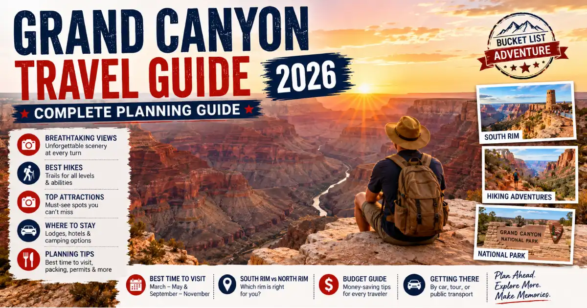
This Grand Canyon travel guide covers everything needed to plan a 2026 visit — which rim to choose, where to stay, how to book permits, which trails to hike (and which to avoid), what to eat, how to budget, and how to avoid the most common mistakes that turn America’s greatest natural wonder into a frustrating experience rather than a transcendent one.
For complete guides, see our Best Places to Visit in Arizona 2026, Things to Do in Sedona 2026, and Best Time to Visit Arizona guides.
| Category | Details |
|---|---|
| Entry Fee | $35/vehicle (7-day pass, both rims) |
| South Rim Season | Open year-round |
| North Rim Season | Mid-May through mid-October |
| Distance: South Rim from Phoenix | 230 miles / ~4 hours |
| Distance: South Rim from Las Vegas | 280 miles / ~4.5 hours |
| Distance: South Rim from Flagstaff | 80 miles / ~1.5 hours |
| Best Overall Visiting Months | March–May, September–November |
| Busiest Months | June–August (summer peak) |
| Quietest Months | December–February |
| Minimum Recommended Time | 1 full day (South Rim only) |
| Ideal Time | 2–3 days (South Rim); 4–5 days (both rims) |
| America the Beautiful Pass | $80/year, covers all National Parks |
The decision between the Grand Canyon’s two developed rims determines essentially everything else about the visit — the logistics, the experience, and the specific views. Understanding the fundamental differences helps most visitors make the choice that fits their trip.
The South Rim is what most people picture when they think of the Grand Canyon — the developed rim with iconic views from Mather Point, the El Tovar Hotel (a 1905 National Historic Landmark lodge perched at the canyon’s very edge), the Grand Canyon Village, and the famous rim trail stretching 13 miles between viewpoints. The South Rim sits at 6,860 feet elevation and is open 365 days a year, accessible by private vehicle, free shuttle bus (from the Grand Canyon Visitor Center parking), train (the Grand Canyon Railway from Williams, Arizona), and bus from Flagstaff and Phoenix.
Choose the South Rim if: This is your first Grand Canyon visit, you’re driving from Phoenix or Las Vegas, you have limited time (1-2 days), you want the most developed visitor infrastructure, you’re visiting in winter, or you want the widest range of hiking options.
The North Rim sits approximately 1,000 feet higher than the South Rim (8,000 feet vs. 6,860 feet) and receives only about 10% of the Grand Canyon’s total annual visitors — primarily because it’s significantly harder to reach (no year-round road access from either Phoenix or Las Vegas without a very long drive) and open only mid-May through mid-October. The higher elevation creates a distinctly different ecosystem (dense forests of ponderosa pine, aspen, and Engelmann spruce rather than the South Rim’s pinyon-juniper vegetation) and dramatically fewer crowds. The North Rim’s views look at different canyon walls than the South Rim’s, providing a different but equally dramatic perspective on the canyon’s geology.
Choose the North Rim if: You’ve already visited the South Rim, you’re driving from Utah or Nevada and the routing makes sense, you want significantly fewer crowds, you’re visiting specifically in summer (the North Rim’s higher elevation provides meaningfully cooler temperatures than the South Rim in July-August), or you want a more wilderness-oriented Grand Canyon experience.
Both Rims: Visiting both rims in a single trip requires either a 5-hour drive between the two along the highway (the rims are only 10 miles apart as the crow flies but 215 miles by road), a rim-to-rim hike (one of the most demanding single-hike challenges in American national parks, typically done in 2-3 days with a permit), or a helicopter flight across the canyon (available commercially from both rims, connecting the two rims in minutes rather than hours of driving).
Distance: 230 miles | Time: ~4 hours | Route: I-17 North to AZ-89A to AZ-64 North
The most common approach for international visitors flying into Phoenix Sky Harbor. Take I-17 North from Phoenix to Flagstaff (approximately 2.5 hours), then AZ-89 North through Wupatki National Monument and Cameron to the Desert View entrance (eastern South Rim entrance), or continue on I-17 to AZ-180 Northwest from Flagstaff to the South Entrance Station (the primary South Rim entrance). The Desert View route (AZ-89 from Cameron) adds approximately 30 minutes but provides Desert View Watchtower as the first stop — worth considering for visitors who haven’t previously seen this eastern rim viewpoint.
Distance: 280 miles | Time: ~4.5 hours | Route: US-93 South to I-40 East to AZ-64 North
Las Vegas is the second most common departure point for South Rim visitors. The drive crosses the Hoover Dam (visible from the new bypass bridge, with a pullout for viewing available) and passes through Kingman before joining I-40 east to Williams, then AZ-64 north directly to the South Rim entrance. Williams is worth a brief stop for the historic Route 66 downtown commercial strip and as the departure point for the Grand Canyon Railway (see below).
Distance: 80 miles | Time: ~1.5 hours | Route: AZ-180 Northwest
The shortest drive to the South Rim from any major city, making Flagstaff an excellent base for multi-day Grand Canyon visits — return to Flagstaff each evening (avoiding the premium pricing and limited availability of in-park lodging) while spending full days at the canyon. Flagstaff additionally provides access to Sedona (30 miles south) and the Navajo Nation’s Monument Valley and Antelope Canyon for multi-destination northern Arizona itineraries.
From: Williams, Arizona | Duration: 2.25 hours each way | Cost: $65–$226 round trip depending on class | Book: Advance reservations at thetrain.com
The Grand Canyon Railway (operating since 1901, with a hiatus from 1968-1989) provides a genuinely distinctive transportation alternative — a restored historic train traveling from Williams, Arizona to the Grand Canyon South Rim village, with entertainment (cowboy musicians, mock train robbery performance) during the journey, arrival directly at the historic depot near El Tovar Hotel, and the ability to explore the rim without driving. The round-trip journey (departing Williams at 9:30 AM, arriving Grand Canyon at 11:45 AM, departing canyon at 3:30 PM, arriving Williams at 5:45 PM) provides approximately 3.5 hours at the rim — sufficient for a first visit but limiting for visitors wanting extensive hiking.
Insider tip: Parking at the Williams depot and taking the train eliminates South Rim parking stress entirely — South Rim parking during summer peak can require arriving by 7 AM to secure a spot near the visitor center. The train’s departure from Williams and arrival at the canyon village deposits passengers within walking distance of the primary rim viewpoints and shuttle bus system.
Grand Canyon Airport (GCN), located approximately 6 miles south of the South Rim in Tusayan, receives limited commercial flights (primarily from Phoenix and Las Vegas via regional carriers) alongside the much more active helicopter and small-aircraft tour operations. Car rental is available at the airport, though driving the 6 miles to the South Rim entrance is necessary upon arrival — the airport itself provides no walkable rim access.
The South Rim’s primary visitor experience centers on the 13-mile paved Rim Trail — flat, wheelchair accessible (in most sections), running continuously from Pipe Creek Vista (eastern end) through the Grand Canyon Village to Hermit’s Rest (western end), with shuttle buses providing transportation between major viewpoints for visitors not walking the full length. The trail’s western section (from Grand Canyon Village to Hermit’s Rest) is closed to private vehicles from March through November, with the free Hermit’s Road (Red) Shuttle providing access — this car-free policy dramatically improves the experience compared to the eastern section where vehicle and pedestrian traffic mix.
Essential South Rim viewpoints:
Mather Point — The most visited single viewpoint in the entire National Park System, positioned on a peninsula of rim that extends into the canyon providing views both east and west along the canyon corridor simultaneously. The standard arrival viewpoint for most visitors (adjacent to the Grand Canyon Visitor Center and the Mather Point parking area) and arguably the single best introduction to the canyon’s scale available from any single point on the South Rim. Sunrise here (particularly in spring and fall when the pre-dawn drive is feasible without extreme cold or dangerous road conditions) is one of America’s most extraordinary daily natural events — the canyon’s progressive illumination from pre-dawn blue through pink, orange, and gold as the sun rises over the eastern canyon rim transforms the visible landscape minute by minute.
Yavapai Point and Yavapai Geology Museum — A 0.75-mile walk east from Mather Point, Yavapai Point provides excellent canyon views alongside the Yavapai Geology Museum (a small, free exhibit interpreting the canyon’s 2-billion-year geological history through the specific rock layers visible from the viewpoint windows) — the most useful geological interpretation of any South Rim location.
Desert View Watchtower (Eastern Rim) — 26 miles east of Grand Canyon Village along Desert View Drive, the Watchtower (a 1932 Mary Colter-designed stone tower whose interior is painted with Hopi murals and whose exterior observation deck provides the highest viewpoint accessible to visitors on the South Rim) offers the canyon’s most complete panoramic perspective — looking west along the canyon corridor toward the main South Rim village area, east toward the Navajo Nation and Painted Desert, and north into the Marble Canyon section of the Colorado River corridor. The Desert View area also provides the South Rim’s most accessible Colorado River viewpoint (the river is actually visible from certain Desert View Watchtower positions, unlike most South Rim viewpoints where the inner canyon walls block river sightlines).
Hopi Point — Widely considered the South Rim’s best sunset viewpoint, with an unobstructed western horizon that catches the last direct sunlight of the day — accessible via the Hermit’s Road (Red) Shuttle (required during the vehicle-restriction months), and popular enough at sunset that shuttle timing requires arriving at the viewpoint at least 30 minutes before the sun’s actual horizon contact.
Pima Point — The quietest viewpoint on the Hermit’s Road (fewer shuttle stops here than at Hopi Point or Mohave Point, and significantly fewer visitors), providing excellent sunset and late afternoon views with substantially more solitude than the major shuttle stops.
Powell Point — Memorial to explorer John Wesley Powell (who led the first documented river journey through the Grand Canyon in 1869) with excellent views and typically moderate crowds.
Hiking into the Grand Canyon is the experience that most fully captures the canyon’s scale and diversity — from the rim, the canyon is undeniably spectacular but fundamentally two-dimensional; descending even a few hundred feet into the canyon reveals the multiple ecosystem zones, rock formations, and lived-in quality of the inner canyon that rim-level viewing cannot convey. The South Rim’s two primary maintained trails (Bright Angel Trail and South Kaibab Trail) are the foundational hiking options for most visitors, with specific considerations for each.
Trailhead: Grand Canyon Village (adjacent to Bright Angel Lodge) | Difficulty: Strenuous | Round trip to river and back: 18 miles, 4,460 feet elevation change | Turnaround points: 1.5-Mile Rest House (3 miles RT), 3-Mile Rest House (6 miles RT), Indian Garden/Havasupai Gardens (9 miles RT)
Bright Angel Trail is the most historically significant and most hiker-friendly trail in Grand Canyon — developed along a natural fault line in the canyon wall (creating a relatively gradual descent compared to other Grand Canyon trails), equipped with seasonal water sources at the 1.5-Mile Rest House, 3-Mile Rest House, and Indian Garden (Havasupai Gardens) year-round, and wide enough through most of its length for comfortable two-way traffic between descending and ascending hikers. The trail follows Bright Angel Creek down to the Colorado River (9 miles one-way, 4,460 feet of elevation loss) — a distance and elevation change that makes the complete rim-to-river day hike one of the most dangerous activities in the national park (see safety section below).
For day hikers and casual visitors, the appropriate turnaround points are: 1.5-Mile Rest House (3 miles RT, 1,131 feet descent — manageable for most visitors in good weather, providing a taste of the inner canyon without dangerous commitment), 3-Mile Rest House (6 miles RT, 2,112 feet descent — a solid half-day hike for reasonably fit visitors, reaching a rest facility with toilets and seasonal water), or Indian Garden/Havasupai Gardens (9 miles RT, 3,060 feet descent — a challenging full day hike, recommended only for experienced hikers in genuinely cool weather with substantial water carried).
Trailhead: Yaki Point (South Rim, shuttle access only — no private vehicle parking) | Difficulty: Strenuous | Round trip to river and back: 14.4 miles, 4,780 feet elevation change | Turnaround points: Ooh Aah Point (1.8 miles RT), Cedar Ridge (3 miles RT), Skeleton Point (6 miles RT)
South Kaibab Trail descends a ridge rather than following a creek drainage — the result is that nearly every step of the descent provides panoramic canyon views rather than the enclosed, canyon-wall experience of Bright Angel Trail. This view-maximizing design comes with significant drawbacks: no water sources whatsoever along the entire trail length (requiring carrying all water from the rim), a steeper average grade than Bright Angel Trail, and exposed sunny terrain that makes summer hiking genuinely dangerous. The trade-off in extraordinary views makes South Kaibab the most photogenic trail in Grand Canyon for the sections it covers.
For day hikers, the appropriate turnaround points are: Ooh Aah Point (1.8 miles RT, 620 feet descent — the best 360-degree canyon views accessible with minimal hiking from the South Rim, deservedly named), Cedar Ridge (3 miles RT, 1,140 feet descent — a good conditioning hike with excellent views and a composting toilet at the Cedar Ridge flat), Skeleton Point (6 miles RT, 2,040 feet descent — requiring genuine fitness and early start given no shade and no water).
The rim-to-rim hike (South Rim to North Rim, or vice versa, via the corridor trails — typically South Kaibab to North Kaibab via Phantom Ranch at river level) is one of the most iconic and most challenging multi-day hikes in American national parks — approximately 21 miles total distance with approximately 10,000 feet of combined elevation change, typically completed in 2-3 days with overnight camping at Bright Angel Campground and/or Phantom Ranch (a historic lodge at river level, accessible only by foot, mule, or raft). Backcountry permits (required for all overnight stays below the rim, obtained through the Backcountry Information Center permit lottery) are among the most competitive in the national park system — applying 4-6 months in advance is standard practice, with walk-up permit availability at the canyon the day before a desired start date representing a long-shot option.
Mule trips: Commercial mule rides descending the Bright Angel Trail (day trips to Indian Garden and overnight trips to Phantom Ranch) are operated by Xanterra (the Grand Canyon’s primary concessionaire) — overnight mule trips to Phantom Ranch are the second most competitive reservation in the Grand Canyon system after river permits, with availability typically booking 13 months in advance of the desired date.
All South Rim lodging within the park is operated by Xanterra Parks & Resorts (xanterra.com). Reservations open 13 months in advance of the desired stay date — for summer peak season and holiday periods, booking at exactly this 13-month window is genuinely necessary to secure preferred properties.
El Tovar Hotel — The Grand Canyon’s flagship lodge, a 1905 National Historic Landmark situated directly on the canyon rim (the canyon visible from certain room windows and from the hotel’s veranda), with 78 rooms ranging from standard to suites. The most desirable and most expensive South Rim accommodation ($200–$500+/night depending on room type and season). Book at the 13-month opening window for summer months.
Bright Angel Lodge — A 1935 Mary Colter-designed historic lodge directly on the rim adjacent to the Bright Angel Trailhead, offering a range of accommodation types from historic cabins (some with canyon views, some without) to simple motel-style rooms in the main lodge building. More affordable than El Tovar ($120–$300+/night) with similar rim proximity. The Bright Angel Lodge History Room (free exhibit within the lodge) covers Mary Colter’s architectural vision for the canyon’s historic buildings.
Maswik Lodge — Located approximately 0.25 miles from the rim (no canyon views), Maswik is the most affordable in-park accommodation ($120–$200/night) and the most recently renovated of the South Rim lodges. Convenient to the shuttle bus system and the village area without the premium of rim-adjacent properties.
Kachina and Thunderbird Lodges — Two adjacent motel-style lodges on the rim between El Tovar and Bright Angel Lodge, offering modern room amenities in a rim-adjacent location ($200–$350/night). More recently renovated than El Tovar or Bright Angel Lodge but lacking those properties’ historic character.
Phantom Ranch — The only lodging below the rim, accessible only by foot (rim-to-rim hikers), mule (day and overnight trips from South Rim), or Colorado River rafting. A collection of historic stone cabins and dormitory bunkhouses at the bottom of the canyon, offering the Grand Canyon’s most singular overnight experience — sleeping at river level with the canyon walls surrounding the property in every direction. Book at the 13-month window via the “Phantom Ranch Lottery” system (xanterra.com); extraordinary demand for the limited beds makes this one of the most difficult reservations in American travel.
Outside the Park:
Tusayan (the town immediately south of the South Rim entrance): Best Western Premier Grand Canyon Squire Inn, Holiday Inn Express, and various other mid-range hotel options provide accommodation just outside the park boundary ($150–$250+/night peak season) for visitors unable to secure in-park lodging. The trade-off is slightly more driving (6 miles to the South Entrance Station) but significantly more availability.
Flagstaff (80 miles south): Multiple hotel options at various price points, plus the advantage of a genuine small city’s restaurant and cultural infrastructure. The 1.5-hour round trip adds commuting time to rim visits but allows greater accommodation flexibility and the option of combining Grand Canyon with Flagstaff’s independent attractions.
Williams (58 miles south): A Route 66 historic town with various lodging options and the Grand Canyon Railway departure point — particularly appealing for visitors using the train and wanting to avoid driving entirely.
The North Rim’s primary developed area (the Grand Canyon Lodge and associated visitor facilities at Bright Angel Point) sits approximately 1,000 feet higher than the South Rim, creating a meaningfully different ecological zone (dense conifer forest rather than the South Rim’s pinyon-juniper scrub) and a dramatically different visitor experience (fewer than 500,000 annual visitors vs. the South Rim’s 5+ million).
Getting there: The North Rim is accessible via US-89A from Kanab, Utah (the primary approach from both Las Vegas and the Utah national parks corridor), or via an extremely long drive from Phoenix (approximately 5.5 hours). Jacob Lake Inn (45 miles north on US-89A) serves as the last services point before the North Rim, providing gas, food, and lodging for visitors not staying at Grand Canyon Lodge.
Grand Canyon Lodge — North Rim: The only in-park lodging on the North Rim, a 1937-era lodge with cabins of various types perched at Bright Angel Point overlooking the canyon, plus motel units immediately adjacent. The lodge’s stone-and-timber main building (rebuilt after a 1932 fire in the original structure) provides a Sun Room with full-wall windows facing the canyon — one of the most architecturally satisfying interior spaces in any American national park lodge. Book at the 13-month window via the Forever Resorts reservation system.
Bright Angel Point Trail (North Rim): A 0.5-mile round-trip paved trail from the Grand Canyon Lodge to the Bright Angel Point promontory — the most accessible North Rim viewpoint, providing a genuinely extraordinary perspective on the canyon’s north-facing walls that looks across to the South Rim (approximately 10 miles distant at this point) from a dramatically different angle than any South Rim viewpoint.
North Kaibab Trail: The North Rim’s primary hiking trail, descending from the North Rim trailhead to Phantom Ranch at river level (14.2 miles one-way, 5,760 feet elevation loss). The same turnaround-point logic applies as South Rim trails — Coconino Overlook (1.4 miles RT), Supai Tunnel (4 miles RT), and Roaring Springs (9.4 miles RT) represent the primary day-hike destinations before the river-level commitment becomes overnight-permit territory.
The Grand Canyon generates more search-and-rescue operations than virtually any other National Park — approximately 250-300 SAR responses annually, with heat-related distress, dehydration, and overestimated physical capability being the primary contributing factors. Understanding the specific dangers of Grand Canyon hiking is genuinely important.
The National Park Service explicitly advises against attempting to hike from the rim to the Colorado River and back in a single day, and posts this warning prominently at all major trailheads. The canyon violates the hiker’s usual experience: going down (typically the easier direction in mountains) happens first, when hikers are fresh, cool, and energetic — the return (going up, in increasing heat as the day progresses, against tired legs) happens when hikers are depleted, often dehydrated, and facing the day’s peak temperatures. The Bright Angel Trail’s 9-mile rim-to-river distance and 4,460 feet of elevation loss/gain is comparable to hiking from the valley floor to the summit of a significant mountain — in a desert environment with summer temperatures exceeding 110°F at river level.
Summer temperatures at river level (Phantom Ranch) regularly exceed 110°F (43°C) in July and August, and exceed 100°F from late May through early October. The South Rim itself (at 6,860 feet) remains substantially cooler (typically 80s°F in summer), meaning hikers who begin descending in pleasant rim conditions are heading into dramatically increasing heat with every 1,000 feet of descent — a process that’s psychologically difficult to anticipate accurately because the change is gradual.
Dehydration is the most common condition requiring Grand Canyon SAR response. The NPS recommendation (1 liter of water per hour of strenuous hiking in summer) means a full rim-to-river hike requires carrying approximately 8-10 liters of water, which most day-hiking packs cannot accommodate. The in-canyon water sources (1.5-Mile Rest House, 3-Mile Rest House, Indian Garden/Havasupai Gardens on Bright Angel Trail — all seasonal, off during winter) provide midway replenishment that makes Bright Angel Trail significantly safer than South Kaibab Trail, which has no water sources whatsoever.
NPS rangers advise a simple turn-around protocol: if it took one hour to hike down, plan one hour and fifteen minutes for the hike back up (ascending takes longer than descending, particularly on tired legs), and add additional margin for heat exposure. If your planned turnaround time is reached but you haven’t reached your desired destination, turn around anyway — the destination will be there on a future visit; search-and-rescue operations are expensive and genuinely dangerous for the rescuers.
Day hiking on the South Rim or North Rim (including descending to the river and returning the same day) requires no permit beyond the park entry fee ($35/vehicle). However, the NPS strongly discourages rim-to-river day hikes, particularly in summer.
Any overnight stay below the rim (camping at Bright Angel Campground, Indian Garden/Havasupai Gardens Campground, Cottonwood Campground, or anywhere in the backcountry) requires a backcountry permit from the Grand Canyon Backcountry Information Center. Permits are distributed by lottery — applications open 4 months before the desired month, with online and mail applications accepted. The most competitive dates (spring and fall rim-to-rim hiking season) require applying immediately at the opening window with alternatives specified.
Private river permits (for groups bringing their own equipment and running the river independently) are distributed via an annual lottery with waitlist periods of years for prime dates. Commercial river permits (booking with one of the licensed Grand Canyon outfitters who provide guides, equipment, and logistics) require 1-2 years advance booking for full-canyon trips (the entire 225-mile navigable length, typically 14-21 days) or 6-12 months for partial-canyon commercial trips.
Grand Canyon Visitor Center (South Rim, adjacent to Mather Point) — The primary orientation facility, with exhibits on canyon geology, ecology, and human history, ranger programs, backcountry permit information, and bookshop. The free shuttle bus system (covering the Village, Hermit’s Road, and Kaibab/Rim Route) departs from here.
Yavapai Geology Museum (South Rim, 0.75 miles east of Visitor Center) — The most geologically educational visitor facility on the South Rim, with exhibits interpreting the visible canyon geology through windows that frame specific rock layers.
Desert View Visitor Center (East Rim, 26 miles from Village) — Smaller facility at the eastern South Rim entrance, providing orientation for visitors arriving from Cameron/Navajo Nation direction.
North Rim Visitor Center (North Rim) — Located near Grand Canyon Lodge, providing ranger programs, permit information, and orientation for North Rim visitors.
South Rim dining is operated primarily by Xanterra. Options range from the El Tovar Dining Room (table service, the canyon’s most formal restaurant, dinner reservations strongly recommended, $25–$55/entrée) and Bright Angel Restaurant (casual table service near Bright Angel Lodge, $12–$25) to the Canyon Village Market Deli (grab-and-go sandwiches and basic provisions), the Maswik Food Court (cafeteria-style, fast/affordable, $10–$18), and various coffee and snack kiosks along the rim trail.
Outside the park: Tusayan (the town immediately south of the park) offers a range of restaurants from fast food through sit-down casual dining at more affordable price points than in-park options. The Grand Canyon Brewing Company (Grand Canyon, AZ, in Williams) provides a worthwhile stop on the drive between Flagstaff/Williams and the park.
Packing food: For day hikers, packing food from outside the park (Flagstaff grocery stores, or the Whole Foods/Trader Joe’s in north Phoenix for visitors driving directly) provides the best combination of quality and cost — in-park food is limited in variety and premium-priced, while bringing a prepared picnic allows eating at any rim viewpoint with the canyon as backdrop.
Depart Phoenix/Flagstaff by 6 AM → arrive South Rim before 10 AM → Mather Point sunrise or morning viewpoint visit → Bright Angel Trail descent to 1.5-Mile Rest House (turnaround) → Rim Trail walk toward El Tovar for lunch → Desert View Watchtower drive (afternoon) → sunset at Hopi Point → return drive.
Best for: First-time visitors with limited time, day-trippers from Phoenix or Las Vegas.
Day 1: Arrive by mid-morning → Visitor Center orientation → Rim Trail walk from Mather Point to El Tovar → Desert View Drive afternoon → sunset at Hopi Point → overnight at Tusayan or in-park lodge. Day 2: Sunrise at Mather Point → South Kaibab Trail to Cedar Ridge (morning, before heat) → Hermit’s Road (Red) shuttle to Pima Point and Hermit’s Rest → afternoon → depart for Flagstaff or Phoenix.
Best for: Visitors wanting a comprehensive South Rim experience without backcountry commitment.
Day 1: South Rim arrival, Mather Point, Desert View Drive. Day 2: South Kaibab Trail morning hike, Hermit’s Road afternoon. Day 3: Drive to North Rim (5 hours via highway) → Bright Angel Point → North Rim overlooks → overnight at Grand Canyon Lodge.
Best for: Returning visitors, those specifically wanting the North Rim experience.
Day 1: Arrive South Rim, shuttle to South Kaibab Trailhead, descend to Bright Angel Campground (9.5 miles, 4,780 feet descent) — requires permit. Day 2: Bright Angel Campground to Phantom Ranch (1.7 miles) or continue to Bright Angel Creek. Day 3: Phantom Ranch to Cottonwood Campground via North Kaibab Trail (7 miles, 4,240 feet ascent to Cottonwood) — requires permit. Day 4: Cottonwood Campground to North Rim (7 miles, 1,500 feet ascent). Day 5: North Rim exploration, arrange transportation south (shuttle service or vehicle pre-positioned at North Rim).
Best for: Experienced hikers with backcountry permits secured months in advance.
Temperatures: South Rim 40–70°F, inner canyon 60–90°F. Spring offers the most comfortable hiking conditions — cool enough for safe inner-canyon descent, warm enough for rim exploration without winter gear, and uncrowded relative to summer peak. Wildflowers (April–May, particularly after a wet winter) add color to both the rim vegetation and the inner canyon’s riparian areas.
South Rim: 70–85°F, pleasant. Inner canyon: 90–110°F+, potentially lethal for unprepared hikers. Summer is the busiest season for rim-level visiting (longest days, school vacation schedules driving family travel) but the most dangerous for inner-canyon hiking. Night hiking (departing trailheads before dawn, completing descent and partial ascent before the inner canyon reaches peak heat) is the standard summer strategy for visitors wanting to descend.
Temperatures: South Rim 45–75°F, inner canyon 65–100°F (cooling significantly through October–November). The monsoon season (July–September) produces afternoon thunderstorms that dramatically improve the air quality after summer’s dust, and the canyon’s cottonwood trees along creek drainages turn gold in October–November. North Rim closes mid-October.
South Rim: 20–45°F, ice on rim trails possible, inner canyon 30–60°F. Snow on the rim creates dramatic photography conditions (white snow against red canyon walls) and the quietest visitor experience of the year. Some rim trail sections may be icy — traction devices (Yaktrax or similar) recommended for any rim walking. Inner canyon hiking is excellent — cool temperatures make descent/ascent comfortable, and crowds are minimal.
About Travel Tourister Travel Tourister’s destination specialists have explored the Grand Canyon across both rims and multiple seasons — from South Rim sunrise at Mather Point and South Kaibab Trail dawn hikes to North Rim’s uncrowded Bright Angel Point and the unique perspective of Colorado River level at Phantom Ranch — to deliver the most practical and honest planning guide for 2026 Grand Canyon visitors of every experience level.
Posted By : Vinay
Latest Article
2nd Floor, 39, Above Kirti Club, DLF Industrial Area, Kirti Nagar, New Delhi, Delhi 110015



Travel Tourister is a leading Travel portal where we introduce travellers to trusted travel agents to make their journey hasselfree, memorable And happy. Travel Tourister is a platform where travellers get Tour packages ,Hotel packages deals through trusted travel companies And hoteliers who are working with us across the world. We always try to find new and more travel agents and hoteliers from every nook and corners across the world so that you could compare the deals with different travel agents and hoteliers and book your tour or hotel with the one you have chosen according to your taste and budget.
Copyright © Travel Tourister, India. All Rights Reserved

 Call
Call Enquiry