Published on : 27 Oct 2026
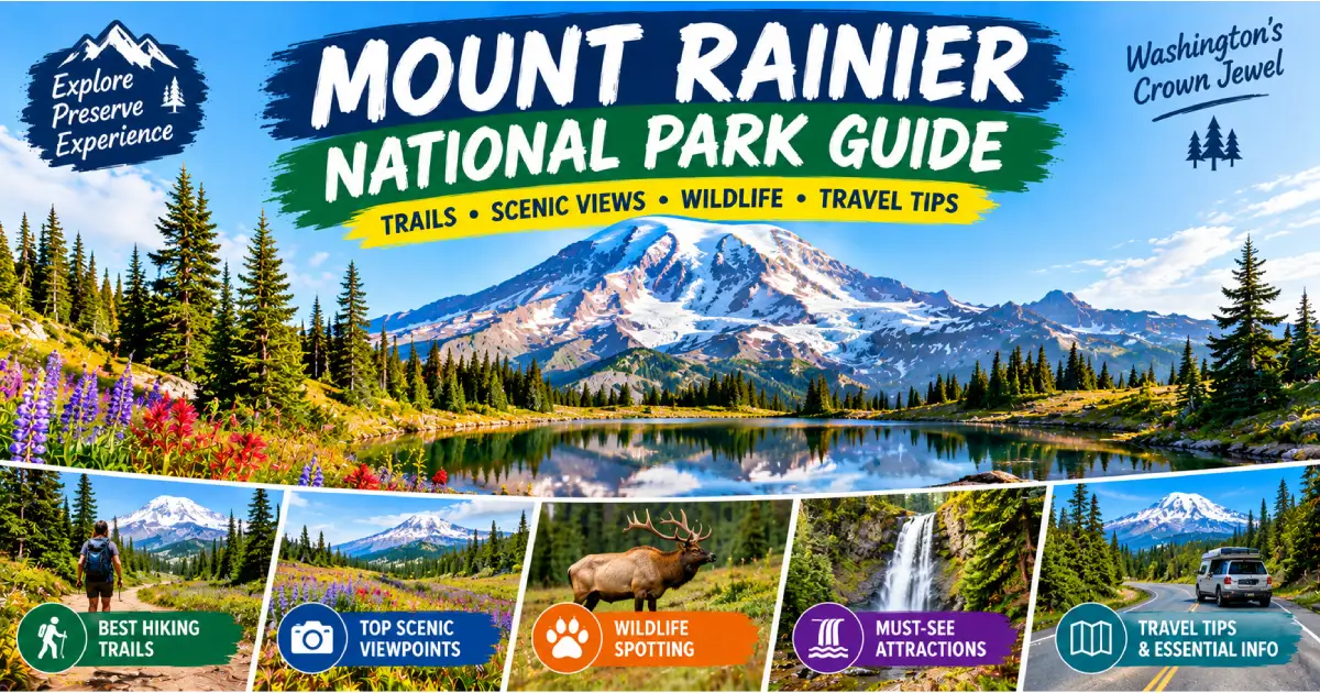
Mount Rainier is the most iconic mountain in the Pacific Northwest and the most glaciated peak in the contiguous United States — a 14,411-foot active stratovolcano in the Cascade Range of Washington State that rises 13,000 feet above the surrounding lowlands in one of the most dramatic vertical gains of any peak in the lower 48. The mountain is visible from Seattle (90 miles north), Portland (140 miles north), and on clear days from as far as the coast of Oregon. Its summit ice cap holds 26 glaciers covering 35 square miles — more glacial ice than any peak in the contiguous United States — and the glaciers feed five major river systems including the Carbon, Puyallup, Nisqually, Cowlitz, and White Rivers, which provide drinking water for more than 2 million people in the greater Puget Sound region.
The park — established in 1899 as the fifth national park in the United States and the first national park in Washington — covers 369 square miles of old-growth forest, subalpine meadow, and glaciated alpine terrain. The Park is famous above all else for its wildflower meadows: Paradise (5,400 ft) and Sunrise (6,400 ft) produce the most spectacular subalpine wildflower displays in the Pacific Northwest, with Indian paintbrush, lupine, avalanche lily, and bistort blooming across the open meadows from mid-July through mid-August against the constant backdrop of the mountain’s icefalls and glaciers. The combination of the mountain’s visual dominance, the flower meadows, and the accessibility of both Paradise and Sunrise — each reached by a paved road — makes Mount Rainier National Park the most visited park in Washington and one of the most photogenic in the country.
In 2026, Mount Rainier National Park operates a timed-entry reservation system for vehicles accessing Paradise and Sunrise during peak season (July through Labor Day weekend). Reservations are required Fridays–Sundays and federal holidays from mid-July through September; weekday visits remain walk-up. Reservations open 90 days in advance at recreation.gov ($2/reservation, in addition to the $35/vehicle entry fee). The Longmire area and the Nisqually entrance remain open year-round without timed-entry requirements, making Mount Rainier one of the few Cascade peaks with year-round paved road access.
| Area | Elevation | Highlight | Best Trail | Best Season |
|---|---|---|---|---|
| Paradise | 5,400 ft | Wildflower meadows | Skyline Trail (5.5 mi) | July–September |
| Sunrise | 6,400 ft | Highest road point in WA | Burroughs Mountain (7.4 mi RT) | August–September |
| Longmire | 2,761 ft | Historic district, year-round | Trail of the Shadows (0.7 mi) | Year-round |
| Carbon River | 1,650 ft | Only inland temperate rainforest in WA | Carbon River Rainforest Loop (1.5 mi) | Year-round |
| Mowich Lake | 4,929 ft | Remote, no crowds | Spray Park (8 mi RT) | August–September |
| Grove of the Patriarchs | 1,600 ft | Largest old-growth in the park | Grove of the Patriarchs (1.5 mi RT) | Year-round |
| Reflection Lakes | 4,861 ft | Classic Rainier reflection photo | Lakes Trail (5 mi loop) | July–October |
| Emmons Glacier | 5,400 ft | Largest glacier in lower 48 | Emmons Moraine Trail (3.4 mi RT) | August–September |
| Wonderland Trail | 2,300–6,700 ft | 93-mile circumnavigation | Full loop (10–14 days) | July–September |
| Mount Rainier Summit | 14,411 ft | Highest peak in WA | Disappointment Cleaver route (16 mi RT) | May–September |
Location: 19 miles from Nisqually entrance (WA-706 east gate); 1.5 hours from Seattle Elevation: 5,400 ft | Visitor Center: Jackson Visitor Center, open daily late May–October Entry Fee: $35/vehicle; timed-entry reservation required Fri–Sun and federal holidays July–Labor Day Lodging: Paradise Inn (1916 historic lodge, $165–$250/night, late May–early October)
Paradise is the heart of Mount Rainier National Park — the finest subalpine meadow destination in the Pacific Northwest, the most-photographed area of the park, and the standard starting point for summit climbs and glacier approaches. The name was given by the family of James Longmire (who built the first hotel at the mountain) after his daughter-in-law Martha Longmire exclaimed “It looks just like paradise” on seeing the flower-filled meadows in 1885. The U.S. Geological Survey records Paradise as receiving more measured snowfall than any weather station in North America — the average winter snowpack exceeds 680 inches (nearly 57 feet), and the 1,122-inch record (93.5 feet) set in 1971–72 remains the greatest measured snowfall at any weather station on earth.
Skyline Trail (5.5-mile loop, 1,400 ft gain, moderate-strenuous): The finest day hike at Paradise and the standard route for first-time visitors to the wildflower meadows — a loop that climbs through the Paradise meadows to the Panorama Point overlook (6,800 ft, the finest view of the Nisqually and Paradise Glaciers from the trail system), traverses the upper meadow, and descends past Myrtle Falls (the most photographed waterfall on the mountain) back to the visitor center. The wildflower peak is mid-July through early August, when the meadows combine Indian paintbrush (Castilleja miniata), lupine (Lupinus latifolius), avalanche lily (Erythronium montanum), and black-tipped orange-red Bistort in the most intense wildflower display in Washington. The trail is snow-free from approximately late July through September; accessible with microspikes in June.
Camp Muir (9,511 ft, 9 miles RT, 4,500 ft gain, very strenuous — Day hike): The finest strenuous day hike in Mount Rainier National Park — a trail from Paradise (5,400 ft) to the Camp Muir base camp (9,511 ft), the standard overnight camp for Mount Rainier summit climbers. The route follows the Skyline Trail to Panorama Point, then continues on snow (microspikes or crampons required above 7,000 ft) to the stone shelter at Camp Muir — the highest point reachable by a trail route without technical glacier skills. The view of the Cowlitz Glacier, the Tatoosh Range, and Mount Adams and Mount Hood from Camp Muir is the finest summit approach view on the mountain. An early start (before 7 AM) is essential to avoid afternoon cloud buildups and softer snow.
Myrtle Falls (0.8 miles RT from visitor center, easy): The most photographed waterfall in Mount Rainier National Park — a 72-foot falls on the Edith Creek drainage, visible from a footbridge on the main Paradise trail system with Mount Rainier’s summit ice cap as a backdrop on clear days. The finest photography composition at Paradise.
Alta Vista Trail (1.5-mile loop, 600 ft gain, easy-moderate): The finest shorter loop at Paradise — a loop through the wildflower meadows above the visitor center with continuous views of the mountain. The finest loop for families and visitors with limited time; the upper sections offer the same wildflower meadow environment as the Skyline Trail without the 5.5-mile full loop commitment.
Paradise Inn (1916): The finest historic lodge at Mount Rainier — a 121-room inn constructed in 1916 of Alaska cedar, with a two-story lobby featuring exposed cedar beams, a massive stone fireplace, and handcrafted furnishings by German carpenter Hans Fraehnke (the dining table and grandfather clock). The inn has been substantially restored and is listed on the National Register of Historic Places. The dining room serves the finest on-mountain dinner at Mount Rainier ($28–$45 for dinner entrées); breakfast on the inn porch (6:30–10:30 AM) with the mountain visible above the meadows is among the finest hotel breakfast settings in the Pacific Northwest. Reservations essential (nps.gov/mora, same-day check-in rarely available in July–August).
Location: 37 miles from the White River entrance (WA-410 northeast gate); 2 hours from Seattle Elevation: 6,400 ft | Visitor Center: Open daily late June–late September Entry Fee: $35/vehicle; timed-entry Fri–Sun and federal holidays July–Labor Day Note: Road closes to through traffic (does not connect to Paradise); access from WA-410 only
Sunrise is the highest point accessible by paved road in Washington State and offers the most dramatic close-range view of the Emmons Glacier — the largest glacier in the contiguous United States at 4.3 square miles and 2.5 miles long — from the standard Sunrise visitor area. The Sunrise area sits in the northeastern rain shadow of the mountain (receiving significantly less precipitation than Paradise), making it the sunniest and driest major visitor area in the park. The combination of the high elevation, the drier climate, and the direct north-facing view of the Emmons Glacier makes Sunrise the finest photography base in the park for close mountain photography.
Burroughs Mountain Trail (7.4 miles RT to Second Burroughs, 1,600 ft gain, strenuous): The finest day hike at Sunrise and one of the finest above-treeline hikes in Washington — a trail from the Sunrise visitor area across the tundra of First Burroughs Mountain (7,060 ft) to Second Burroughs Mountain (7,828 ft), with the finest ground-level view of the Emmons Glacier’s crevasse zone from any trail-accessible point in the park. The First Burroughs loop (3.6 miles RT, 800 ft gain) is the finest shorter option; the Second Burroughs extension adds 3.8 miles and 800 ft for the close Emmons views. Carry microspikes for early season patches.
Emmons Moraine Trail (3.4 miles RT, 250 ft gain, easy-moderate): The finest accessible trail to a glacier viewpoint in the park — a trail from the White River Campground (6 miles below Sunrise on White River Road) along the moraine deposited by the Emmons Glacier’s historic advance, with the glacier terminus visible at close range from the trail’s end. The Emmons Glacier is advancing slightly — one of the few advancing glaciers in North America, due to insulating rockfall from the 1963 Little Tahoma Peak rockfall that covers its lower section.
Sourdough Ridge–Dege Peak (5.4 miles RT, 900 ft gain, moderate): The finest ridge walk at Sunrise — a trail along the Sourdough Ridge from the visitor area to the 7,006-foot Dege Peak summit, with the finest panoramic view of Mount Rainier from the north, the Cascades (Mount Baker to the north, Glacier Peak, Mount Adams, Mount Hood in Oregon on clear days), and the Emmons/Winthrop Glacier complex. Sunrise to Dege Peak in the morning (before 10 AM, when the light is on the northeast face) is the finest photography walk at Sunrise.
Sunrise Point (6,100 ft, roadside viewpoint, no hiking required): The finest roadside view on the Sunrise Road — a turnout 4 miles below the visitor center with the finest panoramic view of the White River valley, the Emmons Glacier, and Mount Rainier’s summit from a roadside stop. The finest quick stop on the Sunrise approach road; sunrise photographers use this location (as the name implies) for the earliest morning light on the mountain’s northeast face.
Location: 7 miles from the Nisqually entrance (WA-706, the south gate); year-round access Elevation: 2,761 ft | Visitor Center: Longmire Museum, open daily year-round
Longmire is the oldest developed area in Mount Rainier National Park — a historic district with the park’s oldest buildings, the year-round accessible museum and ranger station, and the finest forest trails in the lowland zone. The Longmire district preserves the legacy of James Longmire, who discovered the mineral springs here in 1883 and built the first hotel at the mountain in 1884. The existing historic structures (the Longmire Inn/National Park Inn, the Administration Building, the Fuel Station, and the Community Building) date from 1906–1939 and are a National Historic District.
National Park Inn (year-round, $145–$215/night): The only year-round lodging within Mount Rainier National Park — a 25-room inn in the Longmire historic district, with the finest year-round access to the park’s lowland trails and winter snowshoeing. The inn’s dining room serves breakfast, lunch, and dinner year-round ($15–$35/entrée); the porch view of the forest and the distant mountain on clear days is the finest low-elevation lodging setting in the park.
Trail of the Shadows (0.7-mile loop, easy, year-round): The finest short walk at Longmire — a loop through the Longmire meadow and mineral springs (iron-rich cold springs that Longmire believed had medicinal properties; the bubbling spring vents are visible from the trail), passing the 1888 James Longmire homestead cabin (the oldest standing structure in the park). The finest first walk for new park visitors arriving via the Nisqually gate.
Rampart Ridge Trail (4.6-mile loop, 1,200 ft gain, moderate): The finest half-day loop at Longmire — a loop climbing from the lowland forest through old-growth Douglas fir and western red cedar to the Rampart Ridge viewpoint (3,700 ft) with views of the Longmire meadow and the lower Nisqually valley below, returning via the Van Trump Park trail junction.
Cougar Rock Campground (200 sites, $30–$45/night, May–October, recreation.gov): The finest frontcountry campground in the Paradise corridor — a large campground 2.4 miles above Longmire with a mix of tent and RV sites, flush toilets, and the closest campground to Paradise accessible without a timed-entry reservation for the campground itself. Reserve 3–4 months ahead for July–August weekends.
Location: Ohanapecosh area, WA-123 near the Stevens Canyon entrance (southeast corner) Distance from Paradise: 18 miles east via Stevens Canyon Road
The Grove of the Patriarchs is the finest old-growth forest trail in Mount Rainier National Park — a 1.5-mile round-trip walk across a suspension footbridge over the Ohanapecosh River to a river island supporting one of the largest concentrations of ancient Douglas fir, western red cedar, and western hemlock in the Pacific Northwest. Individual trees in the grove are 300–1,000 years old; the largest Douglas fir in the grove is 35 feet in circumference and over 800 years old. The river island’s isolation from fire history (protected by the surrounding water) has allowed the grove to develop to the maximum old-growth density found in the park.
The suspension footbridge (75 feet long, one person at a time) adds a mild adventure element to what is otherwise an easy, flat trail — making the Grove of the Patriarchs the finest family old-growth trail in the park. The Ohanapecosh area also hosts the Ohanapecosh Visitor Center and the Silver Falls Loop (3 miles, easy), which follows the Ohanapecosh River to a series of cascades and pools in a canyon of old-growth forest.
Location: Northwest corner of the park; Carbon River entrance via WA-165 from Orting Carbon River Road: Unpaved beyond the ranger station; accessible to vehicles 2 miles to the campground; 5 miles total to the historic ford (pedestrian/bike only beyond gate)
Carbon River Rain Forest: Mount Rainier’s Carbon River valley is the only inland temperate rainforest in the contiguous United States — a Sitka spruce–western red cedar forest receiving 70–80 inches of annual precipitation (driven by the Carbon River valley’s orientation into the prevailing moisture flow from the Pacific), with moss-draped trees, club moss carpets, and nurse logs identical in character to the coastal rainforest of the Olympic Peninsula but located 70 miles from the ocean. The Carbon River Rainforest Loop (1.5 miles, easy) is the finest accessible walk in the Carbon River area; the longer Carbon River Trail (8 miles one-way to Carbon Glacier) passes through the finest continuous old-growth forest in the park at the lowest elevation.
Carbon Glacier (16 miles RT from Carbon River entrance): The lowest-elevation glacier in the contiguous United States — the toe of the Carbon Glacier descends to 3,500 feet, making it accessible from a forest trail without crossing alpine terrain. The suspension bridge below the glacier terminus (rebuilt after the 2006 Carbon River Road flood damage) provides the finest low-elevation view of an active glacier in the United States.
Spray Park (8 miles RT, 1,700 ft gain, strenuous, from Mowich Lake): The finest uncrowded wildflower hike in Mount Rainier National Park — a trail from Mowich Lake (4,929 ft, the highest point accessible by paved road on the west side of the park) through old-growth forest to the Spray Park subalpine meadows (6,400 ft), with meadow wildflower displays as dramatic as Paradise but with a fraction of the visitors. The Mowich Lake area receives half the visitors of Paradise and Sunrise; Spray Park in August is one of the finest less-visited destinations in any national park in the Pacific Northwest.
Location: Stevens Canyon Road, 5 miles east of Paradise (WA-706/Stevens Canyon Road junction) Season: July–October (Stevens Canyon Road closed in winter)
Reflection Lakes is the most photographed viewpoint in Mount Rainier National Park — a series of shallow subalpine lakes directly south of Mount Rainier whose still water (in calm morning conditions) reflects the mountain’s summit and the Tatoosh Range in one of the most reproduced landscape photographs of any Pacific Northwest peak. The best reflection conditions occur on calm mornings (before 9 AM) in late July through September, when the prevailing westerly winds that distort the reflection have not yet developed. The parking area is small (fills by 9 AM on summer weekends); arriving before 8 AM or using the park shuttle from Paradise is the standard approach.
Lakes Trail (5-mile loop from Reflection Lakes, 1,200 ft gain, moderate): The finest loop trail in the Reflection Lakes area — a circuit connecting Reflection Lakes, Louise Lake, and the Bench Lake viewpoints above the Tatoosh Range, with continuous views of the mountain across the subalpine terrain. The wildflowers on the Bench Lake section (above 5,400 ft) are among the finest on the south side of the park.
Length: 93 miles circumnavigation of Mount Rainier | Elevation change: 22,000 ft cumulative Permit: Wilderness permit required; $8/person/night + $6 reservation fee; recreation.gov; released January 15 for the following summer (most popular segments sell out within the first week) Season: Mid-July through mid-September (higher sections snow-free window)
The Wonderland Trail is the finest long-distance trail in Washington State and one of the finest in the United States — a 93-mile circumnavigation of Mount Rainier that passes through every major ecosystem in the park: lowland old-growth forest (Carbon River, Ohanapecosh), subalpine meadow (Spray Park, Indian Henry’s Hunting Ground, Summerland, Mystic Lake, Sunrise), glacial moraines (Emmons, Winthrop), and river crossings (all five major drainages). The trail gains and loses 22,000 feet of cumulative elevation — more than summiting Everest from sea level — making it one of the most physically demanding long trails in the country per mile despite its relatively short total distance.
Standard direction: Clockwise from Longmire (counter-clockwise has slightly more uphill on average, but the views of the mountain are better approaching from the east) Standard duration: 10–14 days (most hikers average 7–10 miles per day given the terrain) Resupply: The only resupply point on the trail is at the Sunrise and Paradise visitor centers (limited) — most hikers mail resupply boxes to the White River and Longmire ranger stations
Best single section (3–4 days): Longmire → Indian Henry’s Hunting Ground → Klapatche Park → Golden Lakes → Mowich Lake (25 miles, the finest combination of meadow, moraine, and lakeside camping on the trail)
Standard route: Disappointment Cleaver (16 miles RT, 9,000 ft gain, 2 days) Guided climb: $1,200–$1,500/person (3-day program, Rainier Mountaineering Inc., rmi-expeditions.com) Self-guided permit: $52/person (recreation.gov; register at the Paradise Climbing Information Center) Season: May–September (optimal May–early July when crevasses are bridged by snow) Success rate: Approximately 50% of permitted parties reach the summit (weather and physical fitness are primary factors)
Mount Rainier is the most frequently climbed glaciated peak in the United States and a standard objective for mountaineers seeking high-altitude glacier experience before attempting peaks in Alaska or the Alaska Range. The standard Disappointment Cleaver route requires crampon and ice axe technique, rope team travel, and the ability to navigate in whiteout conditions — skills that are standard for any guided participant but require at least a weekend glacier travel course for independent climbers.
Rainier Mountaineering Inc. (RMI): The park’s primary concessionaire for guided summit climbs since 1969; operates 3-day summit programs ($1,200–$1,500/person, including all technical gear) with a one-day snow school at Paradise before the summit attempt. The 3-day RMI program is the finest introduction to technical glacier climbing in the United States.
Logistics: Climbers camp at Camp Muir (9,511 ft, stone shelter + tent platforms) on day 1; summit attempt departs Camp Muir at midnight (to reach the summit by 8–10 AM before afternoon cloud development); descent and return to Paradise on day 2. The midnight summit push (in clear conditions) offers the finest high-altitude star view in Washington.
Hoary Marmot (Marmota caligata): The most conspicuous wildlife at Paradise and Sunrise — large yellow-gray marmots (to 15 lbs) that colonize the boulder fields at the meadow-talus interface at both areas. The marmots are fully habituated to human presence; their shrill alarm calls (to warn of golden eagles, the primary aerial predator) are a constant audio element of the subalpine meadow experience at both areas.
Black Bear: Common throughout the park; berry season (August–September) brings bears into the subalpine meadows at Paradise and Sunrise to feed on huckleberries (Vaccinium membranaceum) and blueberries. Bear canister required for all backcountry camping.
Mountain Goat (Oreamnos americanus): Frequently visible on the rocky ridges above the treeline at both Paradise and Sunrise; the finest viewing is on the Burroughs Mountain ridge and the Rampart Ridge. Mountain goats are native to the Cascades (unlike the Olympic Peninsula, where they were introduced and are now being removed).
Olympic Marmot (non-resident here): All marmots in Mount Rainier NP are hoary marmots; Olympic marmots are found only on the Olympic Peninsula.
American Pika (Ochotona princeps): Small rabbit-relative living in talus slopes at high elevation; detectable by its sharp “eek” call from talus fields at Paradise, Sunrise, and Burroughs Mountain. A climate-sensitive indicator species monitoring the impacts of warming on high-elevation ecosystems.
From Seattle (90 miles, 2 hours to Paradise via WA-7/WA-706):
From Tacoma (55 miles, 1.5 hours):
No public transit to the park in 2026 — the Rainier Connector shuttle (a seasonal pilot program from Enumclaw to the White River entrance) is the only transit option and operates weekends only in July–August. Check the NPS website for the current 2026 schedule.
Within the Park:
Near the Park — Gateway Towns:
Campgrounds within the Park:
| Month | Weather | Wildflowers | Crowds | Notes |
|---|---|---|---|---|
| July | 65°F Paradise, partly cloudy | Early (low elevations) | High | Timed entry begins; some high trails still snowy |
| August | 70°F, partly cloudy | Peak (mid-July–mid-Aug) | Very High | Best wildflower window; book lodging 4–5 months ahead |
| September | 62°F, increasing clouds | Late (huckleberries) | Medium | Crowds thin after Labor Day; mountain views often best |
| October | 52°F, rain and snow | Gone | Low | Fall color in Carbon River; Paradise Inn closed |
| Winter (Nov–Mar) | 30–40°F Paradise, heavy snow | None | Very Low | Snowshoeing and cross-country skiing at Paradise (ranger-led snowshoe walks free with $35 entry) |
| May–June | 50–60°F, snow on trails | None | Low–Medium | Some Paradise trails open; Sunrise road closed; no timed entry |
Best overall: Late July–mid-August for wildflowers; September for views and no timed-entry; December–February for snowshoe walking with no crowds.
Best option: Paradise (timed entry required Fri–Sun in summer; book at recreation.gov)
Day 1: Seattle → Longmire (Trail of the Shadows) → Paradise (Skyline Trail or Alta Vista) → overnight Paradise Inn Day 2: Paradise (Myrtle Falls and Camp Muir base — 4 miles up, 1,500 ft) → Reflection Lakes → Ohanapecosh/Grove of the Patriarchs → return to Seattle via WA-123/US-12/I-5 (3.5 hours) or retrace WA-706 (2 hours)
Day 1: Seattle → Longmire (museum + Trail of the Shadows) → Paradise (afternoon wildflower walk) → overnight Paradise Inn Day 2: Paradise → Camp Muir (full day strenuous) → overnight Paradise Inn Day 3: Stevens Canyon Road → Reflection Lakes → Grove of the Patriarchs → Ohanapecosh → overnight Packwood Day 4: Sunrise (Burroughs Mountain Trail or Sourdough Ridge–Dege Peak) → return to Seattle via WA-410 and I-405 (2 hours)
Posted By : Vinay
Latest Article
2nd Floor, 39, Above Kirti Club, DLF Industrial Area, Kirti Nagar, New Delhi, Delhi 110015



Travel Tourister is a leading Travel portal where we introduce travellers to trusted travel agents to make their journey hasselfree, memorable And happy. Travel Tourister is a platform where travellers get Tour packages ,Hotel packages deals through trusted travel companies And hoteliers who are working with us across the world. We always try to find new and more travel agents and hoteliers from every nook and corners across the world so that you could compare the deals with different travel agents and hoteliers and book your tour or hotel with the one you have chosen according to your taste and budget.
Copyright © Travel Tourister, India. All Rights Reserved

 Call
 Enquiry