Published on : 27 Oct 2026
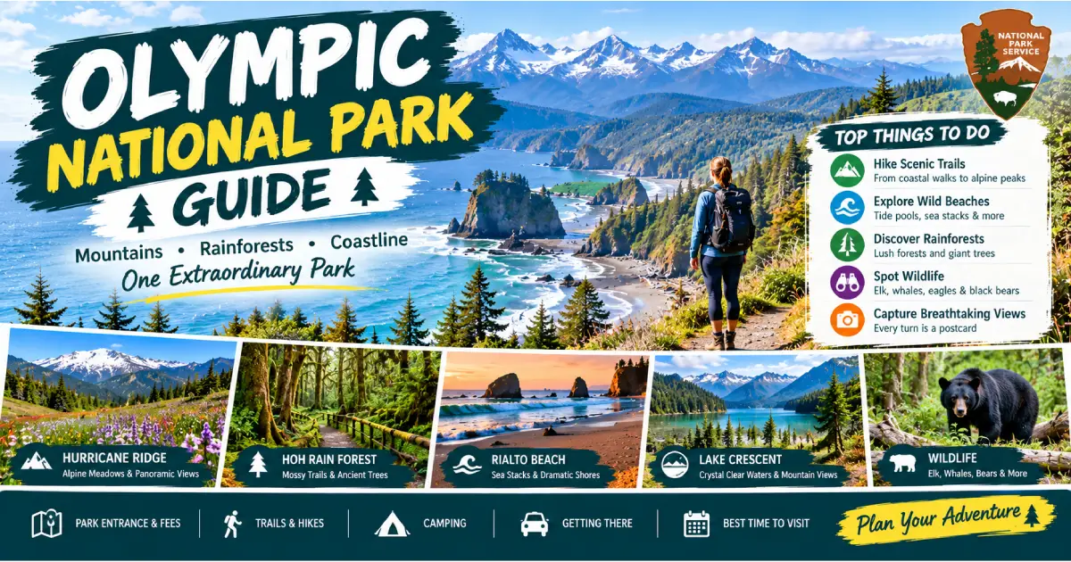
Olympic National Park is the most ecologically diverse national park in the contiguous United States — a 1,441-square-mile wilderness on the Olympic Peninsula of northwestern Washington that preserves three entirely distinct ecosystems within a single park boundary: the largest intact temperate rainforest in the contiguous United States, an undeveloped 73-mile Pacific coastline that is among the most remote and wild shoreline accessible by trail in the lower 48, and a glaciated mountain range with 13 peaks above 7,000 feet topped by Mount Olympus (7,965 ft) — a peak that receives more snowfall than any location in the contiguous United States outside Alaska. No roads connect these three ecosystems within the park; each is accessed separately from US-101, which encircles but does not enter the interior of the Olympic Peninsula.
The park was established by Franklin D. Roosevelt in 1938 after a decade of lobbying by the Mountaineers and conservation organizations who recognized that the Olympic Peninsula contained the last significant unlogged temperate rainforest in the contiguous United States. UNESCO designated it a World Heritage Site in 1981 and a Biosphere Reserve in 1988. The combination of the North Pacific maritime climate (which delivers 12–14 feet of annual precipitation to the Hoh Rain Forest, the wettest location in the contiguous United States) and the rain shadow effect (the park’s eastern slopes receive as little as 16 inches annually, less than Los Angeles) creates the most extreme moisture gradient in any national park in the country.
In 2026, Olympic National Park requires no advance reservation for general entry — the $35/vehicle fee is paid at the park entrance, and no timed-entry system is in place. The Hoh Rain Forest Visitor Center parking lot fills by 10 AM on summer weekends; arriving before 9 AM or after 4 PM is advised. Hurricane Ridge Road requires a $35 entry fee; the road to Hurricane Ridge is open year-round (weather permitting) with chain requirements in winter.
| Area | Highlight | Best Trail | Best Season |
|---|---|---|---|
| Hoh Rain Forest | Old-growth temperate rainforest | Hall of Mosses (0.8 mi) | Year-round |
| Hurricane Ridge | Alpine viewpoint, 5,242 ft | Klahhane Ridge (3.8 mi RT) | July–October; winter skiing |
| Rialto Beach | Wild Pacific coast | Hole-in-the-Wall (2 mi RT) | Year-round |
| Sol Duc Hot Springs | Natural hot springs | Sol Duc Falls (1.6 mi RT) | May–October |
| Lake Crescent | Deep glacial lake | Marymere Falls (1.8 mi RT) | Year-round |
| Ozette Triangle | Remote coast backpack | Cape Alava / Sand Point loop (9.4 mi) | April–October |
| Quinault Rain Forest | Lake and rainforest | Quinault Loop Trail (4 mi) | Year-round |
| Elwha Valley | River restoration | Wolf Creek Trail (4 mi RT) | Year-round |
| High Divide | Best backpacking loop | High Divide–Bailey Range (18 mi) | July–September |
| Mount Olympus | Highest peak, glaciers | Blue Glacier approach (17 mi RT) | July–September |
Location: Upper Hoh Road, 13 miles east of US-101 at Forks (88 miles west of Port Angeles) Visitor Center: Open daily year-round (reduced hours October–May) Entry: $35/vehicle (annual pass accepted) Parking: Fills by 10 AM on summer weekends; arrive before 9 AM or after 4 PM
The Hoh Rain Forest is the defining experience of Olympic National Park and the finest temperate rainforest in North America — a Sitka spruce and western red cedar forest of extraordinary age and scale (individual trees to 300 feet tall and 23 feet in circumference), draped with club moss (Selaginella) and licorice fern in the most visually otherworldly forest interior on the continent. The Hoh receives 140–170 inches of precipitation annually — the wettest location in the lower 48 states — which creates the conditions for the finest temperate rainforest ecosystem outside New Zealand and coastal Chile.
Hall of Mosses Trail (0.8-mile loop, easy, paved sections): The most photographed trail in Washington State — a loop through a grove of mature bigleaf maple trees (Acer macrophyllum) draped with clubmoss (Selaginella oregana) in pendulous curtains 8–10 feet long, creating forest interiors of extraordinary visual richness. The hall of maples is most dramatic in late October–November when the leaves turn gold but the moss remains deep green, and in winter after rain when the moss is fully saturated and the light is flat and diffuse (the finest photography conditions). Trail surface: packed gravel with a few paved segments; accessible for most mobility levels.
Hoh River Trail (17.4 miles one-way to Blue Glacier base): The finest long trail in Olympic National Park — a mostly flat trail following the Hoh River upstream through old-growth Sitka spruce forest (first 5 miles), transitioning to old-growth Douglas fir at 1,500 feet and subalpine fir above 4,000 feet, ending at the Hoh Lake basin below Mount Olympus. Day hikers use the first 5 miles (to Five Mile Island campsite, the finest picnic spot in the Hoh); serious hikers reach Lewis Meadow at 8 miles (the last designated campsite accessible in a long day from the trailhead).
Roosevelt Elk: The Hoh supports one of the finest herds of Roosevelt elk (Cervus canadensis roosevelti — the largest elk subspecies in North America, bulls to 1,100 lbs) in the Pacific Northwest. Elk are commonly encountered on the Hoh River Trail flats and in the Hall of Mosses area, particularly in the early morning (before 9 AM) and late afternoon (after 5 PM). The herd is habituated to trail users; standard wildlife protocols apply (maintain 75-foot distance, do not approach). In September–October (rut), bull elk bugle in the river bottom — the finest wildlife sound experience in Olympic NP.
What to bring to the Hoh: The Hoh is wet essentially year-round; even in July (the driest month), the annual precipitation average means a significant chance of rain on any given day. Waterproof footwear, a rain jacket, and a dry bag for camera equipment are the three non-negotiable items. The combination of rain, dense forest canopy, and cloudy skies means the Hoh is also one of the finest photography destinations in poor weather — the diffuse light (no harsh shadows) and the saturated greens of the moss create the finest landscape photography conditions in Washington.
Location: 18 miles south of Port Angeles on Hurricane Ridge Road Visitor Center: Open daily in summer; weekends only in winter Entry: $35/vehicle (same as park entry) Road Conditions: Winter chain requirements; check NPS app before driving Elevation: 5,242 ft (visitor center); 6,454 ft (Obstruction Peak by road, seasonal)
Hurricane Ridge is the most accessible above-treeline mountain experience in the Pacific Northwest — a broad subalpine ridge 18 miles from Port Angeles with panoramic views of the Olympic Mountains (Mount Olympus, 7,965 ft, directly south), the Strait of Juan de Fuca, and Vancouver Island on clear days. The 1.5-mile paved road from Port Angeles to the ridge climbs 5,200 feet — one of the steepest paved road gradients in the Pacific Northwest — and delivers visitors directly into the subalpine environment without requiring a single step of hiking.
Big Meadow Trail (1 mile, flat, paved, accessible): The finest accessible walk at Hurricane Ridge — a paved loop through the subalpine meadow above the visitor center, with the Olympic Mountains visible to the south and the Strait of Juan de Fuca to the north. The meadow hosts black-tailed deer year-round (often visible 50 feet from the path), Olympic marmot (an Olympic Peninsula endemic, one of the rarest mammals in the Pacific Northwest; visible July–September near the marmot burrow colonies on the south-facing slopes), and Olympic chipmunks at the visitor center perimeter.
Klahhane Ridge Trail (3.8 miles RT, 1,400 ft gain, strenuous): The finest day hike at Hurricane Ridge — a trail to the 6,454-foot Klahhane Ridge summit with the finest panoramic view of the central Olympic Mountains available on a day hike. The trail leaves the visitor center parking area and climbs the ridge to the east; the views from the upper trail (above 6,000 ft) include all visible Olympic glaciers, the Bailey Range, and the full sweep of the Strait of Juan de Fuca. Early season (July) brings the finest wildflowers on the upper slopes.
Hurricane Hill Trail (3.2 miles RT, 700 ft gain, moderate): The finest accessible long walk at Hurricane Ridge — a moderately graded trail to the 5,757-foot Hurricane Hill summit with views of the Elwha River valley, the lowland forests of the Olympic Interior, and the Port Angeles harbor below. The trail follows the ridge west from the visitor center; it is the finest trail for sunset views at Hurricane Ridge (the western exposure catches the last light on the Olympic peaks).
Winter at Hurricane Ridge: Hurricane Ridge is the only ski area in a United States national park — a small rope-tow ski hill (2 rope tows, 1 Poma lift, 3 runs, $30–$40/day) operated by the Hurricane Ridge Winter Sports Club on weekends and holidays December–March (snow permitting). The road is open to private vehicles on winter Fridays–Sundays when conditions allow (check nps.gov/olym for current status). The combination of alpine skiing within a national park and the views of the Olympics on clear days makes Hurricane Ridge winter skiing one of the most distinctive ski experiences in the United States.
Obstruction Peak Road (8 miles from Hurricane Ridge VC, unpaved, seasonal): The finest drive extension from Hurricane Ridge — an 8-mile unpaved road (suitable for standard cars in dry conditions) to Obstruction Peak (6,450 ft), with the finest view of the Olympic Mountains interior from any road-accessible point in the park. The road is typically open July–October and passes through the finest subalpine meadow terrain in the accessible Olympics. The Obstruction Peak trailhead connects to the High Divide Loop (see backpacking section).
Key Access Points: Rialto Beach (La Push Road from Forks), Second and Third Beach (La Push Road), Kalaloch (US-101 mile 157), Cape Alava (Ozette Road from Sekiu)
The Olympic Coast is the longest stretch of wilderness coastline accessible by trail in the contiguous United States — 73 miles of Pacific coastline within the park boundary, with no paved roads reaching the beach for most of its length, wave-carved sea stacks, tide pools of extraordinary richness, and a sea otter population (reintroduced 1969–1970) that is the southernmost on the Pacific Coast. The coast is the finest coastal wilderness hiking destination in the Pacific Northwest.
Rialto Beach (2 miles north of La Push via La Push Road): The finest accessible Pacific beach in Olympic National Park — a dark basalt cobble beach accessible from a flat 0.3-mile walk from the parking area, with the finest concentration of Pacific drift logs in Washington and a 1-mile walk north along the beach to Hole-in-the-Wall.
Hole-in-the-Wall (2 miles RT from Rialto Beach parking): The finest single short hike on the Olympic Coast — a 1-mile walk north along Rialto Beach (at low tide, recommended; at high tide the route requires scrambling over a rocky point) to a natural sea arch cut through a headland, accessible through the arch at medium-to-low tides. The tide pools inside the arch (accessible only at tides below +1.0 ft) are the finest accessible tide pool environment on the Olympic Peninsula, with ochre sea stars, purple urchins, giant green anemones, and tidepool sculpins in pools undisturbed by casual foot traffic. Tide tables from tidesandcurrents.noaa.gov; download for offline use before departure.
Second and Third Beach (La Push Road, south of Rialto): The two finest backpacking beaches on the southern Olympic Coast:
Kalaloch (US-101 mile 157): The most accessible section of the Olympic Coast from US-101 — a series of beaches (Kalaloch Beach, Beach 1 through Beach 6 numbered southward) accessible from short spur roads off US-101. Ruby Beach (6 miles north, the most dramatic of the Kalaloch beaches) has the finest combination of sea stacks, tide pools, and sand for photography.
Ozette Triangle / Cape Alava (Ozette Road, 21 miles from Sekiu): The finest coastal backpacking loop in Olympic National Park — a 9.4-mile triangle connecting the Ozette Ranger Station to Cape Alava (3.3-mile boardwalk through coastal bog and old-growth forest, the westernmost point of the contiguous United States accessible by trail), south along the beach to Sand Point (3 miles of beach with Cannonball Island, sea stacks, and the Makah petroglyphs panel at Wedding Rocks), and back on a 3.1-mile inland boardwalk to Ozette. Day hike or overnight ($8/person/night permit, recreation.gov). The Cape Alava section in the morning (westernmost sunrise point in the lower 48) is the most distinctive trail experience on the Olympic Coast.
Location: Sol Duc Road, 12 miles east of US-101 at Sappho (40 miles west of Port Angeles) Season: Mid-May – early October (Sol Duc Hot Springs Resort) Cost: Day use $17/adult (hot springs pools only); overnight from $180/night (cabins) Trail: Sol Duc Falls (1.6 miles RT, easy)
Sol Duc is one of the most complete day-use destinations in Olympic National Park — hot springs pools in an old-growth forest setting, the most spectacular accessible waterfall in the park (Sol Duc Falls), and the best campground in the Sol Duc valley. The Sol Duc Hot Springs Resort (14 miles from US-101 on Sol Duc Road) operates three hot springs pools (98°F, 100°F, and 104°F) and one freshwater pool, with the pools surrounded by second-growth and old-growth forest.
Sol Duc Falls (1.6 miles RT, easy, 100 ft gain): The finest waterfall trail in Olympic National Park — a nearly flat 0.8-mile walk through an old-growth forest of western red cedar and Douglas fir to Sol Duc Falls, where the Sol Duc River plunges into a narrow basalt slot canyon from four separate channels simultaneously. The combination of the slot canyon geometry, the multi-channel fall pattern, and the old-growth forest framing makes Sol Duc Falls the finest waterfall composition in Washington State. The bridge directly over the falls provides the standard photograph position.
Sol Duc Valley old-growth: The trail to Sol Duc Falls passes through some of the finest old-growth western red cedar forest in the park — individual cedars to 12 feet in diameter and 900+ years old, with nurse logs (fallen cedar logs hosting entire communities of new trees and plants) at every turn. The Ancient Groves Nature Trail (0.5-mile loop, directly off Sol Duc Road, 1 mile before the resort) is the finest short old-growth loop in the Sol Duc Valley.
Location: US-101, 20 miles west of Port Angeles | Elevation: 580 ft Season: Year-round; Storm King area open year-round; Fairholme May–October Lodging: Lake Crescent Lodge ($155–$285/night, May–November)
Lake Crescent is the finest lake in Olympic National Park — a 12-mile-long, 624-foot-deep glacially carved lake of exceptional clarity (visibility to 60 feet) in a narrow valley between the Olympic mountains, with the 1916 Lake Crescent Lodge on the south shore and 7 miles of hiking trails in the adjacent Storm King Mountain area. The lake’s exceptional clarity is due to its very low nitrogen content, which limits algal growth; the water is among the purest of any large lake in Washington.
Marymere Falls Trail (1.8 miles RT, easy, 400 ft gain): The most popular short hike at Lake Crescent — a forest trail through old-growth Douglas fir and western red cedar to a 90-foot waterfall in a narrow canyon. The trail bridges Barnes Creek three times; the final section requires a short steep climb to the falls viewpoint. The finest hike for first-time visitors to the Lake Crescent area.
Storm King Mountain Trail (3.5 miles RT to Inspiration Point, 1,600 ft gain, strenuous): The finest strenuous hike at Lake Crescent — a steep trail to the Storm King ridge with the finest view of Lake Crescent from above. The trail uses a hand rope on the steepest section (the 50-yard “rope pull” below Inspiration Point); this section requires fitness and comfort with steep terrain but no technical skills. The view of Lake Crescent from Inspiration Point (1,850 ft, 1,270 ft above the lake surface) is the finest viewpoint above any lake in Olympic National Park.
Spruce Railroad Trail (4 miles one-way, easy, Lake Crescent north shore): The finest flat hike at Lake Crescent — a rail-to-trail conversion along the north shore of the lake on the grade of a 1919 Spruce Railroad built to haul Sitka spruce lumber for WWI aircraft construction. The trail passes through two reconstructed railroad tunnels and provides the finest lake-level view of Lake Crescent’s clarity and depth. The trail is also the finest cycling route in the Lake Crescent area (mountain bike or gravel bike; rental available at the Crescent Lake Store).
Permit: Wilderness permit required for all overnight stays; $8/person/night plus $6 reservation fee; recreation.gov; released 30 days in advance (popular routes sell out within minutes of release) Best backpacking seasons: Mid-July through mid-September (high routes clear of snow); May–October (coastal routes)
High Divide–Bailey Range Loop (18–20 miles, 4,000 ft gain, 3–4 days): The finest backpacking loop in Olympic National Park and one of the finest in Washington State — a circuit through the Sol Duc drainage, over the 5,474-foot High Divide ridge (with the finest view of Mount Olympus and the Bailey Range from any trail-accessible point in the park), and back through the Seven Lakes Basin (7 subalpine lakes between 4,200 and 4,700 feet, the finest lake-density of any basin in Olympic NP). The High Divide ridge walk (Day 2, approximately 5 miles) with Mount Olympus and its Blue Glacier visible across the valley is the finest above-treeline walk in Olympic National Park.
Standard itinerary:
Hoh River Trail to Blue Glacier Base (34 miles RT, 4–6 days): The finest approach to Mount Olympus — the Hoh River Trail follows the rainforest floor for 17 miles before climbing to the Elk Lake basin (4,500 ft) and the Glacier Meadows camp (4,700 ft) below the toe of the Blue Glacier. The view of Mount Olympus from Glacier Meadows — the mountain’s full southeast face, the Blue Glacier descending from the summit ice cap, and the crevasse zone — is the finest glacier view accessible by trail in Olympic National Park. The glacier itself can be walked on (with crampons and ice axe) from Glacier Meadows; crevasse risk requires glacier travel experience or a guide (Alpine Ascents International, alpineascents.com, guides Mount Olympus for $1,200–$1,500/person for 3-day summit attempts).
Coastal Wilderness Route (Third Beach to Oil City, 17 miles, 3 days): The finest coastal backpacking route in the lower 48 — a 17-mile traverse of the southern Olympic Coast from Third Beach (south of La Push) to Oil City (Hoh River mouth), passing Toleak Point (the finest sea stack and tidepool camping on the route), Giants Graveyard (an offshore group of sea stacks), and the creek mouth camps of the Hoh. Coastal navigation requires tide awareness (impassable headlands at high tide; coastal route maps from the Wilderness Information Center). Route requires: tide table (offline), compass, bear canister (required), and coastal navigation experience.
Olympic National Park hosts one of the finest wildlife-viewing opportunities in the Pacific Northwest, including 4 endemic subspecies found nowhere else on earth:
Olympic Marmot (Marmota olympus): An Olympic Peninsula endemic found only at elevations above 4,500 ft in the subalpine and alpine zones. Best viewing: Hurricane Ridge meadows (near the visitor center), the High Divide ridge, and the Obstruction Peak area. Active May–September (hibernates October–April).
Olympic Chipmunk (Neotamias obscurus): A subspecies endemic to the Olympic Peninsula, distinguishable from the townsend chipmunk by its smaller size and brighter stripes. Ubiquitous in the subalpine areas of Hurricane Ridge and the High Divide.
Roosevelt Elk (Cervus canadensis roosevelti): The largest elk subspecies in North America; the Hoh Rain Forest hosts one of the largest herds in the park (40–60 animals in the Hoh Valley; summer range extending to the subalpine). The elk are the most easily observed large mammal in the park. Best viewing: Hoh Rain Forest flats (early morning and late afternoon), the Elwha River valley, and the Hurricane Ridge meadows.
Black Bear: Common throughout the park; most frequently encountered in the berry-producing zones (subalpine meadows, second-growth forest edges) in late summer and fall. Bear canister required for all overnight camping. Black bears in Olympic are typically wary of humans; incidents are rare. Carry bear spray and know how to use it.
Sea Otter (Enhydra lutris kenyoni): Reintroduced to the Olympic Coast 1969–1970; the Washington coast population has recovered to approximately 2,000 animals. Best viewing: from the sea kayak tour at La Push (Kayak and Surf, 3 miles south of La Push, $75/half-day), from Rialto Beach (scan the kelp beds with binoculars), or from the Ozette coast (Cape Alava area). The Olympic Coast sea otter population is the southernmost on the Pacific Coast.
Orca (Southern Resident Killer Whale): The J, K, and L pods of Southern Resident Killer Whales pass through the Strait of Juan de Fuca seasonally; the Port Angeles–Victoria, BC ferry (Black Ball Ferry Line, $21.50/person, $74/vehicle, year-round crossing 1.5 hours) provides the finest platform for Strait of Juan de Fuca wildlife viewing from the peninsula.
From Seattle:
Black Ball Ferry (Victoria, BC to Port Angeles): The Black Ball Ferry Line MV Coho runs year-round from Victoria, BC (Inner Harbour) to Port Angeles (1.5 hours crossing, $21.50/adult, $74/vehicle with driver). A day trip to Victoria from Port Angeles is the finest international day trip from Olympic National Park.
US-101 encircles the Olympic Peninsula; a complete loop (Hurricane Ridge access road add-on) is 330 miles from Port Angeles. There is no public transportation within the park. Distances between the major areas:
Within the Park (advance reservations essential for summer):
Gateway Towns:
| Season | Weather | Crowds | Notes |
|---|---|---|---|
| June | 65°F, partly cloudy, some rain | Low–Medium | Best wildflowers starting at Hurricane Ridge; least crowded summer month |
| July | 68°F, partly cloudy | High | Driest month on the peninsula; Hurricane Ridge wildflower peak; parking lots fill by 9 AM |
| August | 70°F, partly cloudy | Very High | Peak season; advance lodging essential; Hoh parking fills by 9 AM on weekends |
| September | 65°F, increasing rain | Medium | Best month for elk rut (Hoh); crowds thin after Labor Day; still excellent conditions |
| October | 58°F, frequent rain | Low | Fall color (late September–mid-October); Hoh moss most vivid after rain; half-price lodging |
| Winter (Nov–Feb) | 45°F, heavy rain coast | Very Low | Hurricane Ridge skiing (weekends); Hoh atmospherically beautiful; storm watching on coast |
| Spring (March–May) | 55°F, rain | Very Low | Waterfalls at maximum flow (snowmelt); wildflowers starting at low elevations; no crowds |
Best overall: July–September for hiking, wildlife, and hot springs; October for fall color, elk rut, and no crowds; January–February for storm watching on the coast.
Best option: Hurricane Ridge + Lake Crescent (Port Angeles access, 3 hours from Seattle)
Day 1 (North side): Port Angeles → Hurricane Ridge (Klahhane Ridge Trail) → Lake Crescent (Storm King Mountain Trail) → overnight Port Angeles Day 2 (West side): Port Angeles → Sol Duc Hot Springs (pools + Sol Duc Falls Trail) → Hoh Rain Forest (Hall of Mosses + 3 miles on Hoh River Trail) → overnight Forks Day 3 (Coast): Forks → Rialto Beach + Hole-in-the-Wall (low tide required) → Second Beach → Kalaloch (Tree of Life) → return to Seattle via US-101 south (6 hours via I-5) or north (5 hours via US-101 and ferry)
Day 1: Seattle → Port Angeles → Hurricane Ridge → overnight Lake Crescent Lodge Day 2: Lake Crescent (Spruce Railroad Trail cycling or Storm King hike) → Sol Duc Hot Springs (pools) → Sol Duc Falls → overnight Sol Duc Resort or Forks Day 3: Hoh Rain Forest (Hall of Mosses + Hoh River Trail 5 miles RT) → overnight Forks Day 4: La Push (Second and Third Beach) → Rialto Beach + Hole-in-the-Wall → Kalaloch → overnight Kalaloch Lodge Day 5: Quinault Rain Forest (Lake Quinault Lodge breakfast, Loop Trail) → return to Seattle via US-101 south and I-5 (3.5 hours)
Posted By : Vinay
Latest Article
2nd Floor, 39, Above Kirti Club, DLF Industrial Area, Kirti Nagar, New Delhi, Delhi 110015



Travel Tourister is a leading Travel portal where we introduce travellers to trusted travel agents to make their journey hasselfree, memorable And happy. Travel Tourister is a platform where travellers get Tour packages ,Hotel packages deals through trusted travel companies And hoteliers who are working with us across the world. We always try to find new and more travel agents and hoteliers from every nook and corners across the world so that you could compare the deals with different travel agents and hoteliers and book your tour or hotel with the one you have chosen according to your taste and budget.
Copyright © Travel Tourister, India. All Rights Reserved

 Call
 Enquiry