Published on : 26 Oct 2026
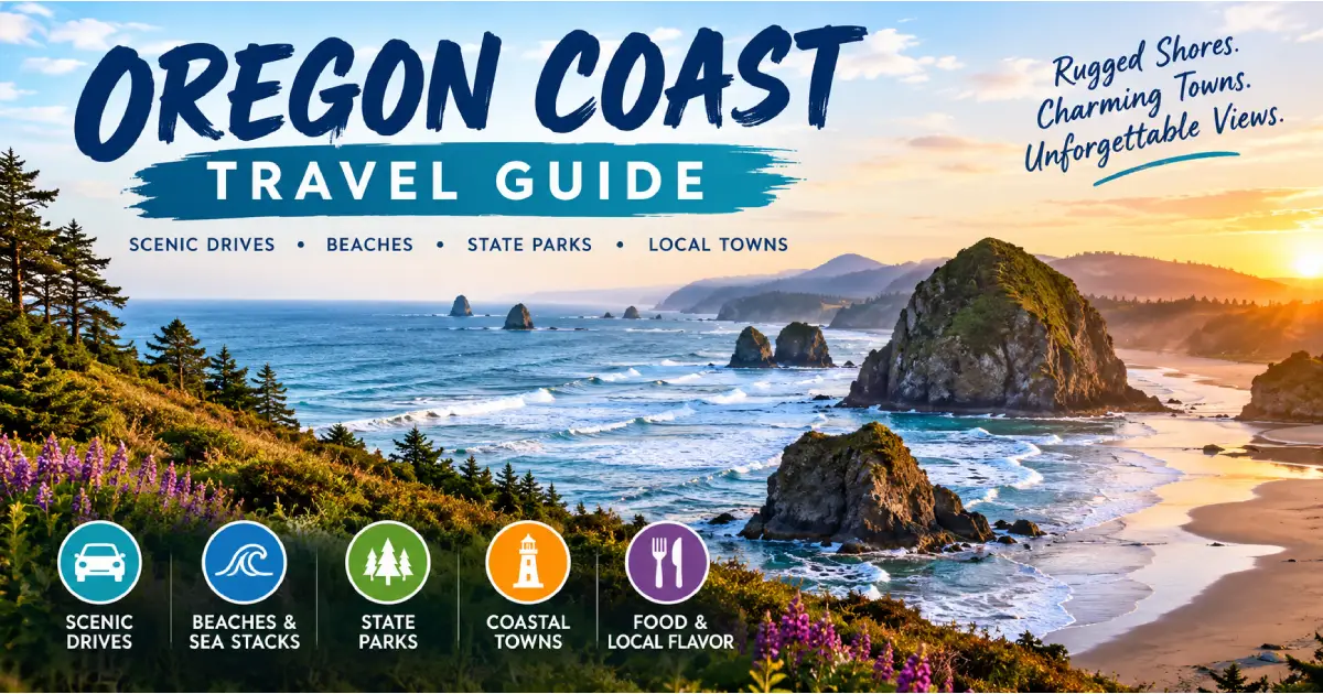
The Oregon Coast is one of the great coastal drives in the world — 363 miles of Pacific shoreline from the Columbia River at Astoria to the California border at Brookings, entirely open to the public under the 1967 Oregon Beach Bill that declared the full wet-sand zone a public highway regardless of adjacent private ownership. No other state in the continental United States has protected its entire coastline in this way, and the practical result is a coast without the private beach clubs, gated resort communities, and restricted access that characterize much of California and the Atlantic seaboard. Every beach in Oregon belongs to the public; every mile of shoreline is yours to walk.
The coast’s character is shaped by the cold California Current (average ocean temperature year-round: 50–55°F — cold enough that swimming without a wetsuit is uncomfortable for most people, but producing the nutrient upwelling that supports extraordinary marine life), the prevailing westerly winds that stack fog against the Coast Range for much of the spring, and the geology of an active subduction zone — sea stacks, tidal arches, offshore rocks, and headlands of volcanic basalt that give the Oregon Coast its characteristic drama. The 17 headlands that interrupt US-101’s southward path are not just scenic — they are the visible evidence of a coastline shaped by millions of years of volcanic activity, wave erosion, and tectonic uplift, each headland a different chapter in the coast’s geological story.
US-101 is the backbone of the Oregon Coast — a single two-lane highway running the full 363-mile length, passing through every coastal town and community, and crossing every bay and inlet on bridges that are themselves architectural landmarks (the Conde B. McCullough bridges of the 1930s, built by the same WPA-era engineer who designed the state’s finest steel bridges, are the finest collection of coastal highway bridges in the United States). Driving the full coast from Astoria to Brookings takes a minimum of 2 days at a pace that includes stops, and rewards a week or more for travelers who want to explore the headlands, beaches, state parks, and small towns that lie just off the main road.
| Region | Key Towns | Distance from Portland | Best For |
|---|---|---|---|
| North Coast | Astoria, Seaside, Cannon Beach | 80–100 miles (1.5–2 hrs) | Sea stacks, history, puffins |
| Central-North Coast | Tillamook, Pacific City, Lincoln City | 85–110 miles (1.75–2 hrs) | Dairying, kite flying, D River |
| Central Coast | Newport, Yachats, Florence | 140–175 miles (2.5–3.5 hrs) | Aquarium, whale watching, dunes |
| South-Central Coast | Coos Bay, Bandon, Gold Beach | 220–265 miles (4–5 hrs) | Golf, sea stacks, jet boats |
| South Coast | Port Orford, Brookings | 290–360 miles (5–6.5 hrs) | Boardman Corridor, warm weather |
From Portland:
By Bus: Pacific Coast Scenic Byway bus (FlixBus/Greyhound connections to Astoria and coastal towns, limited schedule). A car is essential for exploring beyond town centers.
By Air: Portland International (PDX) is the primary entry airport. No commercial airports serve the coast directly; nearest general aviation airports at Astoria (AST, regional turboprop service from Portland), Newport (ONP, charter only), and North Bend/Coos Bay (OTH, Delta regional service from LAX and SFO).
Distance from Portland: 95 miles (2 hours via US-30 or US-26/US-101)
Astoria is the oldest US city west of the Rocky Mountains — a trading post established by John Jacob Astor’s Pacific Fur Company in 1811 at the mouth of the Columbia River, now a Victorian riverfront city of 10,000 with one of the finest concentrations of 1890s–1910s commercial and residential architecture in the Pacific Northwest. The city sits on a steep hillside above the Columbia’s south bank; the Victorian houses on the upper streets command views of the 4-mile-wide river mouth, the Astoria-Megler Bridge (the longest continuous truss bridge in North America, 4.1 miles), and the Washington shore.
What to see:
Dining:
Lodging:
Distance from Portland: 80 miles (1.5 hours via US-26)
Seaside is Oregon’s oldest beach resort — a turn-of-the-century boardwalk town with a 1.5-mile concrete promenade (the “Prom”), an arcade strip, and the Lewis and Clark Turnaround (the official western terminus of the Lewis and Clark Expedition, marked by a bronze statue at the end of the Prom). Less scenic than Cannon Beach but more lively for families; the 10-mile beach is one of the widest and flattest on the Oregon Coast, ideal for kite flying and beach walks.
Lewis and Clark Salt Cairn: A reconstruction of the cairn where the Corps of Discovery boiled seawater to produce salt in the winter of 1805–06 — a small but historically significant site at the south end of the Prom.
Distance from Portland: 80 miles (1.5 hours via US-26)
Cannon Beach is the most photographed and most visited destination on the Oregon Coast — a small resort town (permanent population 1,600; summer population multiples higher) built around the 235-foot Haystack Rock sea stack standing directly on the beach. The combination of the rock, the photogenic tide pools at its base, the nesting tufted puffins (May–August), and the gallery-lined main street (Hemlock Street) makes Cannon Beach the coast’s single most popular destination.
Haystack Rock: See the full description in the Things to Do guide. Key practical notes:
Ecola State Park (3 miles north of Cannon Beach, $5/vehicle): One of the finest headland state parks in Oregon — the Indian Beach section provides access to the finest surf beach on the north coast, and the Ecola Point overlook (0.5 miles from the parking area) delivers a view south to Haystack Rock and north along the coast to Tillamook Head that is the finest coastal panorama on the north Oregon Coast. The Tillamook Head trail (6.5 miles one-way) crosses the headland to Seaside through old-growth Sitka spruce forest; the route passes a point where Lewis and Clark had their first view of the Pacific Ocean from the coast.
Hug Point State Recreation Site (5 miles south of Cannon Beach): A small beach accessible only at low tide via a notch cut into the cliff — horse-and-buggy road blasted into the headland in 1894, still visible as a ledge cut in the basalt. The most unusual beach approach on the north coast.
Lodging:
Dining:
Distance from Portland: 90 miles (1.75 hours via US-26 and US-101) Entry Fee: Free
Oswald West is one of the finest state parks on the Oregon Coast — a 2,474-acre park surrounding Short Sand Beach (a protected cove in the lee of Cape Falcon), accessible via a 0.5-mile trail through old-growth Sitka spruce and red alder. Wheelbarrows are provided at the trailhead to carry gear to the beach (the only parking is on US-101). The beach is the finest protected cove for surfing on the north coast; the surrounding forest is among the most impressive stands of old-growth coastal Sitka spruce accessible on a short walk anywhere in Oregon.
Cape Falcon Trail (5 miles RT, 1,000 ft gain): The finest headland hike on the north coast — the summit of Cape Falcon provides a 180-degree view of the coastline from Nehalem Bay in the south to Tillamook Head in the north.
Distance from Portland: 75 miles (1.5 hours via OR-6)
Tillamook is the dairy capital of Oregon — the valley’s combination of heavy rainfall, mild climate, and rich pasture grass produces milk of exceptional quality that the Tillamook County Creamery Association (TCCA) has turned into the most recognized cheese brand in the Pacific Northwest. The Tillamook Creamery visitor center and factory (4175 US-101, free admission) is the most visited food production facility in Oregon — 1.5 million visitors per year, free factory tours with a viewing window into the cheddar production floor, and the finest ice cream scoop shop on the Oregon Coast (the Black Cherry Chocolate ice cream is the benchmark against which all others are measured).
Tillamook Air Museum (6030 Hangar Rd, $15/adult): A WWII-era blimp hangar (the largest wooden structure in the world, 1,500 feet long, 296 feet wide, 192 feet high) converted into an aviation museum. The hangar itself — visible from US-101 as a enormous wooden dome in the flat Tillamook plain — is one of the most extraordinary architectural experiences on the coast.
Distance from Portland: 90 miles (1.75 hours via OR-18 and US-101)
Cape Kiwanda is the finest sandstone headland on the Oregon Coast — a 200-foot cape of orange sandstone rising directly from the beach at Pacific City, with the Haystack Rock of the central coast (a 327-foot sea stack, different from the Cannon Beach Haystack Rock) standing offshore. The dory fishing fleet launches directly from the beach at Pacific City — hand-built flat-bottomed boats pushed through the surf by tractor, a tradition unique to this stretch of coast.
Pelican Brewing Company (33180 Cape Kiwanda Dr): The finest coastal brewery in Oregon — brewpub at the base of Cape Kiwanda, with Cape Kiwanda Cream Ale and the Tsunami Stout as the signature beers. The outdoor deck faces the beach directly; the Pelican is the finest single après-beach experience on the Oregon Coast.
Distance from Portland: 145 miles (2.5 hours via OR-20)
Newport is the largest city on the Oregon Coast (population 10,500) and the finest town on the central coast for a multi-day base — the Oregon Coast Aquarium, the Hatfield Marine Science Center (free public exhibits from OSU’s coastal research station), the Bayfront historic district (fresh Dungeness crab, clam chowder, and fishing charter offices), and the Yaquina Head Outstanding Natural Area (the finest coastal wildlife headland on the central coast, with the tallest lighthouse in Oregon).
Oregon Coast Aquarium (2820 SE Ferry Slip Rd, $24.95/adult): One of the finest aquariums on the Pacific Coast — three outdoor passages through acrylic-walled tanks (Passages of the Deep, 35-foot depth, Pacific kelp forest environment; the finest aquarium experience in Oregon), plus sea otters, harbor seals, Steller sea lions, giant Pacific octopus, and a seabird aviary. The Pacific Halibut touch pool is the finest interactive exhibit. Book timed entry online for July–August.
Hatfield Marine Science Center (2030 SE Marine Science Dr, free): OSU’s coastal research facility — free public exhibits on Oregon’s marine ecosystems, tidal processes, and fisheries science. The giant Pacific octopus exhibit (a resident octopus in a large tank) is the signature feature.
Yaquina Head Outstanding Natural Area (750 Lighthouse Dr, $7/vehicle): A 100-acre basalt headland 3 miles north of Newport — the Yaquina Head Lighthouse (1873, 93 feet, the tallest lighthouse in Oregon; tours $7 if included in site entry), the tidepools at Cobble Beach (the finest fully accessible tide pool site on the central coast — wheelchair-accessible cobble beach), and a colony of common murres (50,000–80,000 birds nesting on Colony Rock offshore) visible from the headland with binoculars.
The Bayfront: Newport’s historic commercial waterfront on Yaquina Bay — Mo’s Restaurant (since 1946, the original clam chowder institution on the Oregon Coast; chowder $9–$12/bowl), Local Ocean Seafoods (the finest sit-down seafood on the Bayfront, whole Dungeness crab in season $45–$65), and the sport fishing charter offices (Pacific Halibut fishing June–September, $180–$250/person full day).
Lodging:
Distance from Newport: 25 miles south (30 minutes)
Yachats (pronounced YAH-hots) is the finest small town on the Oregon Coast — a village of 700 permanent residents, no traffic lights, and a concentration of independently owned restaurants and lodges that produces the finest dining-per-capita ratio on the coast. The town sits at the mouth of the Yachats River where it meets the Pacific; the basalt shoreline immediately north and south of town (accessible from the Adobe Resort and the Yachats Ocean Road State Natural Site) provides the most dramatic wave action on the central coast — in storm season (November–February), waves regularly top 40 feet and drive spray over the highway.
Cape Perpetua Scenic Area (3 miles south of Yachats, $5/vehicle): The finest single natural attraction on the central coast — a 2,700-acre National Forest Scenic Area with:
Dining in Yachats:
Distance from Portland: 175 miles (3 hours via US-20 and OR-126)
Florence is the gateway to the Oregon Dunes and the finest base town for the central coast’s southern section. The historic Old Town Florence (Bay Street, adjacent to the Siuslaw River bridge) has the finest collection of independent shops and restaurants on the central coast south of Newport; the Siuslaw River Bridge (1936, Conde B. McCullough’s Art Deco bascule bridge) is the most photographed bridge on the Oregon Coast.
Heceta Head Lighthouse State Scenic Viewpoint (12 miles north of Florence, $5/vehicle): The most photographed lighthouse in Oregon — a white tower on a dramatic headland above a white-sand beach, with the lighthouse keeper’s house (now a B&B, $299–$450/night including breakfast; book 6+ months in advance) perched on the hillside. The 1-mile trail to the lighthouse base includes a sea cave below the headland (accessible by ladder at low tide; guided cave exploration offered by park).
Sea Lion Caves (91560 US-101, 11 miles north of Florence, $16/adult): The largest sea cave in the United States (at least 1,500 feet in length, 125 feet high), accessible by elevator from the cliff edge to the cave floor — a permanent colony of Steller sea lions in a natural basalt sea cave, the only such mainland colony in the lower 48 states. Best November–April when the sea lions are most numerous inside (summer they use the outside rocks); impressive year-round.
Distance from Portland: 240 miles (4 hours via I-5 and US-101)
Bandon is the sea stack capital of Oregon — Face Rock, Table Rock, and the Cat and Kittens formation at Face Rock Wayside (Beach Loop Drive) represent the finest sea stack concentration north of the Samuel H. Boardman corridor, and the combination of the sea stacks, the wide beach accessible from multiple public access points, and the Bandon Marsh National Wildlife Refuge at the mouth of the Coquille River makes Bandon the finest coastal town south of Newport for a multi-day stay.
Face Rock Wayside: 1 mile west of downtown on Beach Loop Drive — a flat, paved trail to a series of overlooks of Face Rock (a large horizontal rock with a human face visible in profile), the Cats and Kittens (small rounded rocks), and Table Rock (a flat-topped stack). Free; no hours restriction.
Bandon Dunes Golf Resort (57744 Round Lake Dr, $300–$600/round): The finest links golf resort in the United States — five courses on coastal dunes above the Pacific, all designed by leading international architects: Bandon Dunes (1999, Coore and Crenshaw), Pacific Dunes (2001, Tom Doak — consistently ranked in the top 10 American courses), Bandon Trails (2005, Coore and Crenshaw), Old Macdonald (2010, Tom Doak — redesigned in the style of CB Macdonald), and Sheep Ranch (2020, Tom Doak). A genuine bucket-list destination for serious golfers.
Face Rock Creamery (680 2nd St SE): The finest artisan creamery on the Oregon Coast — cave-aged cheddars, curds, and flavored cheeses made from local Bandon-area milk. Free tasting room; the window into the cheesemaking facility is the best free food-production tour on the south coast.
Distance from Portland: 265 miles (5 hours via I-5 and US-101)
Gold Beach is the finest outdoor adventure base on the south coast — the town at the Rogue River mouth where jet boat tours depart for the Wild and Scenic Rogue River canyon upstream. The Rogue River estuary (the south end of town) provides excellent salmon and steelhead fishing; the river’s Wild and Scenic section begins 7 miles upstream at Grave Creek.
Rogue River Jet Boat Tours: The flagship activity at Gold Beach — jet boats depart from the Port of Gold Beach and travel 64 miles or 104 miles upriver into the Rogue Wilderness, passing through the Hellgate Canyon and stopping at riverside lodges and gravel bars. Jerry’s Rogue Jets (jerrysjets.com, $50–$85/adult depending on trip length; May–October) and Rogue River Mail Boat (mailboat.com, historical mail delivery route, $50–$80/adult) are the two primary operators.
Cape Sebastian State Scenic Corridor (7 miles south of Gold Beach, free): One of the finest headland viewpoints on the south coast — a 1.5-mile trail through shore pine forest to a 700-foot bluff with views 43 miles in either direction on a clear day.
Location: US-101, miles 343–355, between Gold Beach and Brookings Entry Fee: Free Best Season: Year-round; wildflowers March–May; clearest views September–October
The Samuel H. Boardman Scenic Corridor is the finest 12 miles on the Oregon Coast — a series of viewpoints, short trails, and beach access points through a landscape of sea stacks, natural bridges, pocket coves, and offshore islands that many Oregon locals consider the single most beautiful stretch of the entire coast. The corridor is less visited than Cannon Beach and the Columbia Gorge because of its distance from Portland (6+ hours), and that relative remoteness preserves a quality of quiet and emptiness that the north coast cannot match in summer.
Key stops south to north (mileposts):
Crissey Field Beach (Milepost 353.5): The southernmost access point — a long sand beach at the Winchuck River mouth, with views north to the first sea stack clusters of the corridor.
Lone Ranch Beach (Milepost 352): A pocket beach in a cove below US-101 — accessible via a short trail, with the finest picnic area in the corridor. Sea stacks immediately offshore.
Cape Ferrelo (Milepost 351.2): An elevated headland viewpoint — panoramic views of the offshore rocks and the corridor stretching north. The finest overview of the Boardman landscape.
Natural Bridges (Milepost 349.7): The signature feature — a 0.5-mile trail to three natural arches carved through offshore basalt outcrops, visible from an elevated viewpoint above the sea. The combination of the arches, the surge channels between them, and the forest framing the viewpoint is extraordinary at any tide; most dramatic at mid-to-high tide when the sea fills the channels.
Whaleshead Beach (Milepost 349.2): The most photographed beach in the corridor — a massive offshore sea stack with a spout hole that blows spray when waves push water through it. Accessible by a short trail from the picnic area; the beach itself is accessible at lower tides.
House Rock Viewpoint (Milepost 348.7): An elevated headland view of the corridor’s northern section — the dense cluster of offshore rocks, the sea stack chain, and the cliffed shoreline visible together.
Thunder Rock Cove (Milepost 347.2): The finest cove access in the corridor — a 0.3-mile trail to a viewpoint above a hidden cove. Dramatic wave action in storm conditions.
Arch Rock (Milepost 345.5): A viewpoint directly above a basalt arch — the arch is visible from a short trail at the parking area. No trail to the beach (sheer cliffs); viewpoint only.
Spruce Island Viewpoint (Milepost 345): An offshore island of Sitka spruce visible from a turnout — common murres and pigeon guillemots nest on the rock in summer.
China Beach (Milepost 343.4): The northernmost access point — stairs down to a pocket beach framed by sea stacks. One of the finest secluded beach access points in the corridor.
Distance from Portland: 360 miles (6.5 hours via I-5 and US-101)
Brookings is the southernmost city on the Oregon Coast and the warmest — the “Banana Belt” climate produced by the Chetco Effect (warm offshore winds that create a local temperature anomaly) gives Brookings average winter highs of 55°F and summer highs of 65°F, significantly warmer than the north coast. The Brookings area produces 90% of the world’s Easter lily bulbs (the Azalea Festival in May celebrates the local ornamental flower industry). The Chetco River, which enters the Pacific at Brookings, is one of the finest wild steelhead rivers in Oregon.
Harris Beach State Park (1 mile north of Brookings): The finest state park on the south coast — a campground directly above the beach with Bird Island (Oregon’s largest island, important seabird nesting colony) visible offshore. The Goat Island offshore has the finest nesting colony of tufted puffins in Oregon (50,000+ birds; viewable from the beach with binoculars in summer).
Camping ($28/night): The Harris Beach campground has 152 sites, several with ocean views — the finest ocean-view camping on the south coast. Book at oregonstateparks.org.
Time: Driving the full coast (Astoria to Brookings, 363 miles) without stops takes approximately 7–8 hours. With reasonable stops, allow 3–4 days minimum; 5–7 days for a relaxed full-coast experience.
Fuel: Gas stations are present in all towns but spacing increases significantly on the south coast (Brookings to Gold Beach has limited options). Fill up in every town of more than 1,000 people on the south coast.
Speed limits: 55 mph on the open highway; 25–35 mph through towns. Oregon law requires vehicles to turn headlights on whenever windshield wipers are in use.
Oregon self-service gas: Oregon ended its ban on self-service gas in 2023; full-service remains available at many stations but self-service is now standard.
Spring fog (April–June) on the Oregon Coast is persistent and can reduce visibility to near-zero at headland viewpoints. Morning fog on the north coast typically burns off by 10–11 AM; central and south coast fog can persist until early afternoon. The rule: if you arrive at a scenic viewpoint in fog, wait 30–60 minutes before leaving — conditions often clear rapidly.
Oregon’s storm season produces some of the finest storm watching in the United States — waves of 20–40 feet, offshore spray visible from cliff viewpoints, and the coast at its most dramatic and least crowded. Yachats and Depoe Bay are the finest storm watching bases; the Adobe Resort in Yachats and the Channel House in Depoe Bay position guests directly above the wave activity. Bandon is excellent for south coast storm watching with the Face Rock sea stack formations providing foreground drama.
The five major bridges on the central and south Oregon Coast — the Siuslaw River Bridge (Florence), the Umpqua River Bridge (Reedsport), the Coos Bay Bridge (North Bend), the Rogue River Bridge (Gold Beach), and the Isaac Lee Patterson Bridge (Brookings) — were all designed by Oregon State Bridge Engineer Conde B. McCullough and built between 1934 and 1936 under the New Deal. They are collectively designated a National Historic Civil Engineering Landmark and individually the finest collection of Depression-era highway bridges in the United States.
| Season | North Coast | Central Coast | South Coast | Crowds |
|---|---|---|---|---|
| Spring (March–May) | Wildflowers, gray whale migration north, fog | Whale peak April, moderate | Boardman wildflowers, warm Brookings | Low–Moderate |
| Summer (June–Aug) | Puffins at Haystack, warmest, crowded | Sea cave kayaking, aquarium | Gold, uncrowded, Rogue jet boats | High (north), Low–Moderate (south) |
| Fall (Sept–Oct) | Clearest skies, fewer crowds | Best clarity for whale watching | Storm season building | Moderate |
| Winter (Nov–Feb) | Gray whale south migration, storm watching | Peak storm watching at Yachats | Banana Belt warmth at Brookings | Low |
Day 1 — Portland to Cannon Beach (80 miles) Morning: Depart Portland via US-26; arrive Cannon Beach by 10 AM. Haystack Rock tide pools at low tide (check tides the night before). Lunch at Newman’s at 988. Afternoon: Ecola State Park (Indian Beach, Point overlook). Sunset walk on the beach. Overnight: The Stephanie Inn or Surfsand Resort.
Day 2 — Cannon Beach to Newport (165 miles) Morning: Oswald West State Park (Short Sand Beach via wheelbarrow trail, 1 hour). Continue south on US-101 through Tillamook (Creamery ice cream, 20 minutes). Pacific City and Cape Kiwanda (Pelican Brewing lunch). Afternoon: Lincoln City and Depoe Bay (whale watching from the seawall). Arrive Newport late afternoon. Overnight: Sylvia Beach Hotel (book far in advance) or Elizabeth Street Inn.
Day 3 — Newport (base day) Morning: Yaquina Head (tide pools, lighthouse, murre colony). Afternoon: Oregon Coast Aquarium. Evening: Bayfront dinner at Local Ocean Seafoods.
Day 4 — Newport to Bandon (130 miles) Morning: Drive south on US-101 through Yachats — Thor’s Well and Spouting Horn at Cape Perpetua (stop 1 hour). Sea Lion Caves (30 minutes). Heceta Head Lighthouse viewpoint. Florence Old Town lunch. Afternoon: Oregon Dunes drive-by and overlook. Arrive Bandon. Evening: Face Rock Wayside at sunset. Overnight: Bandon Beach Motel or Inn at Face Rock.
Day 5 — Bandon to Gold Beach and Samuel H. Boardman (90 miles) Morning: Gold Beach — Rogue River Jet Boat (3.5-hour trip upriver; depart 8 AM, return noon). Lunch in Gold Beach. Afternoon: Drive the Samuel H. Boardman corridor north to south (Natural Bridges, Whaleshead Beach, Arch Rock, China Beach). End at Brookings. Return to Portland via US-101 and I-5 (6 hours) or overnight in Brookings.
Posted By : Vinay
Latest Article
2nd Floor, 39, Above Kirti Club, DLF Industrial Area, Kirti Nagar, New Delhi, Delhi 110015



Travel Tourister is a leading Travel portal where we introduce travellers to trusted travel agents to make their journey hasselfree, memorable And happy. Travel Tourister is a platform where travellers get Tour packages ,Hotel packages deals through trusted travel companies And hoteliers who are working with us across the world. We always try to find new and more travel agents and hoteliers from every nook and corners across the world so that you could compare the deals with different travel agents and hoteliers and book your tour or hotel with the one you have chosen according to your taste and budget.
Copyright © Travel Tourister, India. All Rights Reserved

 Call
 Enquiry