Published on : 26 Oct 2026
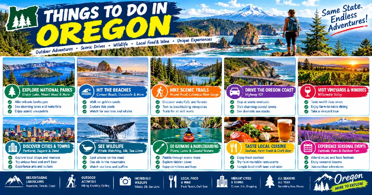
Oregon rewards the curious traveler more than almost any other state in the United States — a place where the range of available experiences in a single trip can span kayaking through a sea cave on the coast in the morning, hiking through old-growth temperate rainforest in the afternoon, and eating some of the finest farm-to-table food in the country in the evening. The state’s extraordinary geographic diversity — volcanic mountains, 363 miles of publicly owned coastline, high desert playa, glacial river gorges, and a world-class wine valley — produces a corresponding diversity of experiences that few states of comparable population can match. Oregon has fewer than 4.5 million residents, but the density of remarkable natural landscapes per square mile is among the highest in the continental US.
What distinguishes Oregon’s best experiences from those of neighboring states is often the combination of accessibility and wildness — the Columbia River Gorge’s 77 waterfalls are 30 minutes from downtown Portland; Crater Lake’s impossible blue is two hours from Medford; the Trail of Ten Falls at Silver Falls is an hour from Salem. Oregon’s 1967 Beach Bill (which declared the entire ocean shoreline public property regardless of adjacent land ownership) means that every mile of the state’s coastline is accessible for free, a legislative achievement with no equivalent anywhere else in the continental US. And the state’s commitment to independent culture — the food cart scene in Portland, the independent breweries, the art galleries in small towns like Joseph and Ashland — gives Oregon experiences a local character that distinguishes them from the branded resort culture found at many major American travel destinations.
This guide covers the 20 best things to do in Oregon in 2026, organized across the state’s major regions, with specific practical information for each activity.
| Activity | Region | Type | Best Season |
|---|---|---|---|
| Hike the Trail of Ten Falls | Willamette Valley | Hiking | Year-round |
| Drive the Columbia River Gorge | North Central OR | Scenic Drive | April–October |
| Swim in Crater Lake | Southern Cascades | Swimming / Scenic | July–September |
| Walk the Oregon Coast Trail | Statewide | Hiking / Beachwalking | May–September |
| Watch Haystack Rock tide pools | North Coast | Wildlife / Nature | Year-round |
| Ride the Mount Hood Scenic Railroad | Hood River Valley | Scenic Train | April–December |
| Rock climb at Smith Rock | Central Oregon | Climbing | March–June, Sept–Nov |
| Whale watch from Cape Perpetua | Central Coast | Wildlife | December–June |
| Kayak the Sea Caves at Cape Arago | South-Central Coast | Kayaking | May–October |
| Tour the Willamette Valley wineries | Wine Country | Wine / Culture | July–October |
| Hike Steens Mountain Loop Road | Southeast Oregon | Scenic Drive / Hiking | June–October |
| Attend the Oregon Shakespeare Festival | Ashland | Theater / Arts | Feb–November |
| Sand-board the Oregon Dunes | South-Central Coast | Adventure / OHV | Year-round |
| See the Painted Hills at sunrise | Eastern Oregon | Photography / Nature | March–June |
| Camp at Wallowa Lake | Northeast Oregon | Camping / Hiking | July–September |
| Explore Portland’s food cart pods | Portland | Food / Culture | Year-round |
| Bike the Banks-Vernonia Trail | NW Oregon | Cycling | Year-round |
| Raft the Rogue River | Southern Oregon | Whitewater | May–September |
| Visit the Timberline Lodge | Mount Hood | History / Architecture | Year-round |
| Stargaze at Ochoco National Forest | Central Oregon | Dark Sky | June–October |
Location: Silver Falls State Park, 26 miles east of Salem (60 miles south of Portland) Distance / Difficulty: 7.2-mile loop, 900 ft cumulative gain, moderate Best Season: Year-round; peak flow November–April; lush green May–June Entry Fee: $5/vehicle day-use
The Trail of Ten Falls is Oregon’s most celebrated hike — a 7.2-mile loop through a basalt canyon that passes behind, beneath, and beside ten separate waterfalls in a single circuit, including four falls where the trail routes through the alcove space between the cliff face and the falling curtain of water. No other hike in the United States encounters this many behind-the-falls passages in a single outing.
The signature experience is South Falls (177 feet) — the tallest waterfall in the park and one of the most photogenic in the Pacific Northwest. The trail descends behind the curtain of water through a 55-foot-deep alcove cut by centuries of spray erosion, emerging onto a basalt ledge with the full face of the falls and the canyon below visible simultaneously. The sensation of standing behind a 177-foot waterfall with the mist on your face and the light filtering through the water is one of the finest single moments in Oregon outdoor recreation.
The ten falls in order:
Practical: Start at the main trailhead (South Falls parking lot) for the full loop; clockwise direction recommended for the best waterfall sequence. Trail is well-graded but has significant root and rock sections after rain — trail runners or hiking boots recommended over street shoes. The South Falls trailhead has a 1920s lodge (snack bar and restrooms) and the Silver Falls Lodge cabins ($70–$120/night) in the park.
Location: Troutdale to The Dalles, I-84 parallel route on the south bank of the Columbia Distance: 74 miles (US-30, the scenic route); allow 4–6 hours with stops Best Season: April–June (maximum waterfall flow), September–October (fall color) Entry Fee: Free (parking fees at individual falls: $5 at Multnomah Falls)
Built between 1913 and 1922 by engineer Samuel Lancaster and designed as “a poem in stone,” the Historic Columbia River Highway (US-30) is the oldest planned scenic road in the United States and still the finest single day drive in Oregon. The road was engineered to follow the gorge contours at an elevation that provides constant views of the Columbia and the Washington shore while accessing the waterfalls that tumble from the basalt plateau above. The 30-mile western section between Troutdale and Ainsworth State Park contains the core waterfall corridor — Latourell (249 ft), Bridal Veil (120 ft), Wahkeena (242 ft), Multnomah (620 ft — the main event), Horsetail (176 ft), and a dozen more in between.
Multnomah Falls is the centerpiece and Oregon’s most visited natural attraction: a 620-foot two-tier waterfall (the fourth highest year-round waterfall in the United States) with a 1914 stone bridge at the first tier and a viewable upper tier. Timed entry permits are required to hike to the top (May–September, $2, recreation.gov — book days in advance in July and August); no permit needed to view from the base. The Multnomah Falls Lodge (1925, at the base, open for lunch and dinner) is the finest refueling stop on the drive.
Horsetail and Ponytail Falls (Milepost 36, 2.7-mile loop): The trail from Horsetail Falls passes behind Ponytail Falls through a cave-like basalt alcove — the Columbia Gorge’s version of the behind-the-falls experience. One of the finest short hikes on the gorge.
Crown Point and Vista House (Milepost 16): The finest single overlook on the drive — a 733-foot basalt promontory with a 1918 rotunda observatory and 30-mile gorge views in both directions. Sunrise from Crown Point is the finest easily accessible dawn viewpoint in the Portland area.
Location: Crater Lake National Park, 80 miles north of Medford Season: July–September (road and lake access) Entry Fee: $35/vehicle; America the Beautiful Pass accepted
Swimming in Crater Lake — the deepest lake in the United States (1,943 feet), the clearest large lake in the world, at a consistent 38–55°F depending on depth and season — is one of the most unusual swimming experiences in the United States. The water’s extraordinary clarity (visibility to 140 feet) and its saturated blue color make the experience of floating in it categorically different from swimming in any other natural body of water; the visual effect of looking down into 100+ feet of visually clear water is disorienting and exhilarating in equal measure.
Cleetwood Cove: The only legal access to the lake surface — a 1.1-mile trail descending 700 feet from the rim to the water (steep; allow 30–45 minutes return uphill in full sun). At the cove: a small dock, a designated swimming area, and the departure point for Wizard Island boat tours. The lake temperature in July at the surface is approximately 55–60°F — cold but manageable for healthy adults. No lifeguards; swimming is at your own risk.
Wizard Island boat tour: From Cleetwood Cove, a 3.5-hour tour with a 90-minute stop on the cinder cone island ($55–$74/adult; books out weeks in advance for July–August; recreation.gov). The hike to the Wizard Island summit crater (1.8 miles RT, 755 ft gain) provides the finest view of the lake’s inner caldera walls.
Location: Statewide, 363 miles from the Columbia River to the California border Best Season: May–September (warmest and least rainy) Entry Fee: Free (all Oregon beaches are public)
The Oregon Coast Trail is a 363-mile walking route along the entire length of Oregon’s Pacific coastline — the longest designated beach walking route in the continental United States and one of the few long-distance trails where the route itself (the wet-sand zone of the beach, legally public in Oregon regardless of adjacent ownership) is both the trail and the destination. The trail passes through beach, headland, forest, and estuary sections, with the headland crossings providing the most dramatic scenery.
Best day sections:
Oswald West State Park to Arch Cape (6 miles, North Coast): The finest single day section on the north coast — the trail crosses Neahkahnie Mountain (a 1,600-foot headland with the finest coastal panorama in Oregon outside of Ecola State Park), descends to Short Sand Beach (the finest protected cove on the north coast), and continues to Arch Cape through Sitka spruce forest at the cliff edge.
Cape Perpetua to Stonefield Beach (8 miles, Central Coast): The central coast’s finest section — Thor’s Well (a sea-filled sinkhole that drains spectacularly at low tide), Captain Cook’s Chasm, the Giant Spruce Trail, and the finest tide pool diversity on the Oregon Coast. Cape Perpetua Visitor Center provides the starting context.
Samuel H. Boardman Corridor (12 miles, South Coast): The finest section of the entire trail — the Arch Rock, Natural Bridges, and China Beach viewpoints, with sea stack scenery that rivals any coastal landscape in the United States.
Location: Cannon Beach, 80 miles from Portland via US-26 Best Season: Year-round; tufted puffins May–August; lowest tides April–June Entry Fee: Free
Haystack Rock — the 235-foot sea stack standing directly on the beach at Cannon Beach — is Oregon’s most iconic single natural feature and one of the finest publicly accessible tide pool sites on the West Coast. The rock’s base is exposed at low tide, revealing a complex intertidal ecosystem of purple sea urchins, giant green anemones, ochre sea stars (recovering from the 2013–2019 Sea Star Wasting Syndrome epidemic), hermit crabs, goose barnacles, and ochre chitons in a series of pools accessible without any equipment.
Tufted Puffins (May–August): Haystack Rock supports the most accessible tufted puffin nesting colony on the Oregon Coast — 60–80 birds nesting in burrows on the rock’s upper slopes every summer. Puffins are visible flying to and from the rock during the nesting season, and the Haystack Rock Awareness Program volunteers station themselves at the base during low tides (May–September) with spotting scopes for puffin viewing. No binoculars necessary; the puffins are visible with the naked eye from the tide pool area.
Practical: Check tide tables (tidesandcurrents.noaa.gov, station #9437540) before visiting; tidal pools are best exposed at tides of +1.5 feet or lower. The lowest accessible tides occur in the early morning in summer. Do not touch or remove anything from the tide pools (Haystack Rock is a Marine Garden — Oregon Department of Fish and Wildlife protected zone).
Location: Hood River to Parkdale, 44 miles roundtrip in the Hood River Valley Season: April–December (various excursion schedules) Ticket: $32–$55/adult depending on excursion; mthoodrr.com
The Mount Hood Railroad is a historic 1906 excursion railway running south from Hood River through the orchard country of the Hood River Valley — one of the finest agricultural landscapes in the Pacific Northwest, with pear and apple orchards on both sides of the track and Mount Hood (11,249 ft) directly ahead as the train climbs toward Parkdale. The 22-mile route follows the Hood River canyon through several fruit-growing communities; the spring blossom run (April–May, when the orchards are in full bloom) and the fall color run (late September–October) are the finest seasonal excursions.
Special excursions: The railroad offers mystery dinner trains (Saturday evenings, $85–$110/person), harvest excursions (October), and holiday trains (December). The standard daytime excursion (4 hours roundtrip) provides the finest accessible agricultural landscape train ride in Oregon.
Location: 9241 NE Crooked River Dr, Terrebonne (25 miles north of Bend) Best Season: March–June, September–November Entry Fee: $5/vehicle day-use
Smith Rock is the birthplace of American sport climbing — the place where, in 1986, Alan Watts established the first 5.14 route in the United States (To Bolt or Not to Be) and where the ethics and standards of American sport climbing were first developed in the early 1980s. Today Smith Rock has 1,800+ established routes on rhyolite and basalt formations above the Crooked River canyon, ranging from 5.6 beginner routes to 5.14 elite sport climbs, making it the most historically and practically significant sport climbing destination in the United States.
For non-climbers: The Misery Ridge–River Trail loop (3.8 miles, 650 ft gain) provides the finest non-climbing experience in the park — the Misery Ridge ascent gives a ridge-crest view of the Crooked River canyon and the Smith Rock columns from above, with the Cascade peaks (Mount Hood, Jefferson, the Three Sisters) visible on the western horizon. The descent via the River Trail passes at the base of the climbing walls, providing close views of climbers on the routes.
Monkey Face: The park’s signature formation — a 350-foot volcanic plug with a natural “mouth” cavity that forms the face. The Monkey Face route (5.8 regular route to the mouth, 5.10+ to the summit) is the most iconic climb in the park; the face is visible from the Misery Ridge viewpoint above.
Guided climbing: Red Point Climbing (redpointclimbing.com, based in Terrebonne) offers half-day ($150/person) and full-day ($200/person) guided sport climbing instruction for beginners.
Location: Cape Perpetua Scenic Area, 3 miles south of Yachats on US-101 Best Season: December–June (gray whale migration); March–April (peak southbound); June–July (feeding gray whales) Entry Fee: $5/vehicle at Cape Perpetua Visitor Center
Oregon’s central coast is one of the finest land-based whale watching sites in the United States — the gray whale migration (approximately 20,000 animals traveling between the Arctic and Baja California each year) passes within sight of the Oregon shore twice annually: southbound December–February, and northbound March–June. The headlands of the central and southern coast — Cape Perpetua (800 ft elevation), Depoe Bay (the narrowest harbor in the world, 50 feet wide, with whale sightings from the highway), and Cape Lookout (the finest whale watching trail on the north coast) — provide elevated, close-range viewing of migrating and feeding whales.
Depoe Bay (12 miles north of Newport): The finest drive-up whale watching site in Oregon — a spouting horn (seawater forced through a basalt crack below the highway, shooting 40 feet in the air) and a harbor wall where gray whales feed within 200 feet of the road. The Whale, Sea Life and Shark Museum (234 S. Highway 101, $5/adult) provides context.
Cape Perpetua (800 ft, 2-mile summit trail from the Visitor Center, or drive to within 0.25 miles of the summit): The finest elevated whale watching vantage on the central coast. Binoculars essential; 10×42 magnification recommended. Bring patience — gray whales are slow-moving, surface-feeding animals that spend much of their time at the surface.
Oregon Whale Watching Spoken Here program: Oregon State Parks trains volunteers at 30+ sites along the coast for the peak watching periods (December 26–January 1 and March 14–21 are the designated weeks); sites marked with whale watching signs.
Location: Charleston, Oregon (12 miles from Coos Bay on Cape Arago Highway) Best Season: May–October (calmer seas); June–August ideal Tour Operators: South Coast Tours (southcoasttours.net, $65–$85/person for 2-hour guided tour)
The sea caves and offshore rocks of the Cape Arago / Shore Acres coastline south of Charleston contain one of the finest sea kayaking environments on the Oregon Coast — a series of wave-cut sea caves in sandstone and mudstone accessible by kayak at moderate sea conditions, with harbor seals and Steller sea lions hauled out on the offshore rocks in large numbers throughout the year. The Oregon Islands National Wildlife Refuge (which protects most of the offshore rocks along the Oregon Coast) provides habitat for the largest sea lion colonies in Oregon at Simpson Reef, visible from the Cape Arago shore trail.
Shore Acres State Park (adjacent, $5/vehicle): The finest formal garden on the Oregon Coast — the estate garden of timber baron Louis J. Simpson (1905), with 7 acres of formal gardens, a Japanese garden, and a glass-enclosed observation building for storm watching (October–April). The cliff walk north of the garden provides the finest views of the wave activity on the offshore rocks.
Location: OR-99W corridor from Newberg to McMinnville and south to Salem Best Season: July–October; harvest season (September–October) for crush experience Cost: Tasting fees $20–$45 per winery; many waived with purchase
The Willamette Valley’s Pinot Noir is among the finest in the world — a statement that was controversial when David Lett of Eyrie Vineyards first planted Pinot Noir clones in the valley in 1966, and that has been confirmed by a succession of international comparative tastings including the 1979 Drouhin Paris tasting (Oregon Pinot Noirs placed in the top tier alongside Burgundies) and decades of subsequent critical recognition. The valley’s approximately 700 wineries range from small family operations to internationally recognized estates, and the tasting room culture is both accessible and genuinely educational.
Recommended winery route (Dundee Hills loop, 30–40 miles from Portland):
McMinnville (40 miles from Portland): The wine country town — Third Street (the finest restaurant-per-block concentration in rural Oregon): Nick’s Italian Café (1977, the restaurant that defined Oregon wine country dining), La Rambla, Community Plate. The Atticus Hotel (the finest boutique hotel in wine country, $200–$350/night).
Harvest season (September–October): Call wineries to inquire about crush open houses — many invite visitors during the harvest processing period for the most visceral winemaking experience.
Location: 60 miles south of Burns via OR-205 and Fields-Follyfarm Road Distance: 66-mile loop; allow a full day Best Season: July–October (road snow-free) Entry Fee: Free (BLM land)
The Steens Mountain Loop Road is the highest road in Oregon (summit at 9,733 feet) and one of the finest all-day scenic drives in the American West — a 66-mile loop that begins in the sagebrush at the foot of the Steens fault scarp, climbs through aspen and mountain mahogany groves to the above-treeline summit plateau, descends into the four U-shaped glacial gorges cut into the mountain’s west face, and returns across the Alvord Desert playa. The drive requires a full day and is best treated as an immersive eastern Oregon wilderness experience rather than a check-box scenic drive.
Key stops:
Location: 15 S Pioneer St, Ashland, OR 97520 Season: February–November (main season May–October) Tickets: $35–$125; osfashland.org
The Oregon Shakespeare Festival is one of the largest and most respected regional theater companies in the United States — founded in 1935 by Angus Bowmer on the site of Ashland’s old Chautauqua building, now operating three theaters (the Allen Elizabethan Theatre outdoor stage, the Angus Bowmer Theatre, and the Thomas Theatre) with 11 plays per season, a company of 70+ resident actors, and an annual attendance of 400,000. The outdoor Elizabethan stage (1,190 seats, roofless, modeled on the Fortune Theatre of Shakespearean London) operates June–October under the southern Oregon stars — a performance experience unlike anything else in American theater.
What to attend: The outdoor Elizabethan productions (June–October) are the signature experience — Shakespeare in an outdoor thrust stage under the summer sky, with the stars appearing as the second act progresses. The Angus Bowmer Theatre productions (indoor, year-round) include the most ambitious new American works in the OSF repertoire. Book at least 6–8 weeks in advance for July and August performances; outdoor Elizabethan shows sell out weeks ahead.
Ashland town: The Lithia Park (behind the festival theaters, 93 acres, Lithia water springs — the sulphur-mineral water is famously undrinkable but free to try), the Ashland Springs Hotel (1925, downtown, the finest hotel in Ashland), and the Peerless Hotel (the finest boutique inn, $160–$260/night).
Location: Oregon Dunes National Recreation Area, between Florence and Coos Bay Best Season: Year-round (sand conditions best in dry summer months) Rental Cost: $15–$25/day from Florence outfitters (Sand Master Park, Dune Bug)
The Oregon Dunes are the largest expanse of coastal sand dunes in North America — 40 miles of active dunes reaching up to 500 feet in height between Florence and Coos Bay. Sandboarding (the equivalent of snowboarding on sand, using a specially waxed board) is possible on the larger dune faces, and several outfitters in Florence rent equipment and offer instruction. The sensation of riding a 400-foot dune face at speed is broadly similar to snowboarding on a slow, sticky surface — less speed, more effort in the climbing, and a softer landing.
Umpqua Dunes (milepost 469 on US-101): The finest non-motorized dune section — the highest dune faces in the NRA, with no OHV traffic. The 5.5-mile Umpqua Dunes Trail crosses the full dune field from the parking area to the beach; the intermediate and upper dune faces between miles 1 and 3 provide the best sandboarding terrain.
Sand Master Park (5765 US-101, Florence): The only dedicated sandboard park in the world — private dunes, equipment rental, lessons, and a terrain course. $20/2-hour session including rental.
Location: John Day Fossil Beds NM, Painted Hills Unit, 8 miles northwest of Mitchell, OR Best Season: March–June (spring wildflowers), September–October (fall light quality) Entry Fee: Free
The Painted Hills are one of the most photogenic landscapes in the United States — a series of low hills composed of layered Eocene volcanic ash deposits in bands of red (iron oxide), gold (laterite), black (manganese), and tan (silica), with the color saturation shifting dramatically with light quality and moisture. The hills are best photographed at sunrise (when the low-angle light saturates the reds and golds without the flat overhead illumination of midday) and after rain (when wet ash darkens and intensifies all colors simultaneously).
Painted Hills Overlook Trail (0.5 miles RT, nearly flat): The primary viewpoint — a short paved path to a hilltop overlook with the most photogenic arrangement of colored hills. Best at sunrise (arrive 45 minutes before sun-up for the pre-dawn color); golden hour light lasts 20–40 minutes before the sun angle becomes too high.
Carroll Rim Trail (1.6 miles RT, 400 ft gain): The finest elevated view of the Painted Hills — the rim above the main overlook, reached by a moderate trail through juniper and bunchgrass. The view from the rim encompasses the entire Painted Hills basin and the John Day Valley.
Leaf Hill Trail (0.25 miles, flat): A small interpretive trail through fossilized leaf impressions in the volcanic ash — one of the finest 5-minute paleontology walks in the monument.
Practical: Mitchell, OR (8 miles east) has a gas station, one small restaurant (Tiger Town Brewing), and basic accommodation (Painted Hills Motel, $75–$95/night). The nearest larger town is Prineville (54 miles west). Arrive before 8 AM in summer to avoid the worst heat and the largest crowds.
Location: 72214 Marina Lane, Joseph, OR (6 miles south of Joseph) Best Season: July–September Camping: $28–$35/night; reservations at oregonstateparks.org (open 6 months in advance; July weekends book out quickly)
Wallowa Lake is the finest state park camping destination in Oregon — a glacially carved lake at 4,400 feet in the Wallowa Mountains, with the peaks of the Eagle Cap Wilderness rising directly from the south shore. The campground (210 sites) sits in a flat bench of old-growth Ponderosa pine and cottonwood between the lake and the Wallowa River; moose are regularly visible in the wetland areas at the south end of the lake in early morning.
From the campground:
Location: Multiple pods throughout Portland Best Season: Year-round (covered pods and heated seating operate through winter) Cost: $8–$18 per dish; most pods cash-optional
Portland’s food cart culture is the finest in the United States — over 600 licensed food carts grouped in pods (dedicated lots with multiple carts and shared seating) across the city, representing a greater diversity of cuisines in a single block than most American cities offer in their entire restaurant scene. The food cart model (lower overhead than brick-and-mortar, allowing more culinary risk and more immigrant ownership) has made Portland’s cart pods the finest incubator of authentic international food in the Pacific Northwest.
Best pods:
Location: Banks (40 miles west of Portland) to Vernonia, 21 miles one-way Best Season: April–October; July–August driest Entry Fee: $5/vehicle at trailhead; bike rental from Banks or Portland ($40–$65/day)
The Banks-Vernonia State Trail is the finest paved rail-trail in Oregon — a 21-mile converted railroad corridor through the Tualatin Mountains and the Coast Range foothills west of Portland, with the finest combination of forest, trestle bridges, and gentle sustained grade of any accessible day-cycling route in the state. The trail gains 1,100 feet from Banks to Vernonia on the former Spokane, Portland and Seattle Railway right-of-way, with two significant trestles (the Buxton and the Manning trestles) providing above-canopy views of the surrounding Douglas fir and red alder forest.
Practical: The trail is entirely paved and suitable for hybrid and road bikes (mountain bikes not necessary). The full 21-mile one-way trip takes 1.5–2.5 hours depending on fitness; a shuttle car at Vernonia or a return trip makes for a complete day. The Stub Stewart State Park campground at mile 9 (milepost 9, near Buxton) provides a midpoint camping option for overnight cyclists ($28/night, excellent facilities).
Location: Grants Pass to Gold Beach, 84 miles Best Season: May–September (peak flow May–June; calmer and warmer July–August) Cost: Half-day ($55–$80/adult), full-day ($120–$160/adult), 3-day lodge float ($950–$1,500/person) Outfitters: Rogue River Raft Trips (rogueriverrafttrips.com), Sundance Kayak School
The Rogue River’s Wild and Scenic section — 84 miles from Grave Creek to Gold Beach through the Rogue River Wilderness — is one of the finest whitewater river trips in the Pacific Northwest and one of the original eight rivers protected under the Wild and Scenic Rivers Act of 1968. The river ranges from Class II to Class IV depending on section and water level; the most challenging sections (Blossom Bar and the Coffeepot) require experience or a guide.
Day trip options from Grants Pass:
3-day lodge float (42 miles, Grave Creek to Agnes): The finest multi-day river experience in Oregon — a 3-day float through the Rogue Wilderness with overnights at historic riverside lodges (Black Bar Lodge, Marial Lodge, Paradise Lodge — all backcountry, accessible only by boat or trail). $950–$1,500/person all-inclusive. Book 4–6 months in advance for June and July trips.
Location: 27500 E Timberline Road, Government Camp, OR (60 miles east of Portland via US-26) Best Season: Year-round (ski season November–May; hiking and scenic July–September) Lodging: $200–$450/night; open year-round
Timberline Lodge is the finest example of New Deal public architecture in the Pacific Northwest — a 1937 WPA construction project executed entirely by hand (no power tools; each beam hand-hewn, each metalwork piece hand-forged, each textile hand-woven) by unemployed craftspeople during the Depression, at an elevation of 6,000 feet on the south flank of Mount Hood. The building is both a functioning ski resort and a National Historic Landmark; its exterior provided the model for Stanley Kubrick’s Overlook Hotel in The Shining (1980), and its interior — with its 96-foot central chimney of volcanic stone, its hand-carved wood animals on the newel posts, and its mosaics of Oregon wildlife — represents the finest integrated folk-craft interior design in the American West.
What to do:
Location: 20 miles east of Prineville, central Oregon Best Season: June–October (clearest skies); July–August for warmest nights Entry Fee: Free (national forest)
Central Oregon’s Ochoco National Forest — specifically the Lookout Mountain and Big Summit Prairie areas east of Prineville — is one of the finest dark-sky locations accessible within a day’s drive of Portland. The combination of high elevation (5,000–6,900 feet), low humidity (the high desert climate keeps atmospheric moisture minimal), the absence of urban light pollution within 50 miles in any direction, and the transparency of the clear-sky periods in summer produces viewing conditions that allow the Milky Way core to be visible as a textured band with structural detail to the naked eye — a sight unavailable to the majority of Oregon’s population from their home locations.
Lookout Mountain (6,926 ft, 7 miles east of Prineville via Forest Road 27): The finest single stargazing site in the Ochoco — a broad summit with 360-degree horizon. The Milky Way galactic core is highest in the south between 10 PM and 2 AM in July and August; the Scorpius constellation provides a natural pointer.
Ochoco Divide Campground (Forest Road 22, 30 miles east of Prineville): A primitive campground at 5,700 feet in old-growth ponderosa pine — the finest combination of stargazing and camping in central Oregon. Free; no reservations, no services.
Equipment: 10×50 binoculars reveal significantly more detail than the naked eye for all deep-sky objects (the Andromeda Galaxy, the Orion Nebula, star clusters). A red-light headlamp (white light destroys dark adaptation for 20 minutes; red light preserves it) is essential. Temperatures at 6,000 feet drop to 40°F even in July after midnight — bring layers.
Oregon’s best experiences require a car. The main routes:
The Oregon Pacific Coast Passport ($10, 5-day vehicle pass) covers day-use fees at all Oregon Coast state parks along US-101 — best value for coast road trips covering multiple parks.
The Oregon State Parks Annual Permit ($30/year) covers day-use fees at all state parks statewide — worth it for any trip covering Silver Falls, Smith Rock, Wallowa Lake, Cape Arago, and Cape Perpetua in combination.
Posted By : Vinay
Latest Article
2nd Floor, 39, Above Kirti Club, DLF Industrial Area, Kirti Nagar, New Delhi, Delhi 110015



Travel Tourister is a leading Travel portal where we introduce travellers to trusted travel agents to make their journey hasselfree, memorable And happy. Travel Tourister is a platform where travellers get Tour packages ,Hotel packages deals through trusted travel companies And hoteliers who are working with us across the world. We always try to find new and more travel agents and hoteliers from every nook and corners across the world so that you could compare the deals with different travel agents and hoteliers and book your tour or hotel with the one you have chosen according to your taste and budget.
Copyright © Travel Tourister, India. All Rights Reserved

 Call
 Enquiry