Published on : 07 Sep 2026
By Travel Tourister | Updated Sep 2026
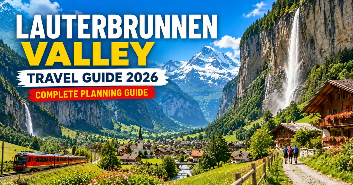
The Lauterbrunnen Valley is the most geologically dramatic inhabited valley in Switzerland — a glacier-carved U-shaped gorge of extraordinary proportions (approximately 300-meter vertical cliff walls on both sides of a valley floor only 100 meters wide in its narrowest sections, the cliff walls so consistently near-vertical that they appear from below as sheer architectural facades rather than natural terrain) hosting 72 named waterfalls (the greatest concentration of named waterfalls in any single Swiss valley), three distinct human communities at different altitudes (Lauterbrunnen village on the valley floor, Wengen on the eastern slope 500 meters above, and Mürren on the western cliff wall 854 meters above the valley floor), and the Trümmelbach Falls (ten glacial meltwater cataracts carrying up to 20,000 liters per second through a series of illuminated tunnels inside the mountain — the most visited paid attraction in the Bernese Oberland and one of the most genuinely extraordinary natural spectacles in Switzerland).
The name “Lauterbrunnen” derives from the Old German for “loud springs” — a reference to the valley’s perpetual waterfall soundtrack that visitors notice immediately on arrival at the railway station, before they have looked up to see the cliff walls above. This acoustic dimension (the continuous presence of falling water audible throughout the valley at any time of year, more immediate in spring snowmelt when the total waterfall flow reaches its annual maximum) is one of the Lauterbrunnen experience’s most specifically distinct elements — a landscape that sounds different from anywhere else in Switzerland.
Planning a Lauterbrunnen Valley visit in 2026 requires understanding the valley’s specific three-layer geography: the valley floor (Lauterbrunnen village and the trail to the Staubbachfall and Trümmelbach Falls), the eastern slope (Wengen and the Wengernalpbahn to Kleine Scheidegg and the Jungfraujoch connection), and the western cliff wall (Mürren and the Schilthornbahn to the Schilthorn summit). Each layer provides genuinely distinct experiences — and visitors who use Lauterbrunnen only as a transit junction to Wengen or Mürren miss the valley floor’s specific character. This guide covers all three layers comprehensively, along with the practical transport, accommodation, and timing information for 2026 visitors.
For related guides, see our Jungfrau Region Travel Guide 2026, Things to Do in Interlaken 2026, Jungfraujoch: Complete Visitor Guide 2026, and Swiss Travel Pass Guide 2026.
| Category | Details |
|---|---|
| Location | Bernese Oberland, Canton Bern, Switzerland |
| Valley Length | Approximately 12 km (Lauterbrunnen village to Stechelberg) |
| Named Waterfalls | 72 (the highest concentration in any single Swiss valley) |
| Villages | Lauterbrunnen (796m), Wengen (1,274m), Mürren (1,650m), Stechelberg (910m) |
| Car-Free Villages | Wengen, Mürren (no road access to either) |
| Primary Access | BOB train from Interlaken Ost to Lauterbrunnen (22 min) |
| Wengen Access | BOB rack railway from Lauterbrunnen (14 min) |
| Mürren Access | Cable car Lauterbrunnen → Grütschalp (5 min) + rack railway to Mürren (35 min) |
| Trümmelbach Falls | CHF 13; 10-minute bus or 25-minute walk from Lauterbrunnen station |
| Swiss Travel Pass | Covers all transport to/within valley; 50% on Schilthorn, Jungfraujoch section |
| Best Months | May–June (waterfall peak); July–September (hiking, swimming); October (autumn colour) |
| Emergency | 112 (universal); Mountain rescue: 1414 (REGA) |
Altitude: 796–910 meters | Length: 12 km | Access: Road (to Stechelberg) and BOB train (to Lauterbrunnen)
The Lauterbrunnen valley floor is the deepest and most enclosed layer of the three-layer experience — a narrow passage of farmland, rushing river (the Weisse Lütschine, draining the valley’s glaciers and snowfields), and the trail system connecting the various waterfalls and communities from Lauterbrunnen station in the north to Stechelberg (the southernmost road-accessible point) in the south. The valley floor’s specific sensory character: the constant sound of the Weisse Lütschine and the waterfalls descending from the cliffs above, the relative coolness of the deeply shaded valley floor (in a valley this narrow with walls this high, direct sunlight reaches the floor only for a few hours daily even in midsummer), and the specific visual scale distortion that the 300-meter cliff walls create — objects on the cliff edges appearing miniaturized by the height, the waterfalls seeming to take impossibly long to descend from their origin.
The Staubbachfall (297 meters of free-falling water, immediately above Lauterbrunnen village — the fall visible from the station platform, from the main street, and from the approach trail) is the first and most immediately accessible of the valley’s 72 waterfalls — the volume varies dramatically with season (at maximum spring flow it fills the entire valley with mist that reaches the village street below; in late summer it reduces to a much thinner veil). A short path (10–15 minutes from the village center, clearly marked) leads through the Staubbachfall’s own viewing cave — a gallery cut into the cliff behind the falling water, from which the valley is visible through the curtain of falling water.
The valley floor walk (from Lauterbrunnen station southward toward Stechelberg, passing beneath successive waterfall entries from the cliff walls and through the hamlets of Zweilütschinen and Gimmelwald approach paths) provides 12 kilometers of specifically enclosed valley walking — the cliff walls remaining present throughout, the waterfalls appearing and disappearing from view as the valley’s gentle curves redirect the sightlines, and the progressive quieting of the road traffic (which ends at Stechelberg) allowing the waterfalls’ sound to dominate the auditory environment completely in the valley’s southern sections.
Altitude: 1,274 meters | Access: BOB rack railway from Lauterbrunnen (14 min) — no road access | Character: Car-free, sun-facing, family resort village | Population: Approximately 1,200 permanent residents
Wengen sits on the Lauterbrunnen Valley’s eastern slope in a south-southwest facing orientation that maximizes sun exposure throughout the day — the specific advantage that gives Wengen the Jungfrau Region’s most consistently warm skiing and hiking conditions among the car-free mountain villages. Arriving in Wengen by the BOB rack railway (the train ascending the valley wall from Lauterbrunnen in 14 minutes, the valley floor receding below as altitude increases) provides the specific pleasure of the cliff-top emergence — the valley disappearing beneath as Wengen’s sunny meadow plateau appears.
The Lauterbrunnen Valley visible below Wengen creates the most dramatically vertigo-inducing valley-view available from any inhabited Swiss village — standing at Wengen’s southern edge and looking down into the valley where the Weisse Lütschine appears as a thin silver thread 500 meters below, the opposite cliff wall (where Mürren sits on its equivalent height plateau) visible across the valley at eye level, and the Staubbachfall’s thin white thread visible on the far cliff wall creates the spatial experience that defines the Lauterbrunnen Valley’s specific character more completely than any single static photograph conveys.
Wengen’s Lauberhorn connection: The Lauberhorn race (the annual FIS Alpine Ski World Cup downhill race, one of the most celebrated races in the World Cup calendar, held in January — the race begins above Kleine Scheidegg and finishes in Wengen village) makes Wengen specifically the most historically significant ski racing village in the Bernese Oberland. The race finish area (in the village itself, the crowd lining the final section of the course at street level) creates the most intimate large-scale ski race atmosphere available anywhere in the world during the race weekend.
Altitude: 1,650 meters | Access: Cable car Lauterbrunnen → Grütschalp (5 min) + Mürren-Grütschalp rack railway (35 min) | Character: Car-free, highest, quietest, most dramatically positioned | Population: Approximately 450 permanent residents
Mürren occupies the Lauterbrunnen Valley’s western cliff wall at 1,650 meters — 854 meters above the valley floor and 376 meters above Wengen’s equivalent position on the eastern slope, the highest of the valley’s three inhabited communities. The cable car from Lauterbrunnen to Grütschalp (5 minutes, ascending 380 meters vertically — the specific moment when the cable car rises above the cliff edge and the valley’s full depth becomes visible below) delivers visitors to the plateau’s top edge, from which the rack railway to Mürren traverses the cliff wall’s top surface.
Mürren’s specific identity: the most complete car-free Alpine village experience available in the Bernese Oberland — 450 permanent residents, no through-road, no privately-owned motor vehicles of any kind (all deliveries by rack railway, all emergency vehicles electric), and the specific quietness that only a small community without internal combustion engines can provide. Standing in Mürren’s Stager-Promenade (the main terrace walk along the cliff’s edge) with the Eiger-Mönch-Jungfrau directly across the valley at eye level and the 854-meter drop to the valley floor below creates the most specifically dramatic inhabited terrace position in the Bernese Oberland.
Height: 297 meters | Access: 10–15 minute walk from Lauterbrunnen station | Best Time: Spring (April–June) for maximum flow; morning for photography | Free
The Staubbachfall (the waterfall that falls immediately above Lauterbrunnen village, visible from the station platform, from the main street, and from essentially every open position in the valley’s northern section) is Switzerland’s tallest freely-falling waterfall — 297 meters of near-vertical free fall, the water becoming mist in the final section as it disperses against the air resistance before reaching the valley floor. The name “Staubbachfall” derives from the German for “dust brook” — a reference to the misting effect that transforms the waterfall’s lower section into a fine spray cloud that drifts across the valley floor on windy days.
The Staubbachfall inspired two significant literary works: Lord Byron visited Lauterbrunnen in 1816 and specifically referenced the Staubbachfall in his poem “Manfred” (whose protagonist, an Alpine recluse, is clearly inspired by the valley’s specific landscape character), and J.R.R. Tolkien visited the valley in 1911 and reportedly used the Staubbachfall and the Lauterbrunnen Valley as visual inspiration for Rivendell in “The Lord of the Rings” — the cliff walls, the waterfalls, and the enclosed valley character appearing in descriptions of the Elven refuge.
The Staubbachfall viewing cave: A marked path from Lauterbrunnen village (10–15 minutes, gaining approximately 30 meters of altitude on a switchback trail) reaches the viewing cave — a gallery cut into the cliff face behind the waterfall, from which the valley is visible through the falling water curtain. The cave’s specific experience: the noise (the waterfall’s impact on the rocks immediately below audible at close range), the physical mist (in high-flow conditions, entering the cave means getting wet — appropriate waterproof clothing is recommended for spring visits), and the specific visual of looking through falling water at the valley below create a waterfall encounter more intimate than any viewpoint from the valley floor provides.
Entry: CHF 13 | Access: Bus from Lauterbrunnen station (5 min) or 25-minute walk | Hours: Daily 9 AM – 5 PM (April–November; check current 2026 hours at truemmelbach.ch) | Duration: 1 hour | Special: Ten glacial meltwater cataracts inside an illuminated mountain
The Trümmelbach Falls — the single most extraordinary specific natural experience in the Bernese Oberland, and the most consistently underestimated major attraction in Switzerland — carry the meltwater from the Eiger, Mönch, and Jungfrau glaciers (1,500 hectares of permanent ice draining through this single underground channel system) through a series of ten cascades within the mountain, accessible by internal tunnel lift and illuminated walkways. At maximum spring flow (May–June), the falls carry 20,000 liters of water per second through channels whose noise (in the most constricted sections, the rushing water’s sound is physically overwhelming — the sound pressure sufficient to feel in the chest cavity) and visual impact (the water’s speed and volume at close range in the illuminated narrow tunnels creating a genuinely alarming sensation of natural force) cannot be described adequately in text.
The geological context: The Trümmelbach Falls are carved by the Trümmelbach (a stream carrying the combined glacial meltwater from the Eiger, Mönch, and Jungfrau’s southern faces) through the mountain’s limestone over thousands of years — the spiral and corkscrew shapes of the carved channels (the water following the rock’s specific fracture patterns and creating smooth, flowing, water-polished surfaces that the internal lighting illuminates dramatically) represent geological processes compressed into human-visible forms that make the mountain’s interior simultaneously a geological document and a viscerally beautiful space.
Why it’s consistently underrated: Most visitors to the Bernese Oberland prioritize the Jungfraujoch (the most famous and most expensive experience, requiring the full day) and regard the Trümmelbach Falls as a minor addition. In reality, the Trümmelbach Falls consistently generates stronger emotional responses from visitors who do both — the combination of geological intimacy (inside the mountain, at close range with the falls) and sensory overwhelm (the noise, the mist, the confined space) creates an experience that the Jungfraujoch’s open-air panoramic grandeur doesn’t replicate. CHF 13 for what many visitors describe as their strongest single Swiss experience is the Bernese Oberland’s clearest value discrepancy.
What to see: The falls are organized in 10 cascades, each accessible by a combination of internal lifts and walking paths. Start from the bottom (cascade 6 — the lift takes visitors to the top sections first on arrival) and walk downward through the illuminated system:
Insider tips: Morning visits (opening time, 9 AM) provide the Trümmelbach Falls with minimal visitor competition — the falls are most impressive (and most crowded) in late morning. Spring visits (May–June) provide the maximum flow; autumn visits (September–October) provide reduced flow but also reduced crowding and more comfortable (less mist-soaked) conditions for visitors who want the geological details visible without the spray. Proper waterproof clothing for spring visits is not optional — the upper cascade galleries genuinely wet visitors even with basic avoidance of the direct spray zones.
Mürrenbach Falls (417 meters): Technically Switzerland’s tallest waterfall, descending from the cliffs above Stechelberg in three distinct sections with the upper section visible above the cliff edge from the valley below. The Mürrenbach Falls is less visited than the Staubbachfall (the Staubbachfall’s immediate accessibility from Lauterbrunnen station and its literary connections making it more broadly known) but achieves a greater total height — a distinction that requires checking because multiple claims to “tallest Swiss waterfall” circulate based on different measurement methodologies.
Schmadribachfall: Accessible by a 2-hour hike from Stechelberg, one of the valley’s most impressive free-standing falls in its natural gorge setting — for hikers who specifically want the non-touristinfrastructure waterfall experience.
The cascade view from Wengen and Mürren: Both cliff-top villages provide elevated views of multiple valley waterfalls simultaneously — from Wengen’s southern edge or Mürren’s Stager-Promenade, 5–8 distinct waterfall threads are visible on the opposite cliff wall simultaneously, the full scale of the 72-waterfall valley comprehensible from the elevated position in a way that the valley floor doesn’t allow.
From Interlaken Ost: BOB (Berner Oberland-Bahn) narrow-gauge train, departing approximately every 30 minutes, 22-minute journey, fully covered by Swiss Travel Pass. The BOB is the only public transport access — no public bus serves Lauterbrunnen from Interlaken.
From Grindelwald: BOB to Zweilütschinen (the valley junction where the Grindelwald and Lauterbrunnen lines split), then change direction — the combined journey approximately 30–35 minutes.
By car: Road access to Lauterbrunnen village is straightforward — the road continues through the village to Stechelberg (the southernmost road point). Parking in Lauterbrunnen is available at the station area (CHF 12–16/day) — visitors planning to ascend to Wengen or Mürren (both car-free) can park in Lauterbrunnen and use the public transport connections upward.
Lauterbrunnen to Stechelberg: PostBus service (frequent, covered by Swiss Travel Pass) or walking (12 km, 2.5–3 hours, clearly marked path). The PostBus stops at the Trümmelbach Falls entrance (stop: Trümmelbach) and at Stechelberg (stop: Stechelberg, Schilthornbahn) where the Schilthornbahn cable car base station departs for Mürren.
To Wengen: BOB rack railway from Lauterbrunnen station, departing approximately every 30 minutes, 14-minute journey, fully covered by Swiss Travel Pass.
To Mürren (via Grütschalp): Cable car Lauterbrunnen → Grütschalp (5 minutes, Luftseilbahn Lauterbrunnen–Mürren, covered by Swiss Travel Pass), then rack railway Grütschalp → Mürren (35 minutes, covered by Swiss Travel Pass). Combined journey approximately 40–45 minutes.
To Mürren (via Stechelberg and Gimmelwald): The alternative Mürren access — PostBus to Stechelberg, then the Schilthornbahn from Stechelberg to Gimmelwald (10 minutes) and Mürren (20 minutes from Gimmelwald). This route passes through Gimmelwald (the tiny hamlet between the valley floor and Mürren — approximately 130 permanent residents — whose specific preserved character is the most authentically pre-tourism Alpine settlement in the Bernese Oberland). The Schilthornbahn from Stechelberg to Mürren (partially covered by Swiss Travel Pass — check current terms) continues above Mürren to the Schilthorn summit.
| Route | Duration | Swiss Travel Pass |
|---|---|---|
| Interlaken Ost → Lauterbrunnen (BOB) | 22 min | Free |
| Lauterbrunnen → Wengen (BOB rack) | 14 min | Free |
| Wengen → Kleine Scheidegg (Wengernalpbahn) | 38 min | Free |
| Kleine Scheidegg → Jungfraujoch (Jungfrau Railway) | 33 min | 50% discount |
| Lauterbrunnen → Grütschalp (cable car) | 5 min | Free |
| Grütschalp → Mürren (rack railway) | 35 min | Free |
| Stechelberg → Mürren (Schilthornbahn) | 20 min | Check current terms |
| Mürren → Schilthorn (Schilthornbahn) | 15 min | 50% discount |
| Lauterbrunnen → Stechelberg (PostBus) | 15 min | Free |
Character: Valley floor, transit hub, car accessible | Best for: Budget travelers, families with cars, base for both valley directions
Lauterbrunnen offers the Bernese Oberland’s most affordable mountain-adjacent accommodation — the valley floor’s location (accessible by car and rail, with no altitude premium in the accommodation pricing that Wengen and Mürren charge for their elevated car-free positions) producing hotel prices consistently 20–35% below equivalent quality in Wengen. The valley’s acoustics (the Staubbachfall and the Weisse Lütschine both audible from most Lauterbrunnen accommodation) provide a specific ambient soundscape that visitors either find deeply soothing or insufficiently quiet for sleep — worth considering when selecting room location (rooms facing away from the falls and river on the western hotel sides provide quieter conditions).
Key properties: Hotel Staubbach (directly below the Staubbachfall, CHF 80–160/night, the most specifically waterfall-adjacent accommodation in the valley), Valley Hostel (popular with backpackers, CHF 30–50/dorm, CHF 90–140/private), Hotel Schützen (mid-range, CHF 120–200/night).
Character: Car-free, elevated, sunny, traditional resort | Best for: Longer stays, skiing families, walkers seeking altitude base
Wengen’s accommodation (accessed entirely by BOB rack railway — luggage can be sent by Swiss Reisegepäck service from Interlaken directly to Wengen hotels for CHF 12–18/bag, delivered the following day) ranges from guesthouses (CHF 90–160/night) through mid-range family hotels (Hotel Regina CHF 180–280/night, Hotel Beausite CHF 150–250/night) to the most prestigious property (Park Hotel Beausite CHF 280–450/night in peak season). The car-free character means all luggage is handled by the rack railway and by hotel porter service — informing the hotel of arrival time and train allows porter collection at the Wengen station.
Wengen’s specific accommodation advantage: The south-facing orientation of Wengen’s hotel terraces (facing southwest toward the afternoon sun, with the valley below and the Schilthorn massif visible across) creates the Jungfrau Region’s finest hotel terrace sun-exposure conditions — morning sun from 8 AM and afternoon sun until 5 PM in midsummer, making Wengen’s outdoor hotel terraces the most reliably warm and light in the region.
Character: Highest, most remote, quietest, most dramatically positioned | Best for: Serious hikers, walkers seeking complete mountain village immersion, photographers
Mürren’s accommodation market (also car-free, accessed by cable car and rack railway from Lauterbrunnen) includes the Hotel Alpenruh (CHF 120–200/night — the most centrally positioned Mürren hotel, immediately adjacent to the Stager-Promenade terrace), the Hotel Eiger (CHF 150–280/night, with direct piste ski-in/ski-out access in winter), and various smaller guesthouses and chalets. The village’s small scale (450 permanent residents) creates a limited total accommodation capacity — advance booking (4–8 weeks ahead in summer, 2–3 months in winter ski season) is more specifically important in Mürren than in Wengen or Lauterbrunnen.
Mürren’s specific accommodation advantage: The Eiger-Mönch-Jungfrau view from Mürren accommodation is the most directly face-on of any Bernese Oberland village — the peaks appearing across the valley at approximately equal altitude rather than above, creating the specific “eye level with the high peaks” impression. Requesting a south-facing room with valley view when booking Mürren accommodation provides this specific outlook from the bedroom window.
Character: Valley floor, road terminus, tiny settlement | Best for: Walkers wanting the valley’s quietest accommodation, access to Schilthornbahn base
Stechelberg (the road’s end, the southernmost point of car-accessible settlement in the valley, and the base station of the Schilthornbahn cable car system ascending to Gimmelwald, Mürren, and the Schilthorn) offers minimal accommodation — the Hotel Stechelberg (a small property with limited rooms, CHF 80–140/night) and some guesthouses providing the valley’s most specifically quiet overnight option. The silence of Stechelberg (the road traffic ends here, the village has no commercial infrastructure beyond the hotel and the cable car station) and the proximity to the valley’s upper waterfall displays create a specifically nature-immersed accommodation experience available nowhere closer to Interlaken.
10:00 AM — BOB from Interlaken Ost to Lauterbrunnen (22 min). 10:25 AM — Lauterbrunnen station: Staubbachfall viewing cave walk (25 min round trip). 11:00 AM — Bus to Trümmelbach Falls (5 min) → Trümmelbach Falls visit (1 hour, CHF 13). 12:15 PM — Bus back to Lauterbrunnen station. 12:30 PM — Valley floor walk (30 min toward Stechelberg direction, viewing multiple smaller falls). 1:30 PM — BOB return to Interlaken Ost.
This half-day covers the valley’s two most significant specific experiences (Staubbachfall and Trümmelbach Falls) without ascending to any of the cliff-top villages — appropriate as an introduction or for visitors with limited time.
8:00 AM — BOB Interlaken Ost to Lauterbrunnen. 8:22 AM — Staubbachfall cave walk (fresh morning light, minimal crowds, 25 min). 9:00 AM — Bus to Trümmelbach Falls (morning opening, first visitors, 1 hour). 10:15 AM — Return to Lauterbrunnen → BOB rack railway to Wengen (14 min). 10:45 AM — Wengen village walk: Stager-Promenade (valley views), church, traditional buildings (1 hour). 12:00 PM — Lunch at a Wengen restaurant (the Hotel Beausite terrace provides the most valley-view dining available in Wengen). 1:30 PM — Walk toward Kleine Scheidegg on the Wengen Panoramaweg (the marked trail running above Wengen toward the Männlichen area — 2–3 hours for the full section) OR Wengernalpbahn to Kleine Scheidegg (38 min, included Swiss Travel Pass) for the Eiger north face viewpoint. 4:30 PM — Wengernalpbahn/BOB return to Lauterbrunnen → Interlaken.
Day 1 (Lauterbrunnen Valley + Mürren): Morning — Staubbachfall, Trümmelbach Falls (as above, 2.5 hours for both). Midday — Cable car from Lauterbrunnen to Grütschalp → rack railway to Mürren (40 min). Afternoon — Mürren Stager-Promenade walk (Eiger-Mönch-Jungfrau at eye level), village exploration (2 hours). Late afternoon — Schilthornbahn to Schilthorn summit (CHF 50–65 from Mürren, 50% Swiss Travel Pass, 15 min) for the Piz Gloria revolving restaurant and James Bond experience. Evening — Overnight in Mürren (Hotel Alpenruh or Hotel Eiger).
Day 2 (Wengen + Kleine Scheidegg): Morning — Rack railway from Mürren back to Grütschalp → cable car to Lauterbrunnen → BOB rack railway to Wengen (1 hour total). Late morning — Walk from Wengen on the Wengernalpbahn parallel trail toward Kleine Scheidegg (2 hours hiking, or 38 minutes by train). Midday — Kleine Scheidegg (Eiger north face at 200 meters distance, station terrace lunch, Jungfrau Railway departure option if clear summit day). Afternoon — Return to Lauterbrunnen via Wengernalpbahn. Evening — Return to Interlaken.
The Lauterbrunnen Valley’s most dramatically powerful seasonal version — April’s snowmelt beginning to fill the waterfalls, May’s peak flow (the entire valley in maximum waterfall display, the Trümmelbach Falls at their most overwhelming with the full snowmelt volume, the Staubbachfall spreading into mist across the valley floor in windy conditions), and June’s continuation as the high-altitude snowfields gradually reduce but maintain substantial flow while the valley’s hiking trails clear of snow.
Practical spring considerations: The Trümmelbach Falls at peak spring flow (May) are the most spectacular but also the most mist-generating — proper waterproof clothing for the upper cascade galleries is genuinely necessary rather than merely advisable. The Staubbachfall cave (behind the falls) in spring may be closed on days of extreme flow due to safety concerns — checking with Lauterbrunnen Tourism (lauterbrunnenvalley.ch) before specifically planning the cave visit in May avoids disappointment.
All valley hiking trails fully accessible, the Wengernalpbahn and Schilthornbahn at full summer schedules, the valley’s high-altitude hiking (the Mürren Nordwand Hike, the Schynige Platte-First route from Wengen’s direction) at their best conditions. The waterfalls are reduced from spring’s maximum but remain visually substantial and acoustically present throughout. Lake temperatures at lower-valley ponds and the Weisse Lütschine (cold — these are glacial meltwater streams, significantly colder than lowland lakes regardless of air temperature) allow specific swimming for the cold-tolerant.
October’s larch forests above Wengen and Mürren (the European larch trees on the slopes above both cliff-top villages) turning golden in mid-October create the Lauterbrunnen Valley’s most specifically photographic seasonal opportunity — the golden larch color visible on the cliff-top slopes from the valley floor, with the Jungfrau massif’s first winter snow dusting appearing simultaneously on the high terrain above.
The Lauterbrunnen Valley transforms into the Jungfrau Ski Region’s access corridor — the BOB running continuously to Wengen and the Wengernalpbahn to Kleine Scheidegg and the Männlichen for ski area access, the Schilthornbahn to Mürren and the Schilthorn ski area, and the valley floor’s winter character (the waterfalls reduced in flow, the cliff faces occasionally iced, and the valley’s narrow-width creating limited direct sun access to the floor making the valley floor experience specifically winter-characteristic) creating a genuinely different version of the landscape from the waterfall-dominated summer.
The most consistently reported Lauterbrunnen Valley regret — visitors who treat the Trümmelbach Falls as optional (in favor of spending more time at Wengen or proceeding to the Jungfraujoch) consistently report it as the visit’s primary missed experience. CHF 13 for 1 hour inside the mountain with 20,000 liters/second of glacial meltwater represents Switzerland’s clearest single price-to-experience value in the Bernese Oberland. Do not skip them.
Lauterbrunnen station is where the BOB train arrives and where the BOB rack railway to Wengen departs — the common pattern is arriving, walking 50 meters to the Wengen platform, and boarding without spending any time in the valley itself. The Staubbachfall (15 minutes’ walk from the station) and the Trümmelbach Falls (5 minutes by bus) are then missed entirely. Building 2–3 hours at valley level before or after the cliff-top village visits provides a comprehensively more complete valley experience.
The Mürren access (cable car to Grütschalp + rack railway to Mürren = 40–45 minutes from Lauterbrunnen) is significantly longer than the Wengen access (BOB rack railway = 14 minutes) — visitors who plan “a quick trip to Mürren” consistently find the access time consuming more of their day than expected. Building a minimum 4-hour window (45 min travel each way + 2.5 hours in Mürren) provides a worthwhile Mürren experience without the rushed feeling that shorter windows produce.
Rain dramatically increases the Lauterbrunnen Valley’s waterfall volume and intensity — a rainy Lauterbrunnen valley day (which might prompt weather-disappointed visitors to retreat to covered attractions elsewhere) is actually the moment when the valley’s 72 waterfalls achieve their most voluminous simultaneously, the cliff faces running with water from dozens of sources rather than the select 72 named falls, and the valley’s enclosed character becoming most specific and most atmosphere-saturated. The Trümmelbach Falls in rain are extraordinary; the Staubbachfall in rain (the falls visible from the covered station waiting area) is impressive. Rain in the Lauterbrunnen Valley is not a reason to leave — it’s a reason to adjust expectations from sunshine photography to waterfall-volume observation.
The 12-kilometer valley floor walk from Lauterbrunnen to Stechelberg (passing beneath the successive waterfall entries from both cliff walls, through the hamlets of Zweilütschinen and the pastoral valley sections south of the tourist infrastructure) is one of Switzerland’s finest valley walks — gentle, flat, entirely below the cliff walls with the waterfalls visible throughout, and arriving at Stechelberg’s specific quiet (road’s end, the last community, the cable car base station visible at the valley’s south face). Most visitors don’t walk the full distance; most who do describe it as a valley experience that surpasses the cliff-top villages in contemplative quality. The PostBus return from Stechelberg makes the one-way walk practical.
About Travel Tourister Travel Tourister’s destination specialists have experienced the Lauterbrunnen Valley across all seasons — from spring Trümmelbach Falls peak-flow visits and Staubbachfall cave explorations through summer Wengen terrace lunches and Mürren Stager-Promenade Eiger encounters to autumn larch-gold cliff-top walks and winter ski-region access mornings — to deliver the most practical and honest complete valley guide for 2026 visitors.
Posted By : Vinay
Latest Article
2nd Floor, 39, Above Kirti Club, DLF Industrial Area, Kirti Nagar, New Delhi, Delhi 110015



Travel Tourister is a leading Travel portal where we introduce travellers to trusted travel agents to make their journey hasselfree, memorable And happy. Travel Tourister is a platform where travellers get Tour packages ,Hotel packages deals through trusted travel companies And hoteliers who are working with us across the world. We always try to find new and more travel agents and hoteliers from every nook and corners across the world so that you could compare the deals with different travel agents and hoteliers and book your tour or hotel with the one you have chosen according to your taste and budget.
Copyright © Travel Tourister, India. All Rights Reserved

 Call
Call Enquiry