Published on : 07 Sep 2026
By Travel Tourister | Updated Sep 2026
Switzerland has 65,000 kilometers of marked hiking trails — more trail per square kilometer than any country on Earth except perhaps New Zealand — spanning every terrain type from the lowland pre-Alpine meadows of the Mittelland (where the Jura Range provides accessible day hiking within an hour of Zurich or Geneva) through the mid-altitude forests and pastoral Alpine valleys (the Bernese Oberland’s middle-height trail network, the Graubünden’s Romansh-speaking valley routes, and the Valais’s vine-terrace paths above the Rhône) to the high-Alpine terrain above 2,500 meters (where the Via Alpina traverses the full length of Switzerland’s Alpine chain over 390 kilometers and where specific summit approaches reach 3,000+ meters without technical equipment on maintained marked paths). The Swiss hiking trail system (maintained by the Swiss Hiking Federation — Schweizer Wanderwege — to consistent quality standards across all 65,000 kilometers, with trilingual signposting, regular trail assessments, and the specific yellow-diamond trail markers that allow confident navigation without maps) is genuinely the finest national hiking infrastructure in the world.
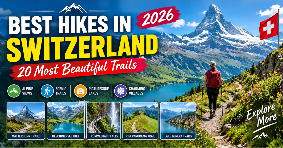
The best hikes in Switzerland in 2026 represent a range of experience levels, terrain types, and geographic regions — from the accessible and world-famous (the Five Lakes Walk above Zermatt, the Männlichen Ridge Walk in the Bernese Oberland, the Rigi circuit above Lake Lucerne) through the more demanding but equally celebrated (the Haute Route from Chamonix to Zermatt, the Via Alpina crossing through all three language regions) to the genuinely overlooked (the Lavaux Vineyard terrace trails above Lake Geneva, the Appenzell Seealpsee circuit through Switzerland’s most distinctly pastoral landscape, the Rhine Gorge Ruinaulta canyon trail in Graubünden) that Swiss residents walk regularly while most international visitors concentrate on the three or four most-photographed routes. This guide covers 20 of the best hikes in Switzerland — with practical trail details, access information, difficulty ratings, and the insider knowledge that makes each walk genuinely rewarding rather than merely completed.
For planning context, see our Switzerland Travel Guide 2026, Swiss Travel Pass Guide 2026, and Best Places to Visit in Switzerland 2026.
| Trail | Region | Distance | Difficulty | Best Season | Swiss Travel Pass |
|---|---|---|---|---|---|
| Five Lakes Walk (Fünf-Seen-Wanderung) | Valais (Zermatt) | 9.6 km | Moderate | June–Oct | Gondola 50% |
| Männlichen Ridge Walk | Bernese Oberland | 6 km | Easy–Moderate | June–Oct | Gondola 50% |
| Schynige Platte to First | Bernese Oberland | 16 km | Strenuous | July–Sept | Rack railway free |
| Rigi Panorama Walk | Central Switzerland | 10–15 km | Moderate | Year-round | 50% discount |
| Muottas Muragl Philosophers’ Path | Graubünden | 8 km | Moderate | June–Oct | Funicular 50% |
| Via Engiadina (section) | Graubünden | 90 km total (various day sections) | Easy–Moderate | June–Oct | PostBus free |
| Rhine Gorge Trail (Ruinaulta) | Graubünden | 10 km | Easy | May–Oct | Free (train access) |
| Lavaux Vineyard Trail | Vaud (Lake Geneva) | 6 km | Easy | Year-round | Free |
| Eiger Trail | Bernese Oberland | 6.8 km | Moderate | June–Oct | Free (partial) |
| Haute Route (Chamonix–Zermatt) | Valais | 180 km (multi-day) | Strenuous | July–Sept | Partial (Swiss section) |
| Swiss Path (Weg der Schweiz) | Central Switzerland | 35 km (multi-day) | Easy–Moderate | May–Oct | Free (boat to start) |
| Bachalpsee Lake Hike | Bernese Oberland | 5 km return | Easy–Moderate | June–Oct | Gondola 50% |
| Seealpsee Circuit (Appenzell) | Appenzell | 10 km | Moderate | June–Oct | Train included |
| Aletsch Glacier Viewpoint Walk | Valais | 4–8 km (various) | Easy–Moderate | June–Oct | Cable car 50% |
| Gorges de l’Areuse | Neuchâtel | 8 km | Easy | Year-round | Free |
| Pilatus Dragon Path | Central Switzerland | 2 km | Easy–Moderate | May–Nov | Rack railway 50% |
| Schwarzsee to Zermatt (via Zmutt) | Valais (Zermatt) | 8 km | Moderate | June–Oct | Cable car 50% |
| Engadin-Silsersee Shore | Graubünden | 13 km | Easy | June–Oct | PostBus free |
| Grosse Scheidegg Circuit | Bernese Oberland | 15 km | Moderate–Strenuous | June–Oct | PostBus (one way) |
| Via Alpina Stage 23–26 | Bernese Oberland | 4 days | Strenuous | July–Sept | Partial |
Region: Valais, Zermatt | Distance: 9.6 km | Elevation gain/loss: 380m / 380m | Duration: 4–5 hours | Difficulty: Moderate | Start/End: Sunnegga (2,288m) → Sunnegga or Rothorn | Season: June–October | Access: Sunnegga funicular from Zermatt (50% Swiss Travel Pass) + CHF 36–42
Switzerland’s most consistently celebrated single-day hike — connecting five high-altitude lakes (Leisee, Grindjisee, Grünsee, Moosjisee, and Stellisee) above Zermatt, each reflecting the Matterhorn at a different angle and in a different foreground environment, creating five compositionally distinct Matterhorn photographs within a 9.6-kilometer circuit. The trail’s combination of genuinely accessible moderate terrain (no technical sections, well-marked throughout, appropriate for moderately fit visitors without hiking experience) with extraordinary reward (the Matterhorn visible from essentially every point on the walk, with the lake reflections providing the specific photographic compositions that appear in most Zermatt photography guides) makes it the most consistently recommended single activity in Zermatt for hiking visitors.
The Stellisee: The hike’s emotional peak — a small lake at 2,537 meters where the Matterhorn’s reflection appears in the lake surface on calm mornings, creating the most sought-after photographic position in the Zermatt hiking network. The specific conditions (calm wind, usually before 10 AM, the Matterhorn directly south of the lake creating the perfect axis for reflection) require timing that the first Sunnegga gondola departure (approximately 8:30 AM) specifically targets.
What makes it extraordinary: The Five Lakes Walk achieves something specific that longer or more demanding hikes don’t — it’s genuinely beautiful at every point rather than having beauty concentrated at a specific summit or viewpoint, the five lakes providing sequential photographic compositions that make the trail rewarding for photographers at multiple points rather than requiring arrival at a single destination to reward the effort.
Practical details:
Insider tips: The Grindjisee (the second lake in the counterclockwise direction) is the hike’s most overlooked reflection — the Matterhorn appearing over a ridgeline rather than rising directly from the water, creating a different composition from the Stellisee’s more direct reflection that most photographers specifically don’t seek out. The Grünsee’s distinctive emerald-green coloration (from specific mineral content in the glacial meltwater feeding it) is the most chromatic of the five lakes and the most vivid in direct morning light.
Region: Bernese Oberland | Distance: 6 km (Männlichen → Kleine Scheidegg) | Elevation: Mostly descending (169m loss) | Duration: 1.5–2 hours | Difficulty: Easy–Moderate | Season: June–October | Access: Gondola from Grindelwald (50% Swiss Travel Pass) or Wengernalpbahn (included)
The Männlichen Ridge Walk — 6 kilometers of panoramic ridgewalking from the Männlichen gondola station (2,230 meters) to Kleine Scheidegg (2,061 meters) with the Eiger-Mönch-Jungfrau filling the entire southern view throughout — is the most consistently recommended single day hike in the Bernese Oberland. The trail’s specific appeal: it requires no exceptional fitness, no technical equipment, and no navigation skill (the single marked path along the ridge is unmistakable throughout), yet delivers sustained panoramic views of the Bernese Oberland’s three most celebrated peaks over a 1.5–2 hour walk that most moderately fit visitors complete without difficulty.
The Männlichen summit (2,343 meters, a 15-minute ascent from the gondola station before the ridge walk begins) provides the highest point of the hike and the most complete panoramic view — the “King of the Bernese Oberland” perspective that the Männlichen’s central ridge position uniquely provides (both the Grindelwald and Lauterbrunnen valleys visible simultaneously in opposite directions, the Eiger’s north face and the full Jungfrau massif simultaneously present).
Practical circuit: Gondola Grindelwald → Männlichen summit (15 min) → Ridge Walk to Kleine Scheidegg (1.5–2 hrs) → Wengernalpbahn back toward Grindelwald or Lauterbrunnen (included Swiss Travel Pass). Total time: 3–3.5 hours including gondola and train.
Insider tips: The ridge walk’s morning departure (first Grindelwald-Männlichen gondola, approximately 8:30 AM) provides the Eiger north face in morning light (the face directly lit from the east) and the clearest visibility before afternoon valley haze develops. The Männlichen-to-Kleine-Scheidegg direction (walking toward Kleine Scheidegg rather than away from it) keeps the Eiger-Mönch-Jungfrau in the front of the view throughout the walk rather than behind the walker — a subtle but significant experiential difference.
Region: Bernese Oberland | Distance: 16 km | Elevation: 600m gain, 1,200m loss | Duration: 5–6 hours | Difficulty: Strenuous | Season: July–September | Access: Schynige Platte Bahn from Wilderswil (included Swiss Travel Pass) | End: Grindelwald First gondola (50% Swiss Travel Pass descent)
The Schynige Platte–First ridge traverse is the Bernese Oberland’s finest single full-day hiking experience — a 16-kilometer high-altitude route connecting the Schynige Platte’s 1,967-meter alpine botanical garden summit with the First gondola station above Grindelwald at 2,168 meters, traversing a ridge that maintains 2,000–2,500 meters throughout with the full Bernese Oberland panorama (both lakes visible for the first half, the Eiger-Mönch-Jungfrau dominant for the second half) visible throughout. The route’s sustained high-altitude character (mostly above 2,000 meters for 5 of its 6 hours), the variety of terrain (meadows, rock sections, and ridge-edge paths with controlled exposure), and the specifically beautiful botanical diversity (the Swiss Alpine Club maintains this as one of the finest wildflower routes in the Bernese Oberland, particularly in July–August) make it the most complete single hiking day available from an Interlaken base.
The logistics: The Schynige Platte Bahn from Wilderswil (one BOB stop from Interlaken Ost, included in Swiss Travel Pass) is the ascent — departing Wilderswil approximately 7:25 AM on the first daily departure, arriving Schynige Platte by 8:15 AM. The First gondola (50% Swiss Travel Pass) provides the descent. Return to Grindelwald by the Eiger Express (50% Swiss Travel Pass) and BOB to Interlaken completes the circuit.
Insider tips: The Faulhorn (2,681 meters, the highest point of the traverse — an additional 30-minute ascent from the main trail, the Hotel Faulhorn at the summit being the highest hotel in the Bernese Oberland and the oldest mountain hotel in Switzerland, open since 1832) provides the single best viewpoint of the entire route: the full chain of Bernese Oberland peaks, both lakes, and on exceptional days the Valais and Graubünden Alpine ranges beyond. Combining the traverse with a Faulhorn summit and the overnight at Hotel Faulhorn (advance booking essential — very limited capacity) creates the most complete version of this walk.
Region: Bernese Oberland | Distance: 5 km return (First → Bachalpsee → First) | Duration: 1.5–2 hours return | Difficulty: Easy–Moderate | Season: June–October | Access: Grindelwald First gondola (50% Swiss Travel Pass)
The Bachalpsee hike (from the First gondola station at 2,168 meters to the Bachalpsee lake at 2,265 meters, approximately 45 minutes each way on a clearly marked trail) provides the Bernese Oberland’s most celebrated single reflection photograph — the Eiger-Mönch-Jungfrau and Wetterhorn simultaneously reflected in the lake surface on calm mornings. The specific morning requirement (wind-calm lake surfaces before approximately 10 AM) rewards the first gondola departure timing.
Extending the Bachalpsee hike: The trail from Bachalpsee continues toward the Grosse Scheidegg (approximately 1.5 hours further from Bachalpsee) and eventually to the Schwarzwaldalp and the Rosenlaui valley — making Bachalpsee the potential beginning of a longer traverse rather than simply the turnaround point for an out-and-back walk. The extension to Grosse Scheidegg provides the Wetterhorn’s eastern face at close range — a perspective unavailable from any other accessible trail in the region.
Insider tips: The Bachalpsee in September (when the high-altitude wildflowers have completed their season and the first autumn tints appear on the lower vegetation, the lake surface calm in September’s reduced-wind conditions, and the visitor numbers substantially below July–August’s peak) provides the most photogenically complete version of the reflection — the clarity of September’s air combining with the calm surface and the reduced crowds to create the photograph that July’s haze and August’s afternoon wind don’t reliably permit.
Region: Bernese Oberland | Distance: 6.8 km (Eigergletscher → Alpiglen) | Duration: 3 hours | Difficulty: Moderate | Season: June–October | Access: Wengernalpbahn to Eigergletscher or Alpiglen (included Swiss Travel Pass)
The Eiger Trail (the marked route running along the base of the Eiger’s north face between the Eigergletscher station and the Alpiglen area) provides the closest-to-the-wall ground-level encounter with the Eiger north face available without technical mountaineering. The trail traverses the terrain immediately below the north face’s lower buttresses, passing through lateral moraine, boulder fields, and the specific geological environment created by the Eiger’s active rock-fall processes.
The specific experience: looking upward at the north face overhead from the trail (the wall appearing to lean over the observer from this close-range below-the-wall position — the specific inversion of perspective that the more famous and more distant Kleine Scheidegg view doesn’t produce) creates the most visceral impression of the wall’s scale available to non-climbers. The plaques on some boulders along the trail (commemorating specific notable ascents and their dates) connect the walker to the climbing history that makes the Eiger specifically famous rather than merely tall.
Practical detail: The trail can be walked in either direction (Eigergletscher start allows immediate access from the Jungfrau Railway’s first stop; Alpiglen start allows the Wengernalpbahn request stop return). The Eigergletscher → Alpiglen direction is recommended as it keeps the north face directly above and in front of the walker (rather than behind).
Insider tips: Morning is specifically recommended for the Eiger Trail — both for the specific north-face lighting (morning light illuminating the face’s details most clearly when the sun strikes it at an angle rather than the flat overhead light of midday) and for the rockfall risk awareness (the north face sheds loose material more actively as the day’s temperature variations expand surface rock). The Eiger Trail is notably less visited than the Männlichen or Bachalpsee routes — even in peak season, morning departures on the Eiger Trail encounter significantly fewer other hikers than the region’s most celebrated routes.
Region: Graubünden | Distance: 10 km (Versam-Safien → Ilanz, or sections) | Duration: 3–4 hours | Difficulty: Easy | Season: May–October | Access: RhB train to Versam-Safien and Ilanz (included Swiss Travel Pass) | Trail type: Linear (train return)
The Ruinaulta (the Rhine Gorge in the Surselva region of Graubünden — the canyon that the Glacier Express traverses, visible from the train windows but only fully experienced at ground level) provides one of Switzerland’s most dramatic easy walks — a 10-kilometer trail through the base of a 350-meter limestone canyon where the Rhine’s turquoise water flows between near-vertical cliff walls at the trail’s edge. The specific trail character: alternating between the canyon’s gravel shores (walking on the river’s edge with the cliffs rising immediately above), the forested cliff-base sections (through pine and birch forest on the canyon’s sides), and occasional cliff-face traverses (the trail sometimes pinned directly to the cliff face on narrow ledges above the water).
The Ruinaulta’s specific appeal compared to more famous Swiss hikes: the canyon’s enclosed character (the visual intimacy of the cliff walls at close range rather than the panoramic distance of high-Alpine viewpoints), the turquoise water’s color (the Rhine in this section a vivid blue-green from the limestone mineral content), and the Romansh-language cultural environment (the Surselva communities above the gorge maintaining Romansh as the daily language in a way that is perceptible in place names, signage, and occasional overheard conversation).
Insider tips: The Ruinaulta is the Glacier Express route’s most dramatic landscape section — passengers on the train see it from above (looking down into the gorge through the train windows), while hikers on the Ruinaulta trail see it from below (looking up at the cliff walls from the gorge floor). Combining a Glacier Express journey (one direction) with the Ruinaulta trail (the other direction) creates the most complete experience of this specific landscape — the train’s aerial view and the trail’s ground-level immersion providing two entirely different perspectives on the same canyon.
Region: Vaud (Lake Geneva) | Distance: 6 km (Cully → Chexbres, or various sections) | Duration: 2–3 hours | Difficulty: Easy | Season: Year-round (best April–October) | Access: SBB train to Cully or Epesses (included Swiss Travel Pass)
The Lavaux vineyard trail (connecting the villages of the UNESCO World Heritage Lavaux wine region between Lausanne and Montreux along Lake Geneva’s north shore, passing through the 12th-century stone-walled terraced vineyards that are among Switzerland’s most carefully maintained agricultural landscapes) provides Switzerland’s most culturally saturated easy walk — the trail passing between vine rows, through medieval stone walls, and beneath the canopy of Chasselas grapevines with Lake Geneva and the French Alps visible below throughout.
The specific wine-growing character: the Lavaux’s Chasselas vines (planted in the walled terraces that the Cistercian monks established in the 12th century and that have been continuously cultivated for 900 years) produce Switzerland’s most distinctively regional white wines — and the cellar doors open throughout the route allow direct comparison of the wine with the landscape that produces it in a form of agricultural connection that import-based wine purchases cannot replicate.
Best sections: The Cully–Epesses section (3 km, the most concentrated terrace landscape), the Dezaley section (the most prestigious Lavaux sub-appellation, where the finest Chasselas is produced, with some of the most photogenic terrace compositions above the lake), and the overall Lutry–Chexbres circuit (12 km, covering the full Lavaux extent for more ambitious walkers).
Insider tips: The Lavaux harvest period (mid-September to mid-October, varying by year — check with Vaud wine tourism for 2026 specific dates) is the trail’s most specifically rewarding season — the harvest teams working the impossible-angle terraces by hand, the grape buckets visible on the paths, and the specific smell of fermenting Chasselas drifting from the open cellar doors create a specifically agricultural harvest atmosphere available only during these 3–4 weeks annually.
Region: Appenzell Innerrhoden | Distance: 10 km | Duration: 3–3.5 hours | Difficulty: Moderate | Season: June–October | Access: Appenzellerbahn from St. Gallen to Appenzell (included Swiss Travel Pass) + Säntis cable car or walking
The Seealpsee circuit (from Wasserauen, accessible by the Appenzellerbahn, to the Seealpsee — a small lake at 1,143 meters in a classic Alpine cirque below the Säntis massif — and returning by a different trail through the Fählensee and various Appenzell pastoral sections) provides Switzerland’s most specifically pastoral hiking landscape: the rolling Appenzell pre-Alpine terrain, the specific Appenzell farmhouse architecture (the characteristic dark timber construction with the wide flower-decorated balconies that appear on Appenzell tourism materials), and the cowbell soundtrack (the large bells of the Appenzell cattle carrying across the valley in the specific tonalities that Swiss Alpine pastoral culture has specifically developed over generations of working with cattle in this terrain).
The Appenzell landscape’s specific character differs from the more dramatic Bernese Oberland or Valais hiking — the pre-Alpine height (rarely above 2,000 meters), the pastoral rather than glacial terrain, and the specifically Appenzell cultural character (the embroidery tradition, the Landsgemeinde democratic tradition, and the Romansh absence — this is solidly German-dialect Swiss territory) create a hiking environment that represents a completely different Switzerland from the internationally famous mountain destinations.
Insider tips: The Säntis (2,502 meters, the dominant peak of the Appenzell Alps — accessible by cable car from Schwägalp or by a 3–4 hour hiking approach from the Appenzell valley) can be combined with the Seealpsee circuit for a more strenuous full-day option — the Säntis summit’s panorama (the Swiss Mittelland extending northward to Germany, the Bodensee/Lake Constance visible, and the main Alpine chain visible in the south) provides the most geographically comprehensive single summit view in northeastern Switzerland.
Region: Central Switzerland | Distance: 10–15 km (various circuits) | Duration: 3–5 hours | Difficulty: Moderate | Season: Year-round | Access: SGV steamer from Lucerne to Vitznau (included Swiss Travel Pass) + Rigi rack railway (50% discount)
The Rigi (1,797 meters, the “Queen of the Mountains” above Lake Lucerne) hosts Switzerland’s most historically resonant mountain walking network — the rack railway ascending from Vitznau (Europe’s first mountain railway, 1871) providing access to a summit trail system whose combinations allow everything from 2-hour gentle circuits (the Rigi Kulm summit area trail with the 360-degree panorama of lakes and mountains) to full-day descents (from the Rigi Kulm summit to the Weggis lake shore via the Rigi Kaltbad or various other descent routes, passing through the forest sections that Mark Twain walked in 1878).
The Rigi’s specific walking appeal: the variety of paths (the exposed summit ridge trails versus the sheltered forest paths on the mountain’s sides), the 360-degree panorama at the summit (Lake Lucerne, Lake Zug, and Lake Lauerz simultaneously visible), and the extraordinary historical resonance (walking paths that European royalty, writers, and the Victorian Alpine tourism community walked across 150 years of continued use).
Recommended circuit: SGV steamer to Vitznau → Rigi Vitznau rack railway to Rigi Kulm → 2-hour summit area walk → descent to Rigi Kaltbad (40 min walking or rack railway) → aerial gondola from Rigi Kaltbad to Weggis → SGV steamer back to Lucerne. Fully covered by Swiss Travel Pass except 50% discount on rack railway.
Region: Central Switzerland (Lake Lucerne/Urnersee) | Distance: 35 km (2-day route) | Difficulty: Easy–Moderate | Season: May–October | Access: SGV steamer to Rütli (included Swiss Travel Pass)
The Swiss Path (created for Switzerland’s 700th anniversary in 1991, circling the Urnersee — the southernmost arm of Lake Lucerne — in a 35-kilometer trail divided into cantonal sections proportional to each canton’s population) provides Switzerland’s most historically specific multi-day walk. Beginning at the Rütli (the founding meadow of the Swiss Confederation, accessible only by boat — included in Swiss Travel Pass), passing Tell’s Chapel, and completing a full circuit of the lake in terrain that has been Swiss national territory since 1291.
Day 1 (18 km): Rütli → Tell’s Chapel → Flüelen (descending the Urnersee’s eastern shore through increasingly wild terrain) Day 2 (17 km): Flüelen → Sisikon → Brunnen (the western shore return, with the Rigi visible across the lake and the Schiller Stone — the rock commemorating Friedrich Schiller, whose “Wilhelm Tell” play established the Tell legend’s international fame — visible from the path)
Insider tips: The Swiss Path’s specific historical density (the founding oath site, the Tell legend’s locations, and the specific pre-Alpine landscape that has shaped Swiss national identity mythology since 1291) rewards visitors who read the relevant history before walking — both the historical account (the 1291 Federal Charter and its disputed interpretation as a founding document) and the literary account (Schiller’s “Wilhelm Tell”) providing frameworks that transform a pleasant lake-shore walk into a specifically meaningful historical journey.
Region: Valais, Zermatt | Distance: 8 km (one-way, Schwarzsee → Zermatt via Zmutt) | Duration: 2.5–3 hours | Difficulty: Moderate | Season: June–October | Access: Matterhorn Glacier Paradise cable car to Furi, then Schwarzsee cable car (50% Swiss Travel Pass)
The descent from Schwarzsee (2,583 meters, the lake at the base of the Matterhorn’s southeast face) through the Zmutt Valley to Zermatt provides the most intimate ground-level encounter with the Matterhorn available on foot — the western face of the Matterhorn (a completely different profile from the northeast face visible from the Zermatt village center) appearing at close range above the Zmutt Valley throughout the descent, the traditional hamlet of Zmutt (1,936 meters, the valley’s traditional pre-tourism settlement) providing the most authentically preserved pre-resort Zermatt character.
The Schwarzsee itself (the nearest accessible lake to the Matterhorn’s base, with the Maria zum See chapel at the lakeside and the Hörnli Hut visible above on the standard climbing route) provides the most dramatic close-range Matterhorn view available without the Matterhorn Glacier Paradise cable car’s 3,883-meter elevation — the mountain’s southeast face appearing directly overhead in a way that emphasizes its vertical scale rather than its iconic pyramidal profile.
Insider tips: The Zmutt Valley’s western Matterhorn profile (the side the Zmutt hamlet faces) is photographically and experientially distinct from the northeast face that every Zermatt photography guide concentrates on — the combination of the close-range south-facing views from near Schwarzsee and the progressively revealed western profile during the Zmutt descent creates a Matterhorn encounter that experienced Zermatt visitors specifically choose this route to access.
Region: Valais (Swiss section: Verbier → Zermatt) | Distance: 180 km (full route, France + Switzerland) | Duration: 10–14 days | Difficulty: Strenuous (high Alpine terrain, significant daily elevation changes) | Season: July–September | Access: Train to Martigny/Verbier for Swiss section start
The Haute Route (the classic summer high-level walking route from Chamonix in France to Zermatt in Switzerland, traversing the full length of the Valais Alps above the valley floor) is one of the world’s most celebrated long-distance mountain treks — consistently rated among the top ten greatest hikes globally by serious trekking publications, the route crossing permanent snow in specific sections, requiring hut-to-hut accommodation (the Swiss Alpine Club huts and various independent mountain huts along the route, bookable through the SAC — Schweizer Alpen-Club — reservation system), and achieving daily passes of 2,500–3,300 meters with views encompassing the highest concentration of four-thousand-meter peaks in the Alps.
The Swiss section (from Verbier or Bourg-Saint-Pierre for walkers who have crossed from Chamonix) traverses the Grand St. Bernard Pass approach, the Cabane du Mont Fort, the Col de Prafleuri, and the Zermatt approach through increasingly Matterhorn-oriented terrain. The final approach to Zermatt (visible from the route’s final passes in its iconic northeast-face profile) rewards the previous 10+ days of walking with the most earned mountain-arrival experience in the Swiss Alps.
Insider tips: The Haute Route’s logistics (hut reservations 4–6 months ahead for July–August dates, the specific gear requirements for potential snow sections, and the route-finding skill required for sections without continuous waymarks) distinguish it from all other hikes in this guide — serious planning, appropriate equipment (crampons and ice axe for specific sections in some years), and ideally guide service for first-time Haute Route walkers are the responsible approach. The Swiss hiking organization SAC (sac-cas.ch) maintains the most current route information and hut booking system.
Region: Switzerland-wide | Total distance: 390 km (all Swiss stages) | Individual stages: 15–20 km each | Difficulty: Moderate–Strenuous (varies by stage) | Season: July–September | Access: Variable by stage
The Via Alpina (the long-distance hiking route traversing the Swiss Alps from Vaduz (Liechtenstein) to Montreux (Lake Geneva), covering the full east-west length of Switzerland’s Alpine chain in 26 stages of approximately 15–20 km each) provides the most comprehensive single-route engagement with the Swiss Alps’ geographic and cultural variety — crossing the Rhaetian Alps of Graubünden, the Central Swiss Alps of Uri and Unterwalden, the Bernese Oberland, and the Valais in a continuous traverse that no other long-distance route in the Alps achieves across a comparable breadth of terrain.
Recommended individual day stages:
Access: Each Via Alpina stage is accessible by public transport at both ends — the SwitzerlandMobility app (schweizmobil.ch) provides stage-by-stage public transport connections, making individual stage selection and public transport return practical for all experience levels.
Region: Neuchâtel (Jura) | Distance: 8 km (Noiraigue → Boudry) | Duration: 2.5–3 hours | Difficulty: Easy | Season: Year-round | Access: SBB train to Noiraigue and from Boudry (included Swiss Travel Pass)
The Gorges de l’Areuse (the canyon carved by the Areuse River through the Neuchâtel Jura, between the Travers Valley and the Lake Neuchâtel shore) provides Switzerland’s finest pre-Alpine canyon walk — 8 kilometers of trail alternating between the narrow gorge’s water-level path (wooden walkways pinned to the cliff face above the river, the gorge walls rising 60–80 meters immediately above), the forested sections above the gorge (with the canyon visible below through the trees), and the specific pre-Alpine landscape character of the Jura range (limestone formations, cave systems, and the specific flora of a south-facing gorge in a temperate climate creating a botanical diversity absent from higher-altitude Alpine trails).
What makes it extraordinary for its difficulty level: The Gorges de l’Areuse achieves canyon drama — the physical sensation of enclosed space, the rushing water’s sound, and the specifically intimate relationship with the rock walls — at a completely accessible difficulty level (no significant elevation, no technical sections, appropriate for families with older children and for non-hikers who want a memorable trail experience). The combination of drama and accessibility makes it Switzerland’s finest easy canyon walk.
Insider tips: The Gorges de l’Areuse in spring (March–April, when snowmelt increases the Areuse’s volume and the gorge’s sound environment intensifies correspondingly) and in autumn (October–November, when the beech forests above the gorge produce vivid orange-gold color visible from the canyon bottom through the trees) provide the most seasonally specific versions of a trail that rewards visit in any season.
Region: Graubünden (Upper Engadin) | Distance: 8 km (Muottas Muragl → Alp Languard, or various) | Duration: 2.5–3 hours | Difficulty: Moderate | Season: June–October | Access: Muottas Muragl funicular from Punt Muragl (50% Swiss Travel Pass)
The Philosophers’ Path (Philosophenweg) — connecting the Muottas Muragl summit (2,453 meters, the Upper Engadin’s finest sunrise viewpoint) with the Alp Languard above Pontresina (2,330 meters) — traverses the high-altitude plateau above the Upper Engadin’s lake chain in a landscape of specifically Graubünden character: the open rocky terrain, the sparse larch forest at the edge of the treeline, and the entire Engadin lake chain visible below throughout the walk create a hiking experience whose elevation provides genuinely panoramic views without the technical demands of the Piz Languard summit proper.
The path’s name (derived from the tradition of Engadin intellectuals walking this route as contemplative exercise — Nietzsche walked similar routes from Sils Maria and the entire Engadin intellectual tradition of walking as philosophical practice is embedded in the route’s character) adds a specifically literary dimension to what is already a visually exceptional walk.
Insider tips: The Muottas Muragl funicular’s first morning departure (check current 2026 timetable at murtezaig.ch) delivers walkers to the 2,453-meter start before the main visitor wave — the Engadin lake chain reflecting the morning light below, the Bernina peaks lit from the east, and the specific tranquility of the high plateau before 9 AM creates the most complete version of this specific walk.
Switzerland’s trail marking system is among the world’s most consistent and most carefully maintained:
The vast majority of hikes in this guide use yellow or white-red-white marking — none require the Alpine route equipment of the white-blue-white system.
Always carry (regardless of weather or duration):
Footwear: Proper hiking footwear is the most important single equipment decision — trail shoes (low-cut, with grip) are adequate for most yellow-marker and some white-red-white routes; hiking boots (ankle support, waterproof) are recommended for white-red-white routes with significant elevation change or rocky terrain.
SchweizMobil (schweizmobil.ch): The official Swiss hiking route database — every marked Swiss hiking trail, with GPS tracks, elevation profiles, transport connections at both ends, and current trail condition reports. The SwitzerlandMobil app provides offline map access for areas without mobile coverage.
REGA (Swiss Air Rescue, 1414): The Swiss mountain rescue service — available 24/7, helicopter-based, covering the entire Alpine region. The REGA app provides direct emergency call with automatic GPS location transmission — download before any Swiss mountain hiking.
MeteoSwiss (meteoswiss.admin.ch): Switzerland’s national weather service provides mountain-specific forecasts for individual peaks and passes — the most reliable single tool for the “afternoon thunderstorm” risk assessment that determines safe high-Alpine hiking windows.
About Travel Tourister Travel Tourister’s destination specialists have walked every trail in this guide — from Five Lakes Walk Stellisee morning reflections and Männlichen Ridge sunrise departures through Schynige Platte-First full-day traverses and Rhine Gorge Ruinaulta canyon walks to Lavaux harvest-season vineyard strolls, Appenzell Seealpsee pastoral circuits, and Muottas Muragl dawn Engadin panoramas — to deliver the most practically honest hiking guide for 2026 Switzerland visitors.
Posted By : Vinay
Latest Article
2nd Floor, 39, Above Kirti Club, DLF Industrial Area, Kirti Nagar, New Delhi, Delhi 110015



Travel Tourister is a leading Travel portal where we introduce travellers to trusted travel agents to make their journey hasselfree, memorable And happy. Travel Tourister is a platform where travellers get Tour packages ,Hotel packages deals through trusted travel companies And hoteliers who are working with us across the world. We always try to find new and more travel agents and hoteliers from every nook and corners across the world so that you could compare the deals with different travel agents and hoteliers and book your tour or hotel with the one you have chosen according to your taste and budget.
Copyright © Travel Tourister, India. All Rights Reserved

 Call
Call Enquiry