Published on : 30 Oct 2026
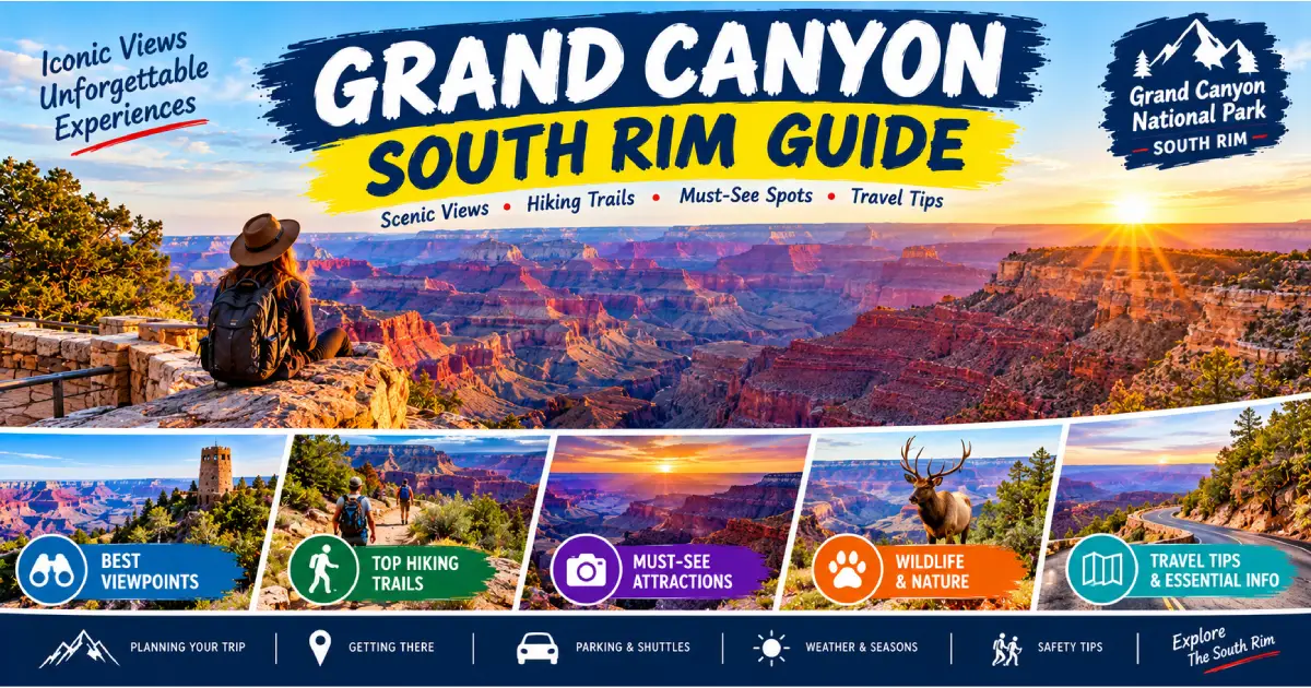
The Grand Canyon is one of those places where every photograph, every description, every superlative you have encountered fails to prepare you for the actual experience of standing at the rim for the first time. The canyon is 277 miles long, up to 18 miles wide, and a mile deep — numbers that the human brain processes as statistics until you are actually at the edge of the Bright Angel Trailhead and looking down at a landscape that took the Colorado River six million years to carve through two billion years of rock. The South Rim, which receives roughly 90 percent of the park’s six million annual visitors, is the more accessible, more developed, and more spectacular of the two rims — a 33-mile developed corridor from Desert View in the east to Hermit’s Rest in the west that encompasses some of the finest viewpoints, the most storied trails, and the richest natural and human history in the National Park System.
Planning a South Rim visit in 2026 requires more advance preparation than most national parks. Grand Canyon implemented a timed-entry permit system for private vehicles entering the South Rim corridor from May 1 through October 31, and permits ($2 per vehicle, in addition to the park entrance fee) must be reserved in advance at recreation.gov. Without a permit, visitors must park at the IMAX theater in Tusayan (7 miles south of the entrance) and take the free park shuttle. The park entrance fee is $35/vehicle, valid for 7 days. The South Rim is open year-round, but the most popular hiking season is spring (March–May) and fall (September–November), when canyon temperatures are manageable — summer brings lethal heat below the rim (110°F+ at Phantom Ranch in July), and winter brings ice, snow, and the extraordinary solitude of a nearly empty canyon.
Understanding the canyon’s geology is the fastest way to deepen every experience here. The rock layers exposed in the canyon walls are a textbook of Earth history: the Kaibab Limestone at the rim (270 million years old, full of marine fossils), down through the Coconino Sandstone (280 million years, ancient desert dunes), the Hermit Formation (285 million years, river deltas), the Supai Group (315–285 million years, iron-rich red sandstone), the Redwall Limestone (340 million years, the great red cliff that dominates the middle canyon), the Tonto Platform (505 million years, green shale), and finally the ancient Vishnu Schist at the bottom of the Inner Gorge (1.7–2 billion years old, black metamorphic basement rock) — a vertical journey through nearly half the age of Earth.
| Category | Detail |
|---|---|
| Park entrance fee | $35/vehicle (7-day pass) |
| Timed-entry permit | $2/vehicle, required May 1–Oct 31, recreation.gov |
| South Rim elevation | 6,860 feet (Mather Point) |
| Canyon depth | 6,093 feet (South Rim to Colorado River) |
| Colorado River elevation | 2,480 feet |
| Bright Angel Trail to river | 9.5 miles one way, 4,380 ft descent |
| South Kaibab Trail to river | 6.9 miles one way, 4,780 ft descent |
| Phantom Ranch lodge | $60–162/night, lottery system |
| Mule rides to Phantom Ranch | $659+/person, books a year+ in advance |
| Rim-to-rim distance | 21 miles (South Kaibab to North Kaibab) |
| Best season | March–May, September–November |
| Nearest airport | Flagstaff Pulliam (FLG), 80 miles south |
Mather Point is the first and most visited viewpoint in the park — located just steps from the Grand Canyon Visitor Center (the main hub, with ranger programs, bookstore, backcountry permits, and shuttle connections), it is the view that greets most of the park’s six million annual visitors and the image that defines the Grand Canyon in the global imagination. The broad paved plaza and safety railings make it accessible to every visitor; despite the crowds, the view across the main canyon corridor to the North Rim (13 miles distant) and down to the Colorado River is genuinely extraordinary, particularly at sunrise and sunset.
The Rim Trail runs west from Mather Point to Hermit’s Rest (12.8 miles total, flat, mostly paved, entirely free, and served by the free Hermit Road shuttle from March–November). Walking even the 1.5 miles from Mather Point west to Yavapai Point — which offers arguably the most comprehensive single view of the canyon’s geology, with the Yavapai Geology Museum explaining every visible layer — is the most rewarding 30-minute walk on the South Rim.
Desert View (25 miles east of Grand Canyon Village on AZ-64, included in park entry fee) is the eastern gateway to the South Rim and the site of the Desert View Watchtower — a 70-foot stone tower designed by architect Mary Colter in 1932, modeled on the ancient Ancestral Puebloan towers at Hovenweep and Mesa Verde. The interior murals by Hopi artist Fred Kabotie are among the most significant Native American art installations in the National Park System, and the view from the top of the tower — down the Colorado River corridor as it bends toward Marble Canyon in both directions, across the Painted Desert to the northeast — is the finest panoramic view available from any accessible point on the South Rim. The Desert View Campground ($18/night, first-come first-served, no reservations) is the quietest frontcountry camping option on the South Rim.
Yaki Point (accessible only by shuttle or bicycle, no private vehicles) sits at the top of the South Kaibab Trailhead — the finest sunrise viewpoint on the South Rim, with an unobstructed east-facing aspect that puts the dawn light directly on the canyon walls. Grandview Point (10 miles east of the village, accessible by car year-round, no shuttle) is named for what many consider the finest view on the entire South Rim: a commanding position above the Horseshoe Mesa that looks directly into the deepest and most complex section of the canyon, with the Colorado River visible in both directions and the entire geological sequence exposed in a single frame.
The historic Grandview Trail descends from this point — the original tourist trail built in 1892 for copper miners, 3 miles to Horseshoe Mesa (6 miles RT, 2,600 ft descent, unmaintained, no water, the finest intermediate day hike on the South Rim for experienced canyon hikers).
The Hermit Road (7 miles west of Grand Canyon Village, closed to private vehicles March–November, served by free red shuttle) accesses eight viewpoints of increasing drama as you travel west: Trailview Overlook (the only point where you can see the Bright Angel Trail switchbacks from above), Maricopa Point, Powell Point (monument to the one-armed Civil War veteran who led the first river expedition through the canyon in 1869), Hopi Point (the finest sunset viewpoint on the South Rim — faces west-northwest for the most dramatic light), Mohave Point, The Abyss (1,500-foot sheer drop to the Tonto Platform, the most vertigo-inducing viewpoint on the rim), Pima Point (the only viewpoint from which you can hear the Colorado River roaring far below — you cannot see it, but the sound carries up), and Hermit’s Rest (Mary Colter’s 1914 stone shelter, the terminus of the road, with water, restrooms, and a small gift shop).
The Bright Angel Trail is the most famous and most hiked trail in Grand Canyon — a 9.5-mile route (one way) from the South Rim (6,860 ft) to the Colorado River (2,480 ft), descending 4,380 feet through the full geological sequence of the canyon. Built in part along a natural fault line that Ancestral Puebloan people used for centuries, it has been the main tourist trail since the 1890s and is the most logistically supported: water is available at the 1.5-Mile Resthouse (year-round) and 3-Mile Resthouse (year-round), and emergency phones are installed at both. This makes it the safest option for visitors new to canyon hiking.
Day hike targets:
The cardinal rule of canyon hiking: Going down is optional; getting back up is mandatory. The canyon is an inverted mountain — you descend first, when you are fresh, and must climb back out, exhausted, in the heat of the day. Start at dawn. Turn around at 1/3 of your water supply. Never hike below the rim in the inner canyon between 10 AM and 4 PM in summer.
The South Kaibab Trail (6.9 miles one way to the river, 4,780 ft descent) is the more dramatic of the two main corridor trails: steeper, entirely exposed (no shade, no water), and built along a ridgeline rather than a drainage, which means the views are panoramic throughout the descent rather than restricted to canyon walls. The Ooh Aah Point (1.8 miles RT, 660 ft descent) is the finest short hike on the South Rim — a rocky perch on a knife-edge ridge with 360-degree canyon views that rewards modest effort with extraordinary scenery. Cedar Ridge (3 miles RT, 1,120 ft descent) extends the experience to a broad platform with a toilet and the first views into the inner canyon depths.
Because the South Kaibab has no water at all below the rim, day hiking below Cedar Ridge is strongly discouraged, and hikers who attempt the full rim-to-river in a single day (in any season) are taking a serious risk. The classic rim-to-rim corridor route descends South Kaibab (the more dramatic trail) and ascends Bright Angel (the more supported trail), or vice versa; this is done either as a supported overnight at Phantom Ranch or as a two- to three-day backpacking trip.
The Rim Trail (12.8 miles, flat, mostly paved, no elevation change) runs from Mather Point west to Hermit’s Rest along the canyon edge, with interpretive signs, regular shuttle stops, and the freedom to walk any section at any pace. The finest section is the 3 miles between Mather Point and Hopi Point, particularly in the early morning when the light is on the canyon walls and the crowds have not yet built. The Rim Trail is also accessible to cyclists (rental available at Bright Angel Bicycles near the Visitor Center, $40/half day) and is one of the finest easy walks in the National Park System.
The Grandview Trail (3 miles one way to Horseshoe Mesa, 2,600 ft descent, unmaintained, no water below the rim) is the finest intermediate hike on the South Rim for experienced canyon hikers — steep, exposed, and challenging, with the reward of Horseshoe Mesa’s sweeping canyon views and the ruins of the 1890s Last Chance Copper Mine. The trail is not part of the maintained corridor system; bring all your own water (3–4 liters minimum), start early, and turn around by midday. The view from the mesa edge looking down into the canyon and the geological complexity visible from this position are superior to anything visible from the maintained trails.
The Hermit Trail (9.3 miles one way to the Colorado River, 4,240 ft descent, unmaintained below the first mile) is the finest multi-day backcountry experience accessible from the South Rim without a permit lottery — it requires a Backcountry Permit ($10 application fee + $10/person/night, recreation.gov) but is significantly less competitive than the Bright Angel/South Kaibab corridor. The Hermit Camp (8.7 miles, backcountry camping) was a grand tourist camp with a cable-car supply system from 1914 to 1930 and the ruins are still visible. The combination of Hermit and Bright Angel trails — entering via Hermit, camping two nights at Hermit Camp and Havasupai Gardens, and ascending via Bright Angel — is the classic 3-day South Rim loop (permit required, $10 application + $10/person/night).
Phantom Ranch — the only lodging below the canyon rim in the entire Grand Canyon, situated at the confluence of Bright Angel Creek and the Colorado River at an elevation of 2,480 feet — is one of the most sought-after and difficult-to-book accommodations in the National Park System. Designed by Mary Colter and opened in 1922, the stone lodge and cabins sit beneath a canopy of cottonwood trees in one of the most dramatic settings in America: surrounded on all sides by the black Vishnu Schist walls of the Inner Gorge, with Bright Angel Creek running past the door and the temperature averaging 82°F even in October.
Booking: Phantom Ranch switched to a lottery system in 2023. Applications open 15 months in advance of the first night of stay (so October 2026 stays open in July 2025); same-day cancellation lottery is also available. Prices: dormitory bunks $60/person, private cabins $162–227/night (2 people). The canteen serves breakfast ($30/person), dinner (beef stew $55/person or steak $60/person), and lemonade — reservations required, also through the lottery. Check recreation.gov for the current system.
Mule rides to Phantom Ranch: The historic Grand Canyon mule rides (departing from the South Rim corral near Bright Angel Lodge) descend the Bright Angel Trail to Phantom Ranch as an overnight trip ($659+/person including lodging and meals). Reservations open 13 months in advance and typically sell out within days of opening; the mule ride is one of the most competitive bookings in the National Park System.
Arrive at Grand Canyon Village at dawn (park at Mather Point if you have a timed-entry permit, or take the shuttle from Tusayan). Watch sunrise from Mather Point (15 minutes). Walk the Rim Trail west to Yavapai Point (30 minutes) and spend 20 minutes in the Yavapai Geology Museum. Continue west to Hopi Point via the Rim Trail or take the Hermit Road shuttle (30 minutes, views at every stop). Return to Village. Walk 1.5 miles down the Bright Angel Trail to the first resthouse and back (2 hours, 3 miles RT). Have lunch at El Tovar Dining Room (reservations recommended, $18–42/entrée) or pick up sandwiches at the Bright Angel Fountain.
Start at dawn, South Kaibab Trailhead (shuttle from Mather Point), hike to Ooh Aah Point (1.8 miles RT, 1.5 hours). Return to rim, take shuttle to Desert View (25 miles east), visit the Watchtower (1 hour). Drive or shuttle back west, stopping at Grandview Point (30 minutes). Return to Village for lunch. Afternoon: walk the full Hermit Road viewpoints via shuttle, focusing on Pima Point and Hopi Point for sunset (2–3 hours). Evening: dinner at El Tovar or the Arizona Room.
Day 1: Morning — Rim Trail from Mather Point to Hopi Point (3 miles, leisurely). Afternoon — drive Desert View Drive east, stopping at Lipan Point, Navajo Point, Desert View Watchtower. Sunset from Mather Point or Yavapai Point.
Day 2: Pre-dawn start — hike South Kaibab Trail to Cedar Ridge (3 miles RT, done by 8 AM before heat builds). Mid-morning — Bright Angel Trail to 3-Mile Resthouse (6 miles RT, done by noon). Afternoon rest and picnic at the rim. Late afternoon — Hermit Road shuttle to Hermit’s Rest and back, stopping at viewpoints. Evening — ranger campfire program at Mather Amphitheater (free, check the schedule posted at the Visitor Center).
Day 1: Descend South Kaibab Trail to Bright Angel Campground (9.7 miles, 4,780 ft descent, 5–6 hours). Set up camp; swim in Bright Angel Creek; explore Phantom Ranch canteen (dinner reservation required).
Day 2: Full rest day at the river. Day hike upstream on the River Trail (5 miles RT, flat) or upstream on Bright Angel Creek to Ribbon Falls (11 miles RT, a dramatic 100-foot waterfall veiled behind a travertine grotto — one of the finest hikes in the entire Grand Canyon). Sunset swim.
Day 3: Ascend Bright Angel Trail to the South Rim (9.5 miles, 4,380 ft ascent, 6–8 hours). Start by 5 AM to be at the 3-Mile Resthouse before 8 AM; plan to reach the rim by noon.
Wildlife: The South Rim’s forested plateau (6,800 feet, ponderosa pine and Gambel oak) supports mule deer (abundant, habituated to humans — do not feed), California condors (one of the great conservation success stories of the 20th century — reintroduced to the canyon in 1996 after extinction in the wild, the population now exceeds 500 birds, and condors are regularly visible soaring along the rim on their 9.5-foot wingspan), Kaibab squirrels (found only on the South Rim plateau — white-tailed subspecies distinct from the North Rim’s Abert’s squirrel), rock squirrels (bold, aggressive, and dangerous — bites are not uncommon when people attempt to feed them), ravens (intelligent, ubiquitous, will steal food from unattended packs), coyotes, and mountain lions (present but rarely seen). In the inner canyon, ringtail cats, bighorn sheep (frequently visible on the Tonto Platform), and rattlesnakes (six species in the canyon — pink Grand Canyon rattlesnake is endemic) are the key species.
Condor viewing: The area around the Bright Angel Trailhead, Yaki Point, and the Visitor Center Plaza are the most reliable condor-watching spots on the South Rim; the birds are most active in midday thermal currents. Look for the wing tag numbers and report sightings at the Visitor Center.
Geology in brief: The Colorado River began cutting the Grand Canyon approximately 5–6 million years ago. The deepest visible rock (Vishnu Schist at the river) is 1.7–1.84 billion years old — roughly 40% of Earth’s total age. The canyon exposes 40 distinct rock layers representing nearly every major geological period from the Precambrian through the Permian, with a significant gap (the Great Unconformity) between the 525-million-year-old Tapeats Sandstone and the 1.7-billion-year-old Vishnu basement — 1.2 billion years of rock simply missing, eroded away before the Tapeats was deposited.
Lodging in the park:
| Accommodation | Price | Notes |
|---|---|---|
| El Tovar Hotel | $215–550/night | 1905 historic lodge, finest on the rim, book 13 months in advance |
| Bright Angel Lodge | $105–195/night | 1935 Mary Colter cabins, closest to Bright Angel Trailhead |
| Kachina/Thunderbird Lodge | $185–240/night | Modern, canyon-view rooms |
| Maswik Lodge | $100–185/night | South of rim, most affordable |
| Phantom Ranch (river) | $60–227/night | Lottery system, 15 months in advance |
| Desert View Campground | $18/night | First-come, first-served, 26 sites |
| Mather Campground | $18–25/night | 327 sites, reservations recreation.gov |
All in-park lodging is managed by Xanterra; book at grandcanyonlodges.com or call 888-297-2757. The 13-month booking window opens at 8 AM Mountain Time on the first of the month; El Tovar and Bright Angel Lodge canyon-view rooms sell out within minutes.
Lodging near the park:
Getting there:
Shuttles: The free Village Route, Kaibab/Rim Route, and Hermit Road Route buses serve the main viewpoints and trailheads March–November; schedules posted at the Visitor Center and at recreation.gov.
Drinking water: Available at the Visitor Center, Bright Angel Lodge, all South Rim restaurants, and at designated water stations on the Bright Angel Trail (1.5 Mile and 3 Mile Resthouse, Havasupai Gardens). The South Kaibab Trail has no water below the rim. Carry a minimum of 1 liter per hour of hiking in the inner canyon.
Best time to visit: March–May (wildflowers below the rim, manageable temperatures, snow possible on the rim in March) and September–November (best weather, fall color on the North Rim, significantly lower crowds than summer). June–August brings extreme inner canyon heat (110°F+ at the river) and afternoon monsoon thunderstorms; hiking below the rim in summer requires a 3 AM start and strict turnaround times. December–February is the quietest season — the rim is cold (20–35°F) and often snow-covered, inner canyon temperatures are 40–60°F, and the canyon in snow is genuinely spectacular; ice on the Bright Angel Trail requires microspikes.
Posted By : Vinay
Latest Article
2nd Floor, 39, Above Kirti Club, DLF Industrial Area, Kirti Nagar, New Delhi, Delhi 110015



Travel Tourister is a leading Travel portal where we introduce travellers to trusted travel agents to make their journey hasselfree, memorable And happy. Travel Tourister is a platform where travellers get Tour packages ,Hotel packages deals through trusted travel companies And hoteliers who are working with us across the world. We always try to find new and more travel agents and hoteliers from every nook and corners across the world so that you could compare the deals with different travel agents and hoteliers and book your tour or hotel with the one you have chosen according to your taste and budget.
Copyright © Travel Tourister, India. All Rights Reserved

 Call
 Enquiry