Published on : 31 Oct 2026
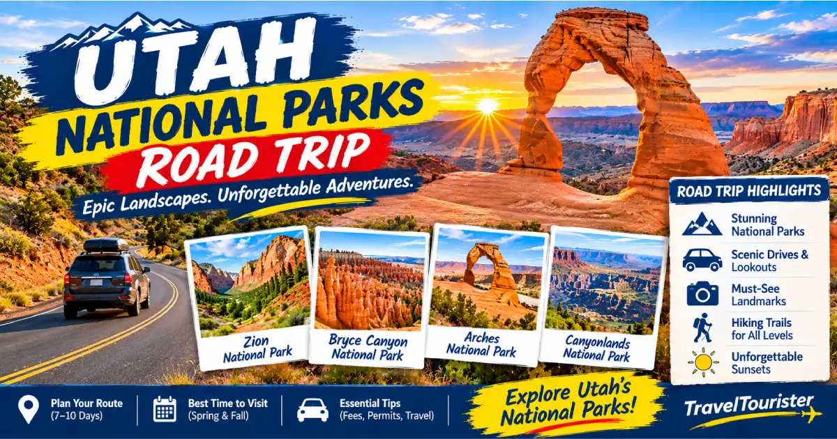
Utah’s five national parks — Zion, Bryce Canyon, Capitol Reef, Canyonlands, and Arches — form the most concentrated collection of canyon country scenery in the world, a 500-mile loop through the Colorado Plateau that takes visitors from slot canyons and soaring sandstone monoliths to hoodoo amphitheaters, ancient reef monoclines, and the greatest density of natural stone arches on Earth. Known collectively as the Mighty Five, these parks are among the most visited in the National Park System, and for good reason: no other road trip in the United States delivers this much geological drama, this much physical beauty, and this much hiking diversity within a single logical route.
The classic Mighty Five loop runs approximately 800 miles from Las Vegas or Salt Lake City and is best done in 10 to 14 days — enough time to properly experience each park without racing through them. Done in 7 days, you can hit the highlights; done in 14, you can add the Grand Staircase-Escalante National Monument between Bryce Canyon and Capitol Reef (one of the wildest and most rewarding landscapes in the American West), Monument Valley just south of Canyonlands, the North Rim of the Grand Canyon, and Dead Horse Point State Park above the Colorado River. The route is logical in any direction, but the classic approach runs counterclockwise from Las Vegas (Zion → Bryce Canyon → Capitol Reef → Canyonlands → Arches → Moab) or clockwise from Salt Lake City (Arches → Canyonlands → Capitol Reef → Bryce Canyon → Zion → St. George).
Planning a 2026 Utah road trip requires more advance work than it once did. Three of the five parks now require timed-entry permits during peak season: Zion (required year-round for the Zion Canyon Scenic Drive, $1/vehicle), Arches (required April–October, 6 AM–5 PM, $2/vehicle), and the Grand Canyon (required May–October if included as an add-on, $2/vehicle). Bryce Canyon and Capitol Reef do not currently require timed-entry vehicle permits. Campground reservations at all five parks open 6 months in advance on recreation.gov and fill within days or hours. The America the Beautiful Annual Pass ($80, covers entry to all five parks and all other federal lands for one year) pays for itself on a single Mighty Five trip and is the most essential item on the packing list.
| Park | Best For | Days Recommended | Timed Entry | Entrance Fee |
|---|---|---|---|---|
| Zion | Angels Landing, The Narrows, slot canyons | 2–3 days | Yes (year-round) | $35/vehicle |
| Bryce Canyon | Hoodoos, Navajo Loop, stargazing | 1–2 days | No | $35/vehicle |
| Capitol Reef | Fruita orchards, Waterpocket Fold, solitude | 1–2 days | No | $20/vehicle |
| Canyonlands | Island in the Sky mesa, White Rim Road | 1–2 days | No | $35/vehicle |
| Arches | Delicate Arch, Landscape Arch, Windows | 1–2 days | Yes (Apr–Oct) | $35/vehicle |
| America the Beautiful Pass | All five parks | — | — | $80/year |
Distance from Las Vegas: 160 miles (2.5 hours via I-15 north) Recommended stay: 2–3 days Base town: Springdale, UT (adjacent to the south entrance)
Zion National Park is the gateway park for most Las Vegas–origin Mighty Five trips and the most visited park in Utah (4.5 million visitors annually) — a canyon of extraordinary vertical drama, where the Virgin River has cut 2,000-foot walls of Navajo Sandstone in warm cream, pink, and orange that tower over the canyon floor in a way that feels architectural rather than geological. The Zion Canyon Scenic Drive is closed to private vehicles year-round (the most significant vehicle restriction of any national park); visitors take the free Zion Canyon Shuttle from the Visitor Center to all trailheads — a system that, despite the crowds, flows remarkably smoothly from 6 AM to 11 PM in peak season.
Essential experiences:
Where to stay: Springdale has 40+ hotels and lodges ranging from Under Canvas Zion ($195–395/night, glamping tents just outside the park) to Cable Mountain Lodge ($165–295/night, finest views in town) to budget motels ($89–149/night). Watchman Campground (229 sites, $20–30/night, reservations required 6 months in advance) is the finest in-park camping option — book the day the reservation window opens. South Campground (first-come, frequently full by 8 AM in peak season) is the alternative.
Distance from Zion: 86 miles (1.5 hours via UT-9/US-89/UT-12/UT-63) Recommended stay: 1–2 days Base town: Bryce Canyon City (adjacent to park entrance) or Tropic, UT (11 miles east on UT-12)
Bryce Canyon — the second stop on the classic counterclockwise loop — is not a canyon but a series of natural amphitheaters carved into the eastern edge of the Paunsaugunt Plateau, containing the highest density of hoodoos on Earth. At 8,000–9,100 feet of elevation, it is the highest of the Mighty Five parks and noticeably cooler than Zion — a relief in summer, and a reminder to bring layers even in July. The park is compact (the main scenic drive is 18 miles one way), the crowds are manageable compared to Zion, and the best experiences are had by descending into the amphitheater rather than looking from the top.
Essential experiences:
See our full Bryce Canyon National Park Guide 2026 for complete trail details.
The UT-12 Scenic Byway: Between Bryce Canyon and Capitol Reef, Utah Highway 12 is one of the most spectacular roads in the world — 124 miles of asphalt that crosses the Aquarius Plateau, the Grand Staircase-Escalante National Monument, and the Escalante River canyons before descending into the Waterpocket Fold. Key stops: Calf Creek Falls (6 miles RT from the Calf Creek Recreation Area, $5/vehicle, the finest short hike in Grand Staircase-Escalante — a 126-foot waterfall in a canyon of ancient fremont petroglyphs and hanging gardens), Head of the Rocks Overlook (the finest single canyon view on UT-12), Escalante town (supply stop, the last services before Capitol Reef), and Boulder Mountain (the forested 11,000-foot plateau that UT-12 crosses between Escalante and Torrey — the highest paved highway in Utah).
Distance from Bryce Canyon: 120 miles (2 hours via UT-12 scenic or 2.5 hours via US-89) Recommended stay: 1–2 days Base town: Torrey, UT (11 miles west of the park visitor center on UT-24)
Capitol Reef is the most undervisited and most rewarding of the Mighty Five for visitors willing to explore beyond the main corridor — a 100-mile-long monocline called the Waterpocket Fold where the Earth’s crust buckled 50–70 million years ago, lifting a wall of sandstone layers 2,000 feet above the surrounding desert in a wrinkle that runs almost perfectly north to south across the center of Utah. The park is named for the white Navajo Sandstone domes that early settlers likened to capitol building domes, and the “reef” for the barrier the monocline presented to east-west travel.
The Fruita Rural Historic District — the inhabited center of the park — is one of the most charming surprises in the national park system: a working fruit orchard of 2,700 apple, pear, peach, cherry, and apricot trees planted by Mormon settlers in the 1880s, maintained by the NPS, and open to visitors for free self-harvest during ripening season (cherries mid-June, apricots early July, peaches mid-August, apples/pears September–October). Pick all you can eat on-site for free, or take fruit home for a per-pound fee ($1–2/pound). The orchards beneath red canyon walls, with deer grazing at dusk, are one of the most quietly beautiful scenes in the American West.
Essential experiences:
Where to stay: Torrey, UT (11 miles west on UT-24) has the finest lodging selection near the park. Capitol Reef Resort ($135–295/night, the most complete facility near the park) and Torrey Schoolhouse B&B ($125–195/night, finest boutique option) are the best options. Fruita Campground (in the park, 71 sites, $20/night, under the cottonwoods next to the orchard — the finest in-park camping on the Mighty Five, reservations required April–October).
Distance from Capitol Reef: 115 miles (2 hours via UT-24/US-191 to Moab area) Recommended stay: 1–2 days Base town: Moab, UT (32 miles from Island in the Sky district)
Canyonlands is the largest and most remote of the Mighty Five — 337,598 acres of canyon country divided by the Colorado and Green Rivers into three distinct districts accessible by separate roads. Most visitors concentrate on the Island in the Sky district (the top of a mesa 2,000 feet above the canyon floor, 32 miles northwest of Moab), which provides the most dramatic and accessible overview of the park’s scale. The Needles district (50 miles south of Moab, the finest backcountry hiking district) and the Maze (the most remote and technically demanding district in the national park system — accessible only by high-clearance 4WD and multiday backcountry expeditions) complete the park.
Essential experiences — Island in the Sky:
Essential experiences — Needles:
Dead Horse Point State Park (adjacent to Island in the Sky, $20/vehicle, finest overlook in the Moab area): A 2,000-foot sheer drop to the entrenched meander of the Colorado River below — the scene used for the final sequence of Thelma & Louise (1991). The Rim Trail (5.4 miles, flat) is the finest easy canyon-rim walk in the Moab area, with continuous views into the canyon system. Dead Horse Point Campground (21 sites, $35–45/night, reservations required, the finest view camping in Utah) books up 6 months in advance.
Distance from Canyonlands Island in the Sky: 32 miles (40 minutes via US-191 south to Moab, then 5 miles north) Recommended stay: 1–2 days Base town: Moab, UT (5 miles south of park entrance)
Arches — the final park on the classic counterclockwise loop, adjacent to Moab — contains more than 2,000 documented natural stone arches, the highest density on Earth. The 18-mile scenic drive accesses all major features; the Delicate Arch Trail (3 miles RT, 480 ft) and the Devils Garden Trail (1.6 miles RT to Landscape Arch; 7.2 miles for the full loop) are the essential hikes.
The timed-entry permit ($2/vehicle) is required April 1–October 31 between 6 AM and 5 PM — reserve at recreation.gov up to 3 months in advance. The finest strategy: arrive before 6 AM for the Delicate Arch sunrise hike (no permit needed before 6 AM), then use the permit for the midday drive to the Windows Section and Devils Garden. Leave before sunset to avoid the outbound traffic on the single-lane canyon road.
See our full Arches National Park Guide 2026 for complete trail details.
| Day | Location | Key Activities |
|---|---|---|
| Day 1 | Las Vegas → Zion (160 mi) | Arrive Springdale, Canyon Overlook Trail, sunset on Watchman Trail |
| Day 2 | Zion | Angels Landing (permit required) OR The Narrows bottom-up; Emerald Pools |
| Day 3 | Zion → Bryce Canyon (86 mi) | Zion–Mt. Carmel Highway, arrive Bryce Canyon, Navajo Loop + Queen’s Garden |
| Day 4 | Bryce Canyon → Capitol Reef (120 mi via UT-12) | Bryce Point sunrise, drive UT-12/Calf Creek Falls, Hickman Bridge Trail |
| Day 5 | Capitol Reef → Moab (115 mi) | Grand Wash, Capitol Gorge Pioneer Register, drive to Moab |
| Day 6 | Canyonlands + Dead Horse Point | Mesa Arch sunrise, Grand View Point, Dead Horse Point Rim Trail |
| Day 7 | Arches → Las Vegas (430 mi) | Delicate Arch at sunrise (pre-6 AM), Windows Section, drive to Las Vegas |
| Day | Location | Key Activities |
|---|---|---|
| Day 1 | Las Vegas → Zion (160 mi) | Arrive, Canyon Overlook Trail, Springdale dinner |
| Day 2 | Zion | The Narrows bottom-up; Zion Human History Museum |
| Day 3 | Zion | Angels Landing (permit); afternoon Emerald Pools |
| Day 4 | Zion → Bryce Canyon (86 mi) | Zion–Mt. Carmel Highway, arrive early Bryce, Navajo Loop + Queen’s Garden (afternoon) |
| Day 5 | Bryce Canyon | Bryce Point sunrise, Peekaboo Loop full day, sunset at Inspiration Point; stargazing |
| Day 6 | Bryce Canyon → Capitol Reef (UT-12 scenic, 120 mi) | UT-12 all day — Calf Creek Falls, Head of Rocks, arrive Torrey/Capitol Reef evening |
| Day 7 | Capitol Reef | Hickman Bridge, Cohab Canyon, Fruita orchard, Capitol Gorge |
| Day 8 | Capitol Reef → Moab (115 mi) | Cassidy Arch, Cathedral Valley (if time), arrive Moab |
| Day 9 | Canyonlands + Dead Horse Point | Mesa Arch sunrise, Island in the Sky, Dead Horse Point |
| Day 10 | Arches → departure | Delicate Arch (sunrise or sunset), Devils Garden, depart |
Days 1–10 as above, plus:
| Day | Location | Key Activities |
|---|---|---|
| Day 11 | Moab day hike | Canyonlands Needles district (Chester Park Loop) or mountain biking |
| Day 12 | Monument Valley (100 mi south of Moab via US-163) | Monument Valley Navajo Tribal Park ($20/vehicle), The Mittens, John Ford Point |
| Day 13 | Grand Canyon North Rim (150 mi south via US-89) | Cape Royal Road, Angels Window, Point Imperial — finest viewpoints in the whole Grand Canyon |
| Day 14 | North Rim → Las Vegas (285 mi via US-89/I-15) | Kaibab Plateau drive, depart |
| Park | Permit Required | Window | Cost | Reserve At |
|---|---|---|---|---|
| Zion Canyon | Year-round for Scenic Drive | Daily 7 AM–8 PM | $1/vehicle | recreation.gov |
| Angels Landing | Year-round, all hikers | Seasonal lottery (4 months ahead) + day-before | $6/person | recreation.gov |
| Arches | Apr 1–Oct 31, 6 AM–5 PM | Up to 3 months ahead | $2/vehicle | recreation.gov |
| Old Rag (Shenandoah) | Year-round | Up to 30 days ahead | $1/person | recreation.gov |
| Campground | Park | Sites | Price | Notes |
|---|---|---|---|---|
| Watchman | Zion | 229 | $20–30 | Most popular in Utah; books within minutes |
| North/Sunset | Zion | 117/127 | $20 | South first-come; North reservable |
| North Campground | Bryce | 98 | $20–30 | Year-round |
| Fruita | Capitol Reef | 71 | $20 | Finest setting on loop |
| Devils Garden | Arches | 51 | $25 | Books within minutes of opening |
| Dead Horse Point SP | Near Canyonlands | 21 | $35–45 | Most dramatic camping in Utah |
| Month | Conditions | Crowds | Recommendation |
|---|---|---|---|
| March | Cool–warm, possible snow at Bryce (7,000 ft+), wildflowers beginning | Low–Moderate | Excellent — snow on hoodoos, Zion walls, mild temperatures |
| April | Best temperatures, peak wildflowers | High | Prime season — book everything 6 months ahead |
| May | Warm, Narrows optimal, spring runoff | Very High | Prime — crowds peak Memorial Day weekend |
| June | Hot in canyon bottoms (90–100°F), comfortable at Bryce elevation | High | Start hikes by 5 AM; afternoon at Bryce |
| July–August | Very hot at Zion/Arches/Canyonlands floors; thunderstorms daily | Highest | Manageable with early starts; Bryce remains pleasant |
| September | Cooling, crowds begin dropping after Labor Day | Moderate–High | Excellent — best balance of weather and crowds |
| October | Best overall month — wildfire season usually ends, color peaks | Moderate | Prime season; Bryce and Capitol Reef spectacular |
| November–February | Cold, some road closures at Bryce (icy), quiet | Very Low | Extraordinary solitude; bring microspikes for Bryce |
Base airports:
Rental car: A standard sedan handles all paved roads in the Mighty Five. High-clearance 4WD opens Cathedral Valley (Capitol Reef), White Rim Road (Canyonlands), and Monument Valley’s dirt roads. Most rental companies in Las Vegas and SLC offer 4WD SUVs at $80–150/day.
Gas: Fill up before entering remote stretches. Kanab, UT (US-89, between Zion and Bryce/North Rim) is the most important fuel and supply stop on the counterclockwise loop. Torrey, UT (UT-24 west of Capitol Reef) and Moab, UT (Arches/Canyonlands hub) are the other key stops. The longest fuel gap on UT-12 between Bryce Canyon City and Torrey is 130 miles — fill in Escalante town (milkshake at Escalante Outfitters while you’re there).
Cell service: Spotty to nonexistent through most of the canyon country. Download offline maps (maps.me or Gaia GPS) and the NPS app for each park before leaving Las Vegas or SLC. The NPS app includes downloadable trail maps that work without cell service.
Budget estimate per person (10-day trip from Las Vegas, shared vehicle for 2):
| Category | Estimated Cost |
|---|---|
| Rental car (10 days, mid-size SUV) | $600–900 |
| Park entry (America the Beautiful Pass) | $80 |
| Gas (approx. 900 miles at $3.50/gal, 25 mpg) | $126 |
| Camping (8 nights at $25/avg) | $200 |
| Lodging (2 nights at $150/avg) | $300 |
| Food ($40/day) | $400 |
| Permits and fees (Angels Landing, etc.) | $50 |
| Total per person (2 sharing car) | ~$880–1,030 |
Posted By : Vinay
Latest Article
2nd Floor, 39, Above Kirti Club, DLF Industrial Area, Kirti Nagar, New Delhi, Delhi 110015



Travel Tourister is a leading Travel portal where we introduce travellers to trusted travel agents to make their journey hasselfree, memorable And happy. Travel Tourister is a platform where travellers get Tour packages ,Hotel packages deals through trusted travel companies And hoteliers who are working with us across the world. We always try to find new and more travel agents and hoteliers from every nook and corners across the world so that you could compare the deals with different travel agents and hoteliers and book your tour or hotel with the one you have chosen according to your taste and budget.
Copyright © Travel Tourister, India. All Rights Reserved

 Call
 Enquiry